03.07.12, Taranaki district (North Island) had a M7 quake, 230km deep, offshore, on a plate fault. Nearby Wellingtonians worried, but there was little damage. It felt like a M4 to me in Christchurch.
Christchurch authorities are demolishing old & new buildings. The CBD is still locked-down in a military red-zone-cordon while high-rise demolitions continue. That enables suburbs to boom when businesses relocate from the CBD.
We sleep through many night-quakes now. Some people can't stand it anymore & leave for 'safer' towns & cities.
Post 22 February 2011 Quake, after more than a year of land-zonings CERA recently rezoned Port Hills white-zone properties to red-zone or green- zone. CERA minister Brownlee's excuse for slow Port Hills zonings: difficulties for geotech experts ascertaining hill-slide, rockfall or cliff-fall dangers. Anyone could see living on a steep hillside, under a cliff, or atop a cliff was dangerous!

14.07.12. Quake damaged, boarded house, Port Hills Rd


14.07.12. Port Hills Rd view, quake rock fall hazard housing
166 Port Hills properties remained white-zoned still in limbo to be rezoned by October 2012. To snap some hillside dwellings, I drove to white-zoned Stonehaven Tce & Lucas Ln in Hillsborough below slippery cliffs.

14.07.12. Port Hills Rd / Alderson Ave

"Tce" rang alarms, as Terrace housing I'd seen in Christchurch were either damaged hillside housing, or damaged riverside housing. I parked on Port Hills Rd by boarded houses. On Alderson Ave corner a board boasted:
Millennium 2000
Communities Christchurch Street
and Garden Awards
This plaque commemorates the special
efforts made by the residents of
Alderson Avenue which was selected
as the most attractive street
within the boundary of the
Spreydon / Heathcote
Community Board

14.07.12. Millennium 2000, Garden Awards board, Port Hills Rd / Alderson Ave

14.07.12. Quake damaged roof, Alderson Ave

14.07.12. Quake damaged, boarded house, Alderson Ave

14.07.12. Alderson Ave view, quake rock fall hazard housing

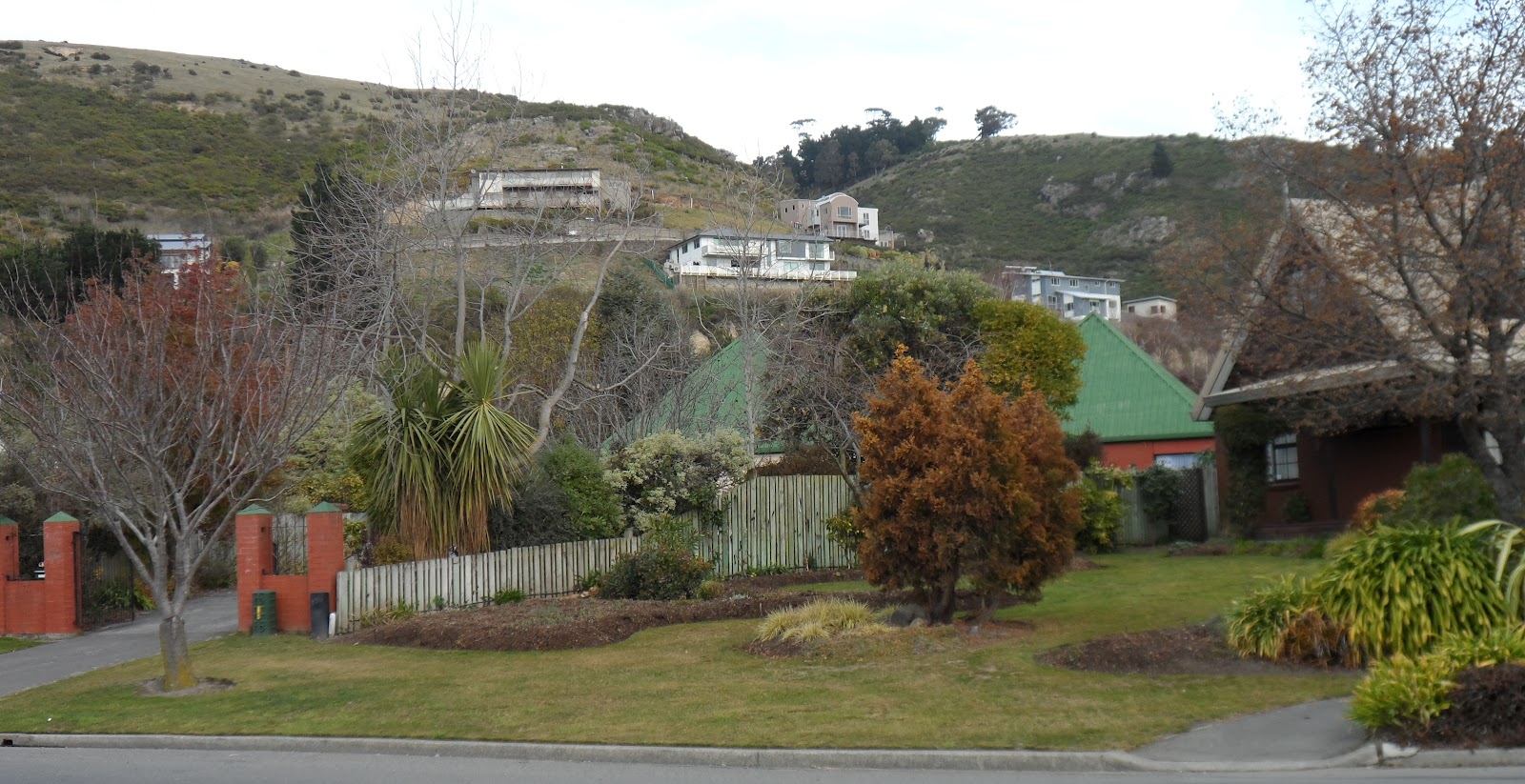
Alderson Ave was a development mess: Housing had crept up Port Hills. On my right Lucas Ln houses were ruined below loess cliffs. Alderson Ave veered left uphill, then continued as Stonehaven Tce which was also damaged. Above the houses at Lucas Ln & Stonehaven Tce, I saw a mix of gullies, rocky bluffs & thick vegetation. Below Stonehaven Tce houses, I saw slippery loess cliffs mostly covered in vegetation. I saw some houses below Stonehaven Tce built on loess cliffs on my left.

14.07.12. Alderson Ave view, quake rock fall hazard housing


14.07.12. Alderson Ave view, quake loess slip hazard & rock fall hazard housing


Stonehaven Tce: Below stony gullies, bluffs & a reservoir, new housing spotted the hillside with vegetation gaps between houses. Stonehaven Tce had retaining walls above & below the road. Stonehaven houses were sandwiched between rocky bluffs above & loess cliffs below. New houses were threatened by rockfall above the road & loess slip below the road. Why did Council consent buildings atop a cliff or below a cliff?

14.07.12. Quake damaged house below loess cliff, Alderson Ave. Quake rock fall hazard housing above


Adding to the slippery slope, a concrete-drain covered in metal-grilles was at the end of a gully by Aldersons Reserve & Lucas Ln where the drain went underground down Alderson Ave.


14.07.12. Quake trashed house below slippery loess cliff, Lucas Ln


14.07.12. Quake trashed house below slippery loess cliff, Lucas Ln


14.07.12. Alderson Ave view, quake trashed housing below slippery loess cliff, Lucas Ln


14.07.12. Drain, Aldersons Reserve, Alderson Ave

14.07.12. Alderson Ave view, Aldersons Reserve, drain & drain ditch, above Lucas Ln, quake trashed housing


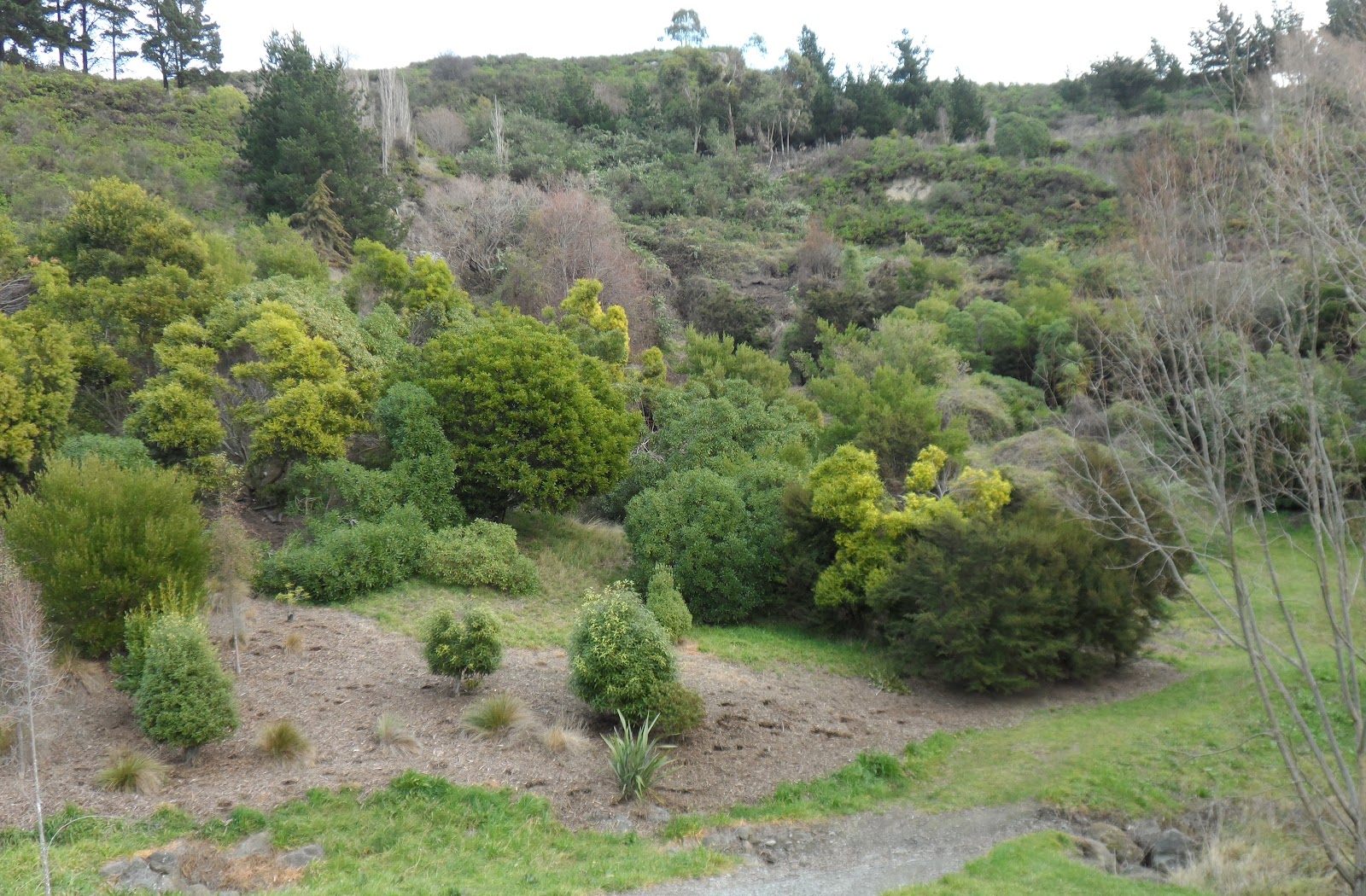
Aldersons Reserve: A gum grove sucked up gully water, but some gums were chopped down. Below gums I saw creamy loess lumps which had bounced a distance during loess cliff collapse. Above the reserve geotech experts had sprayed & chopped out vegetation showing several huge cracks. A fault-line? I didn't venture up the cracks fearing a quake would vanish me.

14.07.12. Alderson Ave housing in danger of quake rock fall & loess slip


14.07.12. Quake cracked curb & road, Alderson Ave
Cracks went uphill, about 3m wide & deep in places, widening going uphill to an old farm property. Further up the cracks, geotech experts had placed pink-tipped, wooden stakes in cleared ground, like hedgehog bristles, checking hillside slip & loess collapse, above Lucas Ln.

14.07.12. Loess clods flung from loess cliff by quakes, Aldersons Reserve

14.07.12. Aldersons Reserve, quake loess slip hazard above Lucas Ln


14.07.12. Quake rock fall hazard & gully drainage hazard above Alderson Ave & Lucas Ln


What a mess! I saw dangers of flooding, rockfall, bluff collapse, loess cliff collapse & loess slip all above Lucas Ln & Stonehaven Tce. It was scandalous that Council planners, consenters, surveyors, architects, engineers, developers & builders went ahead with housing development on steep hillsides. Like at Seabreeze Cl & Bexley swampland development, Stonehaven hillside development should never have been consented!br />
Port Hills houses with million dollar views were doomed to red-zoning, which meant ratepayers would be forced by CERA to share payouts to Port Hills red-zoners. CERA's dealing with Council meant extortion of $100 million from ratepayers to pay some ratepayers for building / buying / repairing dangerous Port Hills properties. (3News). The rationale for that extortion was that Council was responsible for ameliorating Port Hills rockfall-hazards on Council land above housing developments. That didn't benefit red-zoners on the flats who were earlier red-zoned, but the extortion was belatedly decreed by CERA to benefit Port Hills red-zoners!
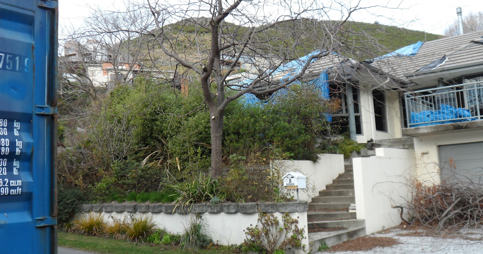
Lucas Ln: I took a closer look near Aldersons Reserve & saw several boarded, tarped ruined-houses which were protected from more rockfall & loess fall by shipping-containers. While I snapped, a woman stopped her car & demanded: "Are you just taking a look?" Affirmative.
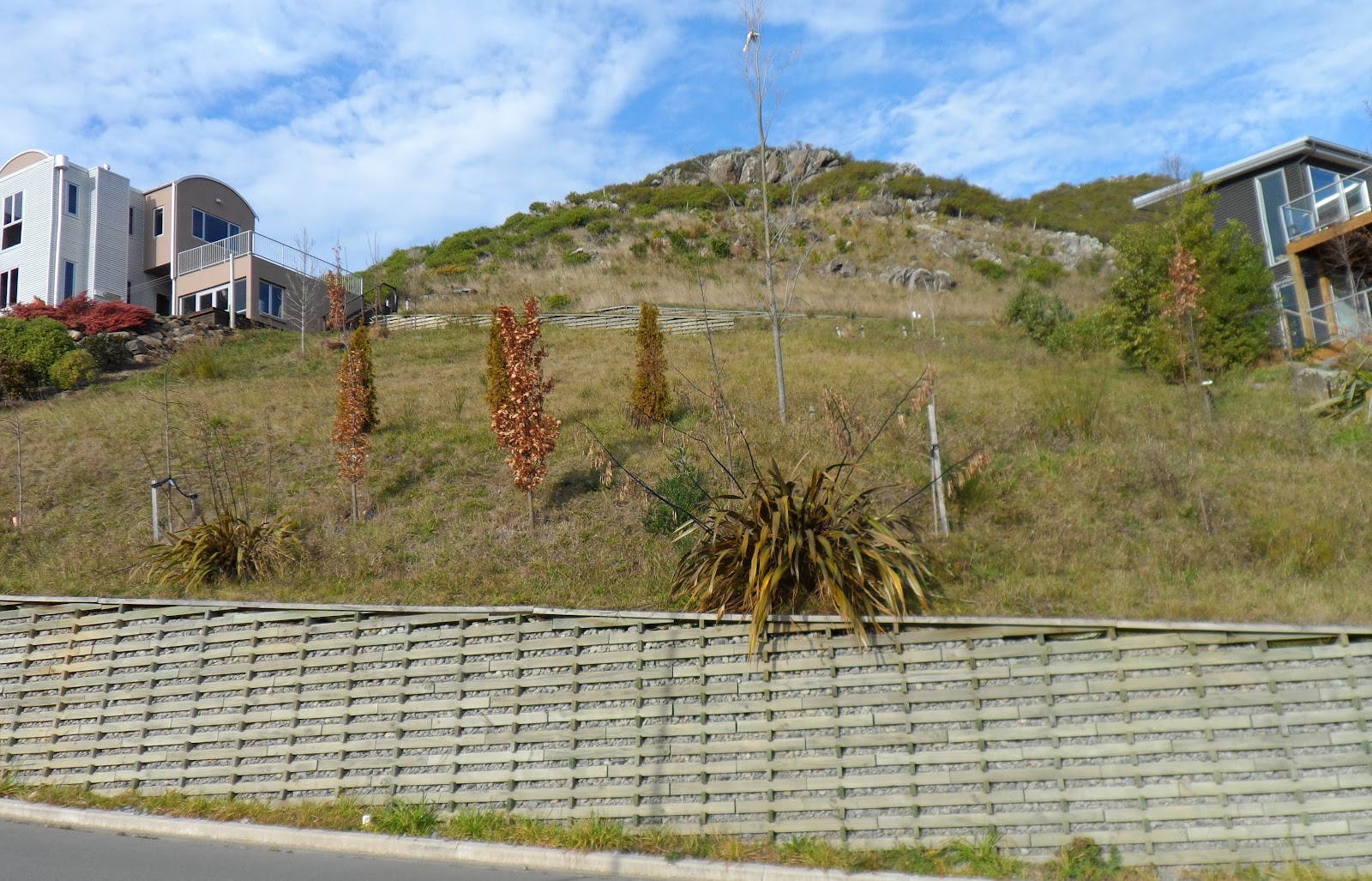
Aldersons Ave took a sharp uphill turn by a farm gate & a three-pronged gum tree where the road became Stonehaven Tce. Metal STONEHAVEN lettering on a stone-wall announced entry to the new uphill development. Rocky bluffs loomed above that Stonehaven development.

14.07.12. Housing in danger of quake rock fall, Stonehaven Tce


14.07.12. Post quake, road repairs to quake cracked / slipped roadside, Stonehaven Tce

14.07.12. Quake cracked, part repaired, roadside & curb, Stonehaven Tce


14.07.12. Quake damaged, retaining wall, slipping away from quake slipped, Stonehaven Tce


14.07.12. Quake damaged pavement, fence & gate slipping downhill, Stonehaven Tce

Stonehaven Tce: Housing was in danger of rockfall from above & slipping downhill, as some houses were built on loess below the road. All along the road, downhill side, cracked concrete-curbs & repaired road-cracks showed where quakes caused slippage.
14.07.12. Concrete retaining wall, quake rock fall hazard above, Stonehaven Tce

14.07.12. Post quake repairs to quake slipped pavement & roadside, Stonehaven Tce


14.07.12. Stonehaven Tce, loess cliff house, post quake view, Glenelg Spur & Hillsborough


14.07.12. Stonehaven Tce, loess cliff house, post quake view, Glenelg Spur, Hillsborough & Opawa

14.07.12 Post quake repairs to slipped roadside & pavement, Stonehaven Tce


14.07.12. Concrete retaining wall below housing, quake rock fall hazard above, Stonehaven Tce

14.07.12. House retaining wall, in danger of quake collapse, above Stronsay Ln, off Stonehaven Tce


14.07.12. Post quake repairs to quake slipped, retaining wall, Stronsay Ln

14.07.12. Stronsay Ln, quake cracked, concrete curb & loess cliff view, Hillsborough & Opawa


14.07.12. Loess cliff, slip hazard & quake rock fall hazard by new housing, Stronsay Ln

14.07.12. Loess cliff lot, quake loess slip hazard, Stronsay Ln

14.07.12. Post quake, Stronsay Ln view, Glenelg Spur & Port Hills Rd


14.07.12. Stronsay Ln view, quake trashed, red zone, abandoned, Christchurch CBD

Retaining-walls separated from the road in a slow slide. Never mind housing damages. One house sported an architect's board in a window. Housing development & real-estate boards hung hopefully on roadside fences:
Builders & Developers
Up to 100%
LAND & CONSTRUCTION FINANCE
AVAILABLE ON THIS SITE

14.07.12. Developers sign, quake rock fall hazard hillside, Stronsay Ln


14.07.12. Quake damaged house on quake rock fall hazard hillside, Stronsay Ln


14.07.12. Post quake, Stronsay Ln view, Glenelg Spur

14.07.12. Post quake, Stronsay Ln view, Opawa

14.07.12. Quake damaged, abandoned house, Stronsay Ln


14.07.12. Quake slipping house, loess cliff top, Stronsay Ln

14.07.12. Void under quake slipping house, loess cliff top, Stronsay Ln


14.07.12. Bare loess ground, quake slipping house, loess cliff top, Stronsay Ln

There were empty lots between Stonehaven houses. Below the road in empty lots, I saw bare loess. I saw some ruined-houses, others were occupied. One house had a huge void below concrete-stairs: the black void extended below the hillside house. A new house had no garden. Herbicide killed vegetation exposed loess soil on that property.
Stronsay Ln fork, downhill off Stonehaven Tce: I trekked to the end of Stronsay Ln past concrete-cracked retaining-walls & builders' rubbish stacked roadside, past overgrown lots, a reservoir looming above. At Stronsay Ln end, rockfall boulders perched atop a rock-smashed retaining-wall.

14.07.12. Quake crack between retaining wall & pavement, Stronsay Ln

14.07.12. Real estate sign, quake cracked road & retaining wall, Stronsay Ln


14.07.12. House in danger of quake rock fall, Stronsay Ln. See rocks secured by steel cables


14.07.12. Builders rubbish, Stronsay Ln end


14.07.12. Bare lots, loess cliff top, Stronsay Ln end


14.07.12. Concrete retaining wall, Stronsay Ln end

14.07.12. Quake rock fall damage, concrete retaining wall, Stronsay Ln end
Below the reservoir, bluff rocks above the last Stronsay Ln house were strapped with steel-cables stopping rockfall.
There were lovely views over Hillsborough, Opawa & Glenelg Spur housing towards the hazy CBD. My 10x zoom camera took good pics of the red-zone ruined-CBD about 10km away, still NZDF-cordoned 17 months post 22 February 2011 Quake. Demolition cranes loomed above the ruined high-rises.
*Trekked Port Hills Rd, Alderson Ave, Lucas Ln, Stonehaven Tce, Stronsay Ln, McCormacks Bay Causeway, Cliff St, Emily Hts. 182 images.
Sunday 22 July 2012. I drove to Moncks Bay, as I wanted to hear testing of the new tsunami warning system built post-quakes: sirens atop power- poles along the coast. Over the last week, I'd seen digital road-signs by QE11 Park & by McCormacks Bay Causeway informing residents about testing of the new tsunami warning sirens at 11am, Sunday 22 July 2012. A first for Christchurch.

22.07.12. Tsunami siren testing, digital road sign, McCormacks Bay Causeway

While Leah & I waited for the siren, I viewed ruined Cliff St & Emily Hts by Moncks Bay. I saw several ruined- houses along Cliff St, one house a demolition-site. Built on red volcanic rock, the end house was horizontally-cracked at window height. Red rock on which the house was built was cracked vertically & horizontally. Another boarded cliff-side house had a red rock in its driveway.

22.07.12. Quake damaged garden wall, Cliff St

22.07.12. Quake damaged housing, Cliff St

22.07.12. Quake damaged housing & house demolition site right, Cliff St

22.07.12. Shipping container cordon / rock fall barrier. Quake damaged house, loess hillside, Cliff St

22.07.12. Quake rock fall on driveway below loess cliff, Cliff St

22.07.12. Quake trashed house on volcanic rock, Cliff St / Emily Hts


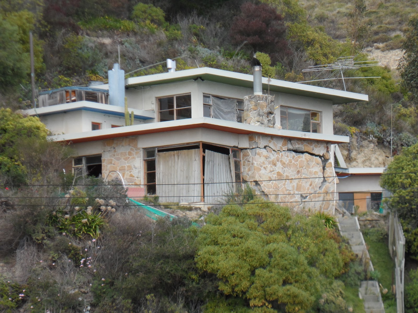


22.07.12. Quake split, volcanic rock, Emily Hts


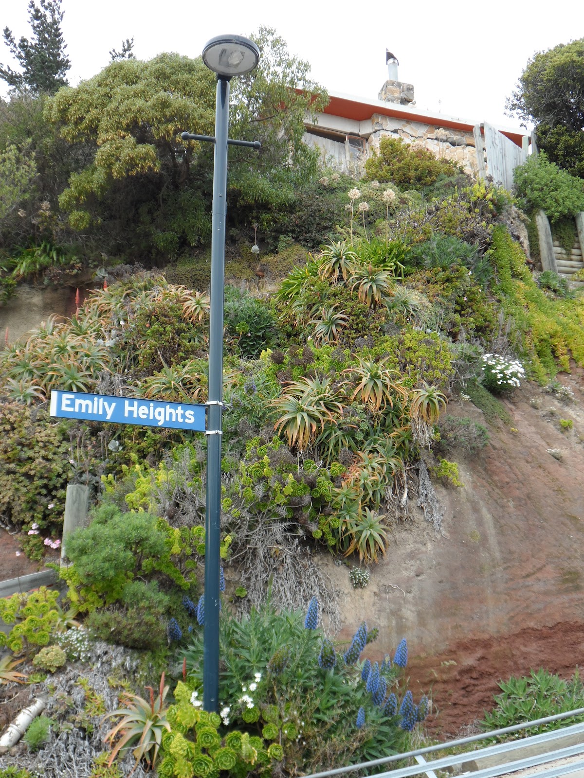
Emily Hts: Another pre-quakes housing development, not as far gone as Stonehaven, Hillsborough, but also built on a slippery slope of loose loess & volcanic rock.

22.07.12. Wooden retaining wall, quake damaged, part repaired roadside, Emily Hts. Moncks Bay, Southshore spit beyond

Emily Hts zig-zagged up the hillside past wooden retaining-walls to the top where another house was built. So far no other pre-quake houses were built on Emily Hts. The ruined-road had roadside-cracks where the hillside was slipping due to quakes. Ruined-houses above & below Emily Hts were tarped & boarded.

22.07.12. Quake trashed, part repaired roadside, Emily Hts. Loess cliffs beyond


There were lovely views of Pegasus Bay, Moncks Bay, Avon / Heathcote Estuary mouth, Southshore spit, quake-stunted Shag Rock & shipping-container protected Clifton corner which was lethal due to rockfall-hazard.

22.07.12. Cliff St view, quake trashed Emily Hts development. Houses below & above loose, loess cliffs


Over the last week I'd seen new adverts touting building-repair businesses. An advert on the back of a ute listed all repairs the contractor would do. Top of the list: EARTHQUAKE REPAIRS.
Metropol BUY BUILD INVEST, Issue 11, July 2012 periodical had many repair / rebuild ads. One ad:
"STAKE CONSULTING LTD...
GROUND PENETRATING RADAR (GPR) [For checking quake voids below bldgs].
Do you think you have underlying problems with your concrete floor?...
SLAB JACKING
Solution and repair for lifting driveways, paths and floors.
Filling of voids below concrete slabs.
CONCRETE CRACK REPAIRS
Don't allow water ingress through your concrete cracks this winter.
Epoxy Pressure Injection..."
Post-quakes, I'd seen many tilt-slab buildings with cracked-walls all epoxy-glued. Soon EQC would be castigated for shoddy repairs, like faulty jack-&-pack of pile foundations. Given damages & shoddy EQC repairs, I wouldn't buy any pre-quake house in Christchurch!
As for the tsunami warning siren, at 85db it wasn't loud enough. Parked at Beachville Reserve by Avon / Heathcote Estuary, Leah heard the siren faintly inside our car. As I wore a hearing aid, I had to exit our car, but hardly heard the siren. Council needed to increase the siren volume or $550 000 would be wasted!
Luke didn't even hear the siren in a South New Brighton house near South New Brighton School. Why did Council spend half a million+ dollars on a siren system for Pacific regional quakes & ignore our Pegasus Bay quakes?
Coda:
Wednesday 31.10.12, CERA press release, Brownlee: "All 190 000 properties in greater Christchurch now have a zoning...
The vast majority of the over 7 860 property owners in the residential red zone have already chosen a buyout option and are in the process of selling their properties to the Crown... "
The residential red-zone buyout was a NZ National government land-grab of riverside properties & hillside properties. Later on, NZ National government would land-grab red-zone-CBD properties for its CERA Blueprint CBD. Geotech engineering firm, Tonkin & Taylor did the land- zoning, then NZ National government / CERA land-grabbed the properties. Who checked Tonkin & Taylor?
Finalizing zoning of residential properties in Christchurch, the final eight Lucas Ln properties were green-zoned! CERA & Council would remove landslip material above Lucas Ln housing. CERA & Council would share the cost of loess removal & securing the slippery slope. Why did Council consent housing development below slippery loess cliffs?
By January 2014 the slippery loess slope above Lucas Ln would be secured.
2012. Hopeful real-estate signs awaited sales of damaged-land & damaged-housing. No buyers. Two Lucas Ln corner houses were rebuilds. A neighbouring ruined-house was still boarded, its garden overgrown.
2018-19. Stonehaven development was still ruined, the roads' tarseal patching was still repaired as in 2012.
Cliff St: Closed. A steel road-barrier blocked the hill bottom. Three ruined-houses were demolished: a house at the hill bottom; the red rock top house; the house below the loess cliff where a fallen red rock had obstructed the driveway. Only demolition-sites were left. Emily Hts: No further development.
Content & pics Copyright Mark JS Esslemont.
See Residential land zoning complete (CERA press release).
No comments:
Post a Comment