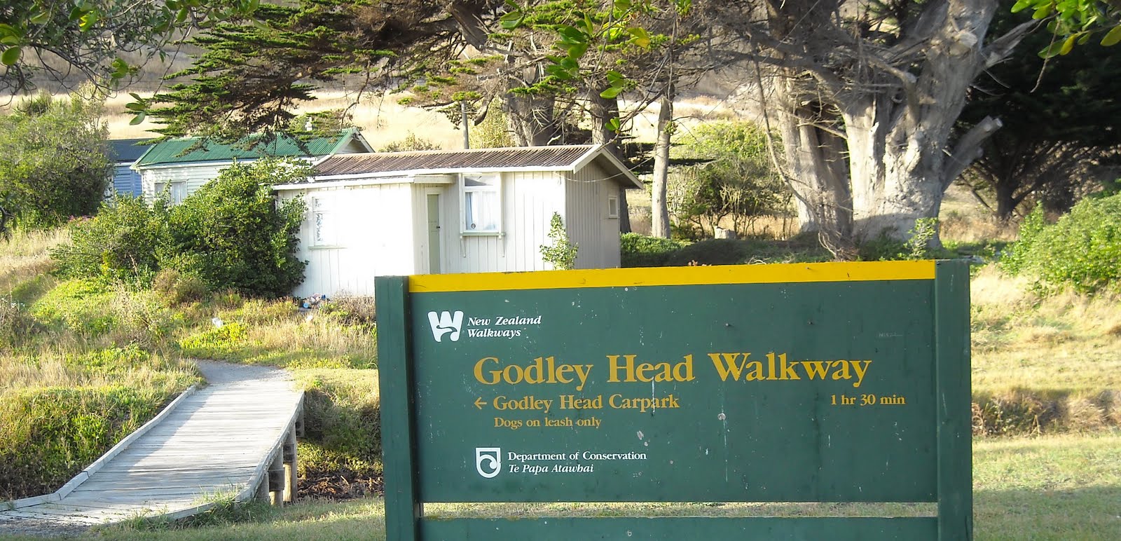
2010. Taylors Mistake: DOC Godley Head Walkway Sign & Bach
One Friday morning I parked my car at Taylors Mistake beach, Christchurch, as I wanted to circuit walk Godley Head Walkway up to Godley Battery, climb Crater Rim Walkway to Godley Head Summit, and return to Taylors Mistake via Crater Rim Walkway and Anaconda Track.

2010. Taylors Mistake, Christchurch
1. GODLEY HEAD WALKWAY: Taylors Mistake to Godley Battery, 3.5 kms. My time, 1 1/2 hours.
At Taylors Mistake Carpark a DOC sign stated:
GODLEY HEAD WALKWAY
<- GODLEY HEAD CARPARK 1 hr 30 min
DOGS ON LEASH ONLY

2010. Taylors Mistake Beach, Christchurch
I crossed a wooden footbridge over a smelly creek filled with rotting kelp. I passed a row of baches with tiny gardens facing Taylors Mistake beach. Two sweaty, middle-aged women jogged past while I coolpixed Taylors Mistake beach and beyond to Whitewash Head, Scarborough.
By baches I passed a profusion of native and exotic plants: iceplants, geraniums, alyssums, cotyledons, daisies, coprosmas, myoporums, broadleafs, olearias, metrosideros, echiums... Near the end of the baches, two sweaty, middle-aged women walked past, while I read more signs:
* MINISTRY OF FISHERIES NOTICE. FISHERIES OFFICERS PATROL THIS AREA
* GODLEY HEAD HERITAGE TRUST...
* DOC GODLEY HEAD WALKWAY...

2010. Taylors Mistake: DOC Dog Leash Sign
* DOGS ON LEASH ONLY

2010. Taylors Mistake: Paua Fishing Rules Sign
* RECREATIONAL FISHING RULES. PAUA...

2010. Godley Head Walkway: Taylors Mistake
I zigzagged up stone steps where two more sweaty, middle-aged women jogged past. I passed through a small gate onto dry, grassy slopes overlooking Taylors Mistake and the Pacific. By the gate DOC signs stated:
!WARNING
TRACK DAMAGED
PROCEED WITH CARE
! PLEASE NOTE
SHEEP GRAZE THIS AREA
DOGS MUST BE ON
A LEASH AT ALL TIMES
FROM THIS POINT ON

2010. Godley Head Walkway: Taylors Mistake & Scarborough
I passed a bench overlooking Taylors Mistake, and passed loess erosion above and below the track, with metal palisade fencing stopping walkers falling off Godley Head Walkway down seacliffs. I passed two more identical signs:
<- GODLEY HEAD WALKWAY
NO BIKES

2010. Godley Head Walkway: Harris Bay, Black Rock, Scarborough
I climbed wooden steps with views of Taylors Mistake, Whitewash Head, Pacific, and a shag sunning its wings on a shore macrocarpa. I passed a path descending to Black Rock at one end of Harris Bay, and another metal palisade fence by more loess erosion.
I passed masses of red-flowering cotyledons on dry, grassy slopes. By the rocky shore, kelp swayed in the Pacific.

2010. Godley Head Walkway: Fishing Spots, Harris Bay, Taylors Mistake, Scarborough
Rounding a corner above Harris Bay, Godley Head Walkway became rocky and rutted before a stile, with a boardwalk descending more loess erosion at the head of Harris Bay. Past rocky fishing spots on Harris Bay shore, Godley Head Walkway ascended gently with views of Taylors Mistake, Scarborough, hazy Pegasus Bay, Pacific.
Trackside kelp and cotyledons reminded me of kelp and cotyledons on Namaqualand sandveld coast.

2010. Godley Head Walkway: Box Cove, Harris Bay, Taylors Mistake, Scarborough
Godley Head Walkway passed Box Cove and paths descending to steps above another rocky fishing spot. The two women walkers sweated past, returning to Taylors Mistake. A male jogger slogged past in black singlet and shorts. He looked unfit and stopped a lot.

2010. Godley Head Walkway: Cotyledons & Gate above Boulder Bay, Scarborough backdrop
On grassy slopes, I passed dry thistles, wiry muehlenbekias and fleshy cotyledons, the morning sun reflecting off red cotyledon flowers all the way up Godley Head. I passed through another small gate above Boulder Bay baches with Pacific views.
I watched the male jogger resting on the steep slope above Boulder Bay. When he saw me, he smartly jogged upwards. I passed through a third small gate, and crossed a stile by macrocarpas above Boulder Bay.

2010. Godley Head Walkway: Boulder Bay, Taylors Mistake, Scarborough
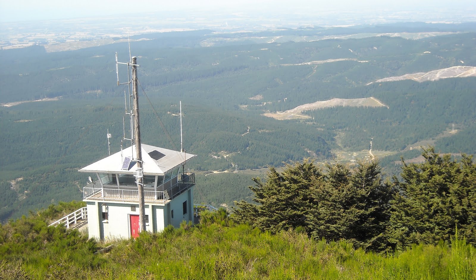
Slogging above Boulder Bay, on my right I saw WW2 Battery Observation Post 3 overlooking Pegasus Bay, and on Godley Head Summit I saw WW2 Battery Observation Post 1, which had a commanding view over Godley Head and the Pacific. The male jogger puffed downhill.
The higher I climbed, the grander my grassland views over Taylors Mistake, Scarborough, Avon-Heathcote Estuary and hazy Christchurch. Haze stopped me seeing Canterbury Plains and Southern Alps.
From Taylors Mistake, all along the track six inch nails, each with blue plastic tape attached, had been hammered into the centre of the track every 14 metres or so. I wondered if the nails marked distance, or mud slips in wet weather?

2010. Godley Head Walkway, Godley Head Reserve: Scarborough & Pegasus Bay
Near Godley Head top, I passed another DOC sign:
CARPARK 5 mins ->
TAYLOR BATTERY <- 15 min return

2010. DOC Fire Service Hole Diggers, Godley Head Road. Mt Evans backdrop

2010. Godley Head Heritage Trust Sign, Godley Head Reserve

2010. Ministery of Fisheries Sign, Godley Head Reserve
In Godley Head Reserve I passed sheep in grassland, and crossed two stiles before reaching DOC Carpark by Godley Head Road. I watched two men digging a hole by their DOC RURAL FIRE truck parked on Godley Head Road, with spectacular views of Mt Evans and cloudy banks Peninsula across Lyttelton Harbour.
Since I'd passed that way a year before, Godley Head Carpark and picnic area was improved by DOC. Signage was better too. I coolpixed signage by Godley Head Road overlooking Pegasus Bay:
* GODLEY HEAD HERITAGE TRUST...
* MINISTRY OF FISHERIES...
* GODLEY HEAD COASTAL WALKWAY...

2010. DOC Sign: Godley Head Reserve

2010. DOC WW2 Hatches & Shafts Sign, Godley Head Reserve. Lyttelton Harbour & Mt Evans behind
On the other side of the DOC Carpark and picnic area, I looked at WW2 hatches and shafts, where a DOC sign stated:
"What are these hatches and shafts?
These relics of the coastal defence era of World War 11 have puzzled us for years.
Underneath you is a large underground chamber - simply a concrete-lined hole in the ground. One of two such bunkers it is thought to have been a war shelter in case the area was bombarded by enemy fire. The tall 'chimney' is possibly a ventilation shaft.
Access was by way of a manhole, then descent of the steel ladder.
Last century they were labelled 'underground kitchens,' but there is no evidence to support this...
The two concrete strong points built into the hillside near the chambers are sentry posts overlooking the landing site below."

2010. DOC Hatches & Shafts Sign, Godley Head Reserve
Remembering my sentry days at Durban Bluff WW2 Guns, during Dec-Jan 1969-70, I guessed the underground hatches, shafts and chambers on Godley Head were storage chambers or magazines, like those riddling Durban Bluff.

2010. DOC Sign, Godley Head Reserve: Tunnel Track, Coastal Lookout, Gun Emplacements
Admiring Lyttelton Harbour and Banks Peninsula views, I lunched at a new concrete table and bench at the DOC picnic area: CocaCola, ham and lettuce sarmie. I watched cars, MTBs, walkers and joggers come and go: cycling along Godley Head Road; looking at DOC info boards and signs; walking paths to Taylor Battery, Godley Battery, Godley Tunnels.

2010. Godley Head Reserve Picnic Area. Lyttelton Harbour, Adderley Head & Port Levy Mouth behind
I coolpixed views over Lyttelton Harbour mouth and Port Levy mouth and bronze words in new concrete steps by DOC picnic tables:
protect ~ honour
protect ~ resist
protect ~ strengthen
I wondered whether the words were DOC's or a WW2 military slogan?

2020. WW2 Memorial: Inscribed Steps, Godley Head Picnic Area. Mt Evans backdrop
2. CRATER RIM WALKWAY and ANACONDA MTB TRACK: Godley Head Carpark to Godley Head Summit return to Taylors Mistake, 3.5 kms. My time, 1 1/2 hours.

2010. DOC Godley Head Map & Info Board, Godley Head Reserve
At Godley Head Carpark by Godley Head Road, I coolpixed DOC info boards by public toilets. A DOC sign stated:
CRATER RIM WALKWAY
AWAROA / GODLEY HEAD TO TAYLORS MISTAKE
VIA SUMMIT ROUTE -> 3.5 km / 1 hr 30 min
MT PLEASANT GUN EMPLACEMENTS VIA EVANS PASS -> 8 km / 2 hrs 30 min

2010. DOC Crater Rim Walkway Sign, Godley Head Reserve

2010. Crater Rim Walkway: Godley Head & Lyttelton Harbour Mouth
From Godley Head Carpark I crossed a stile, and didn't bother wandering Crater Rim Walkway, as sheep tracks through dry tussock ascended the summit. On my way up I coolpixed a DOC sign overlooking Godley Battery and the Pacific:
"Who worked here during World War 11?
It may look a little deserted today, but 718 people were stationed out here in August 1941. Apart from the soldiers and officers, they included a chaplain, medical officers, batmen who looked after officers, fitters, instrument mechanics, carpenter, drivers, storemen, electrician, telephonists, linesmen who looked after the communication lines, cooks and three bootmakers. They got one day off in every six, and a break of seven days off every two months.
In December 1942, life at the camp changed with the arrival of women. The Women's Auxillary Army Corps (WAAC) manned the observation posts, radar, plotting rooms and direction of searchlights, as well as doing administration, kitchen work and driving duties. It wasn't all work out here - the women livened up the social life at the Head. In their time off the soldiers played basketball (netball) and football (rugby). Social occasions were a time for music and dancing."
A WW2 holiday camp at Kiwi taxpayers' expense.

2010. Crater Rim Walkway: DOC Info, Godley Head, "Who worked here during World War 11?"

2010. Godley Head, WW2 Battery Observation Post 3
Near Godley Head Summit, I coolpixed Battery Observation Post 3, which had a flat concrete roof and graffiti-sprayed concrete walls, buried amongst rocks overlooking the Pacific.
On Godley Head Summit, in Battery Observation Post 1, amongst crumbling concrete walls and rusty windows, I coolpixed a DOC info board:
"The view from the top - Battery Observation Post 1
Seaward Defence Headquarers
Can you see far today... or is the view clouded in mist?
This post was the eyes of the fort at Godley Head: one of three observation posts built in World War 11 - all of which remain today.
It was the focal point of the Battery, with officers from the Army, Navy and Air Force all on duty. The Battery Commander was in charge and each officer had an assistant and a telephone operator.
The post could be shrouded by mist and could not always be used for observation - this being done from the other two battery observation posts.
Plotters recorded the position of shipping on a wall chart. A depression range finder was used to determine the distance and bearing of a vessel from the observation post. Information was transmitted from the radar station, or the other observation posts to the plotting room where calculations were done and aiming directions sent to the guns. Instructions came as electrical pulses which operated the dials giving the required elevation and direction. The gunners aligned the guns to these settings to hit the target.
After World War 11 Compulsory Military Training for all 18-year-old males was introduced in 1949 and ceased in 1958; this building was used as the Seaward Defence Quarters during this time. The Godley Battery and Camp were used for Women's Auxillary Army Corps training."

2010. DOC Info: Godley Head, WW2 Battery Observation Post 1

2010. Godley Head: WW2 Battery Observation Post 1. Mt Evans backdrop
By Battery Observation Post 1, I walked past concrete bases of two ruined military buildings, and coolpixed divine views around the nearby geodetic trig beacon on Godley Head Summit:
Southwards - Mt Evans and cloudy Banks Peninsula, Lyttelton Harbour, Diamond Harbour.
Westwards - Lyttelton, Mt Pleasant, Port Hills.
Northwards - Scarborough, Avon-Heathcote Estuary, hazy Christchurch. (Southern Alps obscured by haze).
Eastwards - Godley Battery, Taylor Battery, Lyttelton Harbour Mouth, Pacific.

2010. Godley Head Summit: WW2 Battery Observation Post 1 & Godley Battery above Lyttelton Harbour Mouth

2010. Godley Head Summit view of Lyttelton Harbour Mouth, Adderly Head & Port Levy Mouth

2010. Godley Head Summit view of Lyttelton Harbour, Mt Evans & cloudy Mt Herbert, Banks Peninsula

2010. Godley Head Summit view of Lyttelton Harbour, Purau, Diamond Harbour, Cloudy Mt Herbert & Port Hills

2010. Godley Head Summit view of Lyttelton Harbour, Port Hills & Mt Pleasant Summit

2010. Godley Head Summit view of Scarborough, Avon-Heathcote Estuary, Pegasus Bay

2010. Godley Head Summit view of hazy Pacific
From Godley Head Summit I followed the fence line descending to Godley Head Road by the end of Scarborough Reserve. (I avoided longer Crater Rim Walkway descending the slope on Lyttelton Harbour side). On my left I had views of Banks Peninsula, Lyttelton Harbour, Purau, Diamond Harbour, Quail Island, Port Hills, and below Godley Head - Mechanics Bay. Ahead was Mt Pleasant, and on my right hazy Christchurch.

2010. Crater Rim Walkway: Godley Head view of Lyttelton Harbour, Diamond Harbour & Port Hills. WW2 Sentry Post, fence left. Godley Head Road, fence right
At the bottom of the hill near two WW2 concrete sentry posts overlooking Lyttelton Harbour and Mt Evans, I crossed Godley Head Road and found another sign:
<- SHARED USE TRACK TO TAYLORS MISTAKE BEACH

2010. Godley Head Road: Shared Use Track above Scarborough & Pacific
I crossed a boardwalk over dry sedges below Godley Head Road, and on the shared use track two male MTBs whizzed down to Taylors Mistake, with views over dry, grassy slopes, hazy Pegasus Bay and the Pacific.
I walked through dry grass and fleshy cotyledons and joined ANACONDA MTB TRACK, which zigzagged down to Taylors Mistake. Anaconda MTB Track sign warned: PEDESTRIANS GIVE WAY.

2010. Godley Head Shared Use Track: Taylors Mistake & Scarborough beyond

2010. Anaconda MTB Track: Harris Bay, Box Cove, Pacific, Godley Head beyond
I wandered over a stock grid and joined a walking track leaving Anaconda MTB Track and descending a grassy slope to Taylors Mistake. Near the bottom of the slope, crossing another stock grid, I rejoined Anaconda MTB Track which briefly paralleled Godley Head Walkway and returned to Taylors Mistake behind the row of baches.

2010. Anaconda MTB Track: Taylors Mistake & Scarborough
Signs on one of the stock grids and a gate by baches stated:
ACCESS COURTESY
OF BATCH OWNERS
ASSOCIATION
RIDE AT YOUR OWN RISK
PORT HILLS RANGER ASSOCIATION

2010. Godley Head Walkway: Taylors Mistake Baches & Beach
At the back of batches, by a stile two Christchurch City Council signs stated:
LAMBING IN
PROGRESS
PLEASE DO NOT
DISTURB STOCK
ATTENTION
STOCK GRAZING
IN THIS AREA
ALL DOGS
MUST BE ON A LEASH
AND UNDER CONTROL
AT ALL TIMES

2010. Stile, Godley Head Walkway near Taylors Mistake Baches
On Saturday, Leah and I followed my Friday footsteps to Boulder Bay. Seaviews were clear across Pegasus Bay to the Southern Alps. Across Canterbury Plains we saw hazy Mt Oxford, Mt Richardson, Mt Thomas, and beyond to hazy Puketeraki Range.
Besides many walkers, dog walkers (with unleashed and leashed dogs, some with full poop bags attached to collars), and joggers, we saw groups of anglers at Black Rock by Harris Bay, and at various rocky spots around Harris Bay, and beyond Box Cove by steps near a rock platform.
Returning from Boulder Bay we stopped on the boardwalk above Harris Bay, and watched a woman sitting on a rock far below, waiting for a diver to surface with paua for their bag.
On the path descending to Black Rock, three smiley Indonesian women, wearing dark ankle-length robes and dark scarves, gracefully descended to fishermen on Black Rock.

2010. Cotyledons, Cotyledon orbiculata, Godley Head Walkway
Coda: 2010-2011 earthquakes. Whitewash Head cliff collapsed during the 13.06.11 quake. Box Cove rocks collapsed.
Content & Pics Copyright Mark JS Esslemont