2010. Road to Oxford, Canterbury Plains. Mt Oxford right
Early Good Friday morning, I drove from Christchurch across foggy Canterbury Plains to Oxford and Coopers Creek, as I wanted to climb Mt Oxford via Big Ben Saddle and Ashley Saddle, traverse Mt Oxford eastern summit ridge to Mt Oxford summit (1364m), and return to Coopers Creek via Mt Oxford Track. Estimated distance, 17 kms. My time 10 hours, excluding lunch.
Caution: Hill walking fitness, water, food and weatherproof gear needed. Up Ashley Saddle, no tracks nor marker poles to Mt Oxford summit ridge. Up Ashley saddle, steep drops from Mt Oxford. Mt Oxford, usually snow capped in winter. As the tracks to Big Ben Saddle went through private properties, it was advisable to get permission from land owners to cross their land.

2010. Canterbury Plains view of Mt Oxford eastern traverse. Big Ben below
On the previous Friday, starting late morning I'd attempted the climb, but turned back early afternoon at Big Ben Saddle, as it was stifling hot, windless, and I'd started climbing too late.

2010. Coopers Creek view of Mt Oxford. Big Ben right
1. COOPERS CREEK TO BIG BEN SADDLE. My time, 2 hours.

2010. Mt Oxford Summit sign, Coopers Creek - shortest route, Mt Oxford Track

2010. Coopers Creek beehives

2010. Coopers Creek paddock. Big Ben Saddle beyond
With my Oxford 1:50 000 Topo50 map bought at Mapworld, Christchurch, I crossed a wooden bridge over Coopers Creek and walked along a farm road by Coopers Creek past beehives and sheep. Along the grassy road near Payton Lodge, at a gate I turned right into a paddock with views of Mt Oxford on my left and Big Ben Saddle straight ahead.
Beyond the paddock I crossed a stream, after which the freshly graded dirt road briefly climbed through beeches. Behind me, fog covered Canterbury Plains, Malvern Hills floating on fog.

2010. Graded dirt road through beeches, Coopers Creek

2010. Scale insect honeydew & sooty mould on beech trunk, Coopers Creek

2010. Coopers Creek paddock view of Mt Oxford eastern summit ridge traverse. Big Ben right

2010. Coopers Creek sheep paddock view of Big Ben Saddle

2010. Coopers Creek farm track view of Mt Oxford left, Big Ben right

2010. Coopers Creek sheep view of Big Ben right

2010. Coopers Creek view of Mt Oxford

2010. Forestry camp & old wagon near Coopers Creek

2010. Dead bulldozer & forestry hut near Coopers Creek
About half an hour after leaving Coopers Creek, I turned right off the road, wandered through gorse and kanuka scrub & climbed over a gate into a scruffy forestry camp, with a junk-filled wagon & a dead, yellow bulldozer by a dirt road. Two plastic water cisterns stood either side of the road & ponies grazed by a red, wooden hut.

2010. Forestry camp water cistern view of Coopers Creek, Canterbury Plains & Malvern Hills

2010. Forestry camp view of foggy Coopers Creek, Canterbury Plains & floating Malvern Hills

2010. Forestry huts near Coopers Creek
I turned left down the first dirt road, with three more huts in a hollow by a stream lined by junk: scrap-metal; three 4x4s; a dead ute; old tyres; wood; a serviceable quad bike; SUVs; bath; machinery; truck; trailer and yellow bulldozer by the road. Above the stream, up Big Ben slopes young beech forest regenerated after forestry mayhem.

2010. Bulldozer by forestry huts near Coopers Creek

2010. Forestry camp bus, SUV & shed below beeches near Coopers Creek
Further down the forestry road, I passed another gate and another forestry camp, with an old bus parked beside the road and a chimney sticking out of the bus roof. More junk lay by a shed: tractor; rotting vehicles; trailer; machinery...

2010. Beech forest on Big Ben south facing slope near Coopers Creek
Passing roadside gorse and kanuka, I slogged uphill from the stream towards a pine forest. I passed a dirt road on my right, which I'd explored the previous Friday: an old, white SUV blocked the road, probably to stop errant 4x4s and quad bikers.
I'd found another junk yard amongst beeches replete with wood; plastic; machinery; rusty tools and a rotting Range Rover filled with junk, a saddle and bridles. At a cul d
e sac up near the pine line, I'd seen another junk yard with wood; metal; machinery...
Some farm roads and forestry roads were not marked on my Topo50 map.

2010. Dead Range Rover, forestry camp near Coopers Creek. Big Ben Saddle behind

2010. Big Ben pine forest closeup view of Torlesse Range end, Southern Alps

2010. Big Ben pine forest closeup view of Torlesse Range middle, Southern Alps
An hour after leaving Coopers Creek I entered the pine forest, with spectacular back views of faraway Torlesse Range. For about 15 minutes I walked the pine forest dirt road round a hill, then took the left fork going steeply up to a rocky knoll below Big Ben Saddle. I walked past pines on my left and a scrubby valley going to pine forest on the saddle hill on my right.

2010. Fly agaric mushrooms, Big Ben pine forest road

2010. Big Ben Saddle track view of foggy Canterbury Plains, distant Port Hills & Banks Peninsula hills

2010. Big Ben Saddle track view of fog leaving Coopers Creek & Canterbury Plains. Malvern Hills beyond

2010. Big Ben Saddle track view of Malvern Hills & Mt Hutt beyond

2010. Big Ben Saddle track view of Coopers Creek, Canterbury Plains & Malvern Hills

2010. Big Ben Saddle track closeup view of Canterbury Plains & Malvern Hills
I stopped at the knoll for CocaCola and coolpixing: Southwards - Down the steep road I looked across Oxford hills and over foggy Canterbury Plains towards Banks Peninsula peaks floating on fog: Mt Evans, The Monument, Mt Herbert, Mt Bradley.
Westwards - Coopers Creek, foggy Canterbury Plains, Malvern Hills, distant Mt Hutt and Mt Somers Range beyond.
Northwards - Big Ben grassy slopes looming above, and Mt Oxford summit beyond. (Big Ben not to be confused with Big Ben Range further south by Porters Pass).

2010. Big Ben Saddle track gate view of Big Ben. Mt Oxford left

2010. Big Ben Saddle track view of Big Ben Saddle

2010. Big Ben Saddle track gate view of Big Ben Saddle

2010. Gorse beside Big Ben Saddle track

2010. Big Ben Saddle weathered tree stump view of Coopers Creek, Canterbury Plains & Malvern Hills

2010. Big Ben Saddle zoom view of Lime Quarry, Canterbury Plains, Malvern Hills, Mt Hutt
I passed through a gate and walked the gorse-lined track zigzagging up to Big Ben Saddle. I passed the pine plantation on the saddle hill on my right, and on my left across the saddle I saw Big Ben grassy slopes rising above the saddle. For the next six hours I'd be walking exposed Big Ben and Mt Oxford slopes with little protection from the elements.

2010. Big Ben Saddle view of Canterbury Plains & Malvern Hills

2010. Big Ben Saddle view of Canterbury Plains, Malvern Hills & Mt Hutt

2010. Big Ben Saddle view of Big Ben exposed grassy slope up Big Ben ridge

2010. Big Ben Saddle view of Ashley Gorge. Ladbrooks Hill other side of Ashley Gorge

2010. Big Ben Saddle view of eastern saddle track on Oxford hills
Cool breezes on Big Ben saddle, so I stopped for CocaCola, jam sarmie and snapping:
Down the saddle valley, Big Ben Stream flowed through beech forest to Ashley River. Beyond Ashley River on Ladbrooks Hill slopes, Lees Valley Road wound from Lees Valley to Ashley Gorge.
Tracks went up Beg Ben grassy ridge crest, which obscured Mt Oxford.
Coopers Creek, foggy Canterbury Plains, Malvern Hills, distant Mt Hutt and Mt Somers Range and Taylor Range.
Eastern track climbed the pine-forested hill towards Oxford hills.
2. BIG BEN SADDLE TO ASHLEY SADDLE. My time, 1 1/2 hours

2010. Big Ben view of Big Ben Saddle & foggy Canterbury Plains

2010. Big Ben view of Oxford hills, foggy Canterbury Plains, Port Hills & Banks Peninsula hills
Tracks going up Big Ben and Oxford hills I saw from Big Ben Saddle were not marked on my map. I avoided the track following a fence-line going straight up to Big Ben ridge crest, but followed the rutted, grassy road which zigzagged up Big Ben slope, with views of the beech-forested valley descending to Ashley River, Ashley Gorge and Oxford hills.

2010. Big Ben view of Ashley Gorge & Oxford hills right. Mt Thomas beyond

2010. Big Ben view of subalpine scrub above treeline, including golden Spaniards, tree fuchsias & broadleafs

2010. Golden Spaniard,
Aciphylla aurea, amongst broadleafs, horopito & tree fuchsias, Big Ben track
I passed kanuka scrub with beeches in gullies going down to Ashley River. Water trickled down road ruts and grassy slopes, as the Big Ben slope I climbed was catchment for Big Ben Stream in the valley below, where I saw Ashley Gorge paddocks by Big Ben Stream and Ashley River confluence.
While climbing Big Ben, I had views of farm roads crossing Big Ben Saddle. I had views of foggy Canterbury Plains to Banks Peninsula.

2010. Dracophyllum, hebe, matagouri subalpine scrub & weathered tree stump, Big Ben slope

2010. Big Ben view of Big Ben Saddle & foggy Canterbury Plains
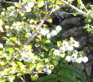
On Big Ben slope, above the tree line I saw a mix of subalpine vegetation: fragrant hebes and astelias amongst scrubby broadleafs, coprosmas and tree fuchsias. While sweating up Big Ben, I saw weathered tree stumps piercing the sky (fire-damaged?) surrounded by subalpine vegetation: tutu, matagouri, broom, tussock, dracophyllum, five-fingers. Red-lichened rocks contrasted vegetation: toetoe, white and pink snowberries, prickly spaniards, blue-white wahlenbergia flowers.

2010. Big Ben slope coprosma, snowberry, golden Spaniard & matagouri

2010. Big Ben slope closeup of coprosma, snowberry & golden Spaniard
2010. Big Ben slope snowberry,
Gaultheria depressa

2010. Big Ben view of Ashley Gorge & Mt Thomas

2010. Big Ben view of Oxford hills

2010. Big Ben view of Oxford hills, foggy Canterbury Plains & Banks Peninsula hills

2010. Big Ben view of foggy Canterbury Plains

2010. Big Ben view of fog leaving Canterbury Plains. Malvern Hills behind
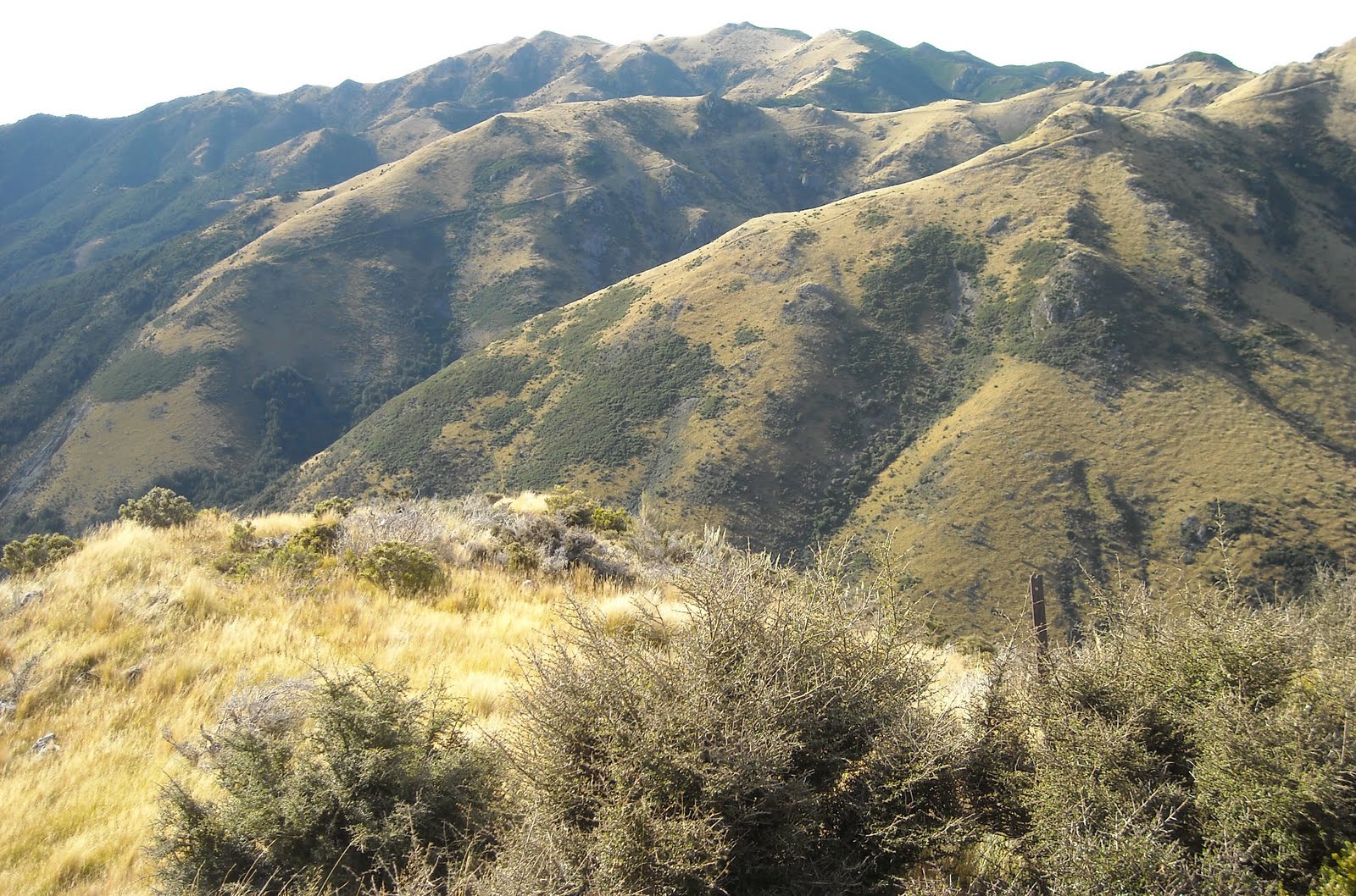
Big Ben ridge crest sloped eastwards to a road corner with grand views of Ladbrooks Hill, Ashley River and Oxford hills, where I found I'd passed Ashley Saddle on the other side of Big Ben. Enjoying cool breezes on Big Ben road corner, I stopped for coolpixing:
Puketeraki Range and Lees Valley. A view down Ashley Saddle valley over beech-forested Oxford Creek flowing down to Ashley River.
Foggy Pacific. Eastwards - Foggy Canterbury Plains to Banks Peninsula hills.
Big Ben grassy ridges and Mt Oxford beech ridges.
Mt Oxford with several slips between ridges.

2010. Fragrant Hebe,
Hebe odora, Big Ben by Ashley Saddle

2010. Wahlenbergias, Beg Ben by Ashley Saddle
On several fence standards I'd passed by the roadside, orange aluminium tags were attached, each with an inscription. eg:
CARBON
PHOTOPOINT
10

2010. Carbon Photopoint 10 marker on standard, Ashley Saddle

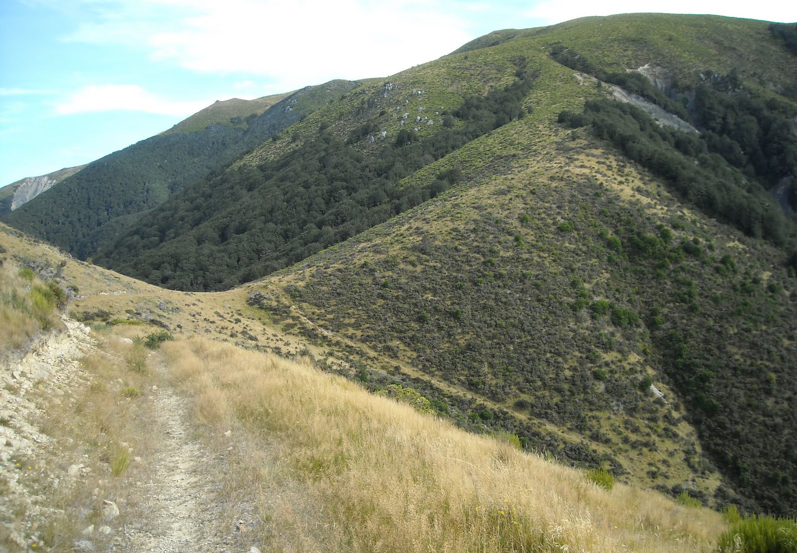
2010. Big Ben farm track view of Ashely Saddle & Mt Oxford

2010. Ashley Saddle pig hunter's quad bike view of Big Ben, Ashley Gorge & Mt Thomas
Rounding Big Ben corner, I walked down to Ashley Saddle where I found a parked quad bike, driver unseen, with Mt Oxford slopes looming on my right and Big Ben slopes on my left.
I'd walked farm and forestry roads from Coopers Creek to Big Ben Saddle, to Ashley Saddle. Thereafter, no tracks, so I made my own way up Mt Oxford slopes and fells to Mt Oxford summit.

2010. Ashley Saddle pig hunters' quad bikes
On Ashley Saddle, besides grass, I saw dracophyllum, hebes, spaniards and matagouri. In cooling breezes I coolpixed Ashley Saddle views:
Ashley River and Ladbrooks Hill.
Coopers Creek, a lime quarry on Canterbury Plains and beyond to Malvern Hills, Mt Hutt, Mt Somers Range, Mt Taylor Range, Black Hill Range.

2010. Ashley Saddle pig dog, with collar aerial
A quad biker drove up from whence I came. He and his unseen mate were pig hunters. His two pig dogs sniffed me out, one a black and white sheep dog, one a brindled mongrel.

2010. Ashley Saddle dracophylum scrubland view of Big Ben, Canterbury Plains & Malvern Hills
3. ASHLEY SADDLE TO MT OXFORD EASTERN SUMMIT, traversing Mt Oxford eastern summit ridge. My time 3 1/2 hours.

2010. Mt Oxford, Ashley Saddle dracophyllum & beech view of Big Ben & Ashley Gorge. Mt Thomas behind
As my map had no marked tracks on Mt Oxford east ridge, for the next 3 1/2 hours, I made my own way up Mt Oxford, and along the top to Mt Oxford summit.

2010. Mt Oxford, Ashley Saddle dracophylum & beech view of Big Ben, Oxford hills, Canterbury Plains, foggy Pacific left & Banks Peninsula hills right

2010. Mt Oxford, Ashley Saddle dracophyllum scrubland view of Big Ben, Oxford hills, Canterbury Plains & Banks Peninsula hills
Wading through dracophyllum tussockland I climbed the steep saddle slope, with Mt Oxford slips dropping either side of the slope. Stopping for breathers, I saw the pig hunter and pig dogs far below walking along a Big Ben path, then stopping and waiting for the other pig hunter. By midday, fog had burnt off Canterbury Plains, but stayed over the Pacific.

2010. Mt Oxford, Ashley Saddle dracophyllum & beech view of Big Ben & Waimakariri River crossing Canterbury Plains

2010. Mt Oxford, Ashley Saddle snowberry,
Gaultheria depressa
On my way up I passed stunted beeches, matagouri, hebes, flax, celmisias, astelias, snowberries amongst dominant dracophyllum and tussocks. After a while the waist-high tussocks and especially dracophyllum skinned my shins. (Mental note: wear long socks or gaiters).

2010. Mt Oxford, Ashley Saddle dracophyllum scrubland view of Big Ben, Ladbrooks Hill, Bottle Hill, Ashley Gorge, Mt Thomas, Canterbury Plains

2010. Mt Oxford, Ashley Saddle dracophyllum view of Big Ben, Oxford hills, Canterbury Plains

2010. Mt Oxford, Ashley Saddle dracophyllum view of Big Ben, Oxford hills, Canterbury Plains, Banks Peninsula hills

2010. Mt Oxford, Ashley Saddle view of Big Ben, Oxford hills, Canterbury Plains, Banks Peninsula hills

2010. Mt Oxford, Ashley Saddle dracophyllum view of Big Ben, Big Ben Saddle & Waimakariri River crossing Canterbury Plains

2010. Mt Oxford, Ashley Saddle dracophyllum view of Big Ben & Waimakariri River crossing Canterbury Plains

2010. Mt Oxford, Ashley Saddle dracophyllum & tussock view of Canterbury Plains & Malvern Hills

2010. Mt Oxford, Ashley Saddle slope view of beech forest, lime quarry, Waimakariri River, Canterbury Plains, Malvern Hills

2010. Mt Oxford, Ashley Saddle dracophyllum view of beech forest, Canterbury Plains, Malvern Hills, Mt Hutt

2010. Mt Oxford, east ridge dracophyllum scrub & beech forest above Canterbury Plains.

2010. Mt Oxford, east ridge dracophyllum & tussock view of Waimakariri River, Canterbury Plains, Malvern Hills, Mt Hutt

2010. Mt Oxford, east ridge dracophyllum & tussock view of Big Ben, Coopers Creek, Waimakariri River, Malvern Hills & Canterbury Plains

2010. Mt Oxford, east ridge tussock & dracophyllum view of Big Ben, Coopers Creek, Waimakariri River, Canterbury Plains

2010. Mt Oxford, east ridge dracophyllum scrubland view of Big Ben, Oxford Hills, Canterbury Plains, Banks Peninsula hills

2010. Mt Oxford, east ridge dracophyllum view of Lees Valley & Puketeraki Range
Near the top, three rusty iron poles marked the way. Ashley Saddle and Big Ben disappeared below, while Canterbury Plains views improved. Alpine ranges became visible in the south, west and north.
It took me two hours steep climbing from Ashley Saddle to reach Mt Oxford east summit ridge, where I stood in the north-west blast, coolpixing views:
Lees Valley, Puketeraki Range and Whistler River joining Ashley River.
Ashley River and Ashley Gorge.
Waimakariri River, Canterbury Plains and Banks Peninsula.
Waimakariri River, Canterbury Plains and Southern Alpine ranges.
Mt Oxford summit fells and more Alpine ranges.

2010. Mt Oxford, eastern summit view of Waimakariri River, Canterbury Plains, Malvern Hills, Mt Hutt

2010. Mt Oxford, eastern summit view of Waimakariri River crossing Canterbury Plains

2010. Mt Oxford, eastern summit view of Big Ben, Oxford Hills, Canterbury Plains, Banks Peninsula hills

2010. Mt Oxford, eastern summit view of Big Ben, Ashley Gorge, Ladbrooks Hill, Oxford hills, Bottle Hill, Mt Thomas, Canterbury Plains

2010. Mt Oxford, eastern summit view of Ladbrooks Hill, Mt Richardson & Ashley River, Lees Valley

2010. Mt Oxford, eastern summit view of Lees Valley & Puketeraki Range

2010. Mt Oxford, eastern summit view of Whistler River & Ashley River confluence, Lees Valley

2010. Mt Oxford, eastern summit view of Whistler River, Lees Valley & Puketeraki Range

2010. Mt Oxford NW summit view of Puketeraki Range
It took me 5 1/2 hours climbing from Coopers Creek to Big Ben Saddle, to Ashley Saddle to summit Mt Oxford eastern summit ridge. It would take me another 1 1/2 windy hours to undulate up the wide summit ridge to Mt Oxford summit. Like my previous sojourn on top of Mt Oxford, I had Mt Oxford summit to myself.

2010. Mt Oxford summit celmisia surrounding
Myrsine nummularia & grass

2010. Mt Oxford summit celmisia, astelia & dracophyllum

2010. Mt Oxford summit fell view of Lees Valley & Puketeraki Range

2010. Mt Oxford summit fell view of Waimakariri River & Canterbury Plains

2010. Mt Oxford summit lichens &
Pentachondra pumila

2010. Mt Oxford summit lycopodiums & celmisias

2010. Mt Oxford summit lycopodiums & celmisias

2010. Mt Oxford summit celmisias
Over the next couple of hours the warm, dessicating nor'wester did its best to blast me off Mt Oxford. No wonder summit plants were stunted, with many forming cushions and mats like craspedias I passed.
Climbing the first mini-summit on the summit ridge, I passed low dracophyllums, tussocks, hebes, celmisias, astelias, spaniards, lycopodiums and
Pentachondra pumila heaths with red berries.
On top of the mini-summit (1235m) I viewed other Alpine foothills I'd recently climbed: Mt Richardson (1047m); Mt Thomas (1023m); Mt Grey (934m).

2010. Mt Oxford summit, fell view of Oxford hills, Oxford, Canterbury Plains, Port Hills, Banks Peninsula hills

2010. Mt Oxford summit, fell view of Waimakariri River crossing Canterbury Plains

2010. Mt Oxford summit, fell view of Oxford hills, Oxford, Canterbury Plains, Port Hills, Banks Peninsula hills

2010. Mt Oxford summit, fell view of another fell, Oxford hills & Canterbury Plains

2010. Mt Oxford summit, fell view of another fell, Bottle Hill & Canterbury Plains

2010. Mt Oxford summit, fell view of Ashley Gorge, Ladbrooks Hill, Mt Richardson, Mt Thomas, Mt Grey

2010. Mt Oxford summit, fell view of Lees Valley
With Canterbury Plains views to my left and Alpine views to my right, dipping through windy tussockland I stopped at Oxford Hill summit (1134m) with its mast, streamlined mast hut and broken trig beacon. I coolpixed 360 degree views: Alpine ranges, Canterbury Plains, Banks Peninsula. By the mast and beacon I snapped tiny Alpine plants.

2010. Oxford Hill view of Mt Oxford summit, Mt Hutt left, Torlesse Range right

2010. Oxford Hill view of Waimakariri River crossing Canterbury Plains, Malvern Hills

2010. Oxford Hill view of Mt Oxford summit, Waikakariri River, Malvern Hills & Mt Hutt

2010. Oxford Hill view of Mt Oxford summit & Mt Torlesse

2010. Oxford Hill view of Mt Oxford western summit ridge, Torlesse Range & Craigieburn Range

2010. Oxford Hill lichens, lycopodiums, hebes,
Pentachondra pumila, ferns, celmisias

2010. Oxford Hill alpine plant diversity including
Raoulia haastii &
Raoulia grandiflora

2010. Oxford Hill celmisias &
Pentachondra pumila

2010. Oxford Hill view of Lees Valley

2010. Oxford Hill summit, tarn view of Mt Oxford summit & Mt Torlesse

2010. Oxford Hill summit, tarn view of Torlesse & Craigieburn Ranges

2010. Vegetable sheep,
Raoulia eximia, wind-funnel below Mt Oxford summit

2010. Mt Oxford summit celmisias,
Pentachondra pumila & grasses

2010. Mt Oxford summit
Pentachondra pumila & celmisia
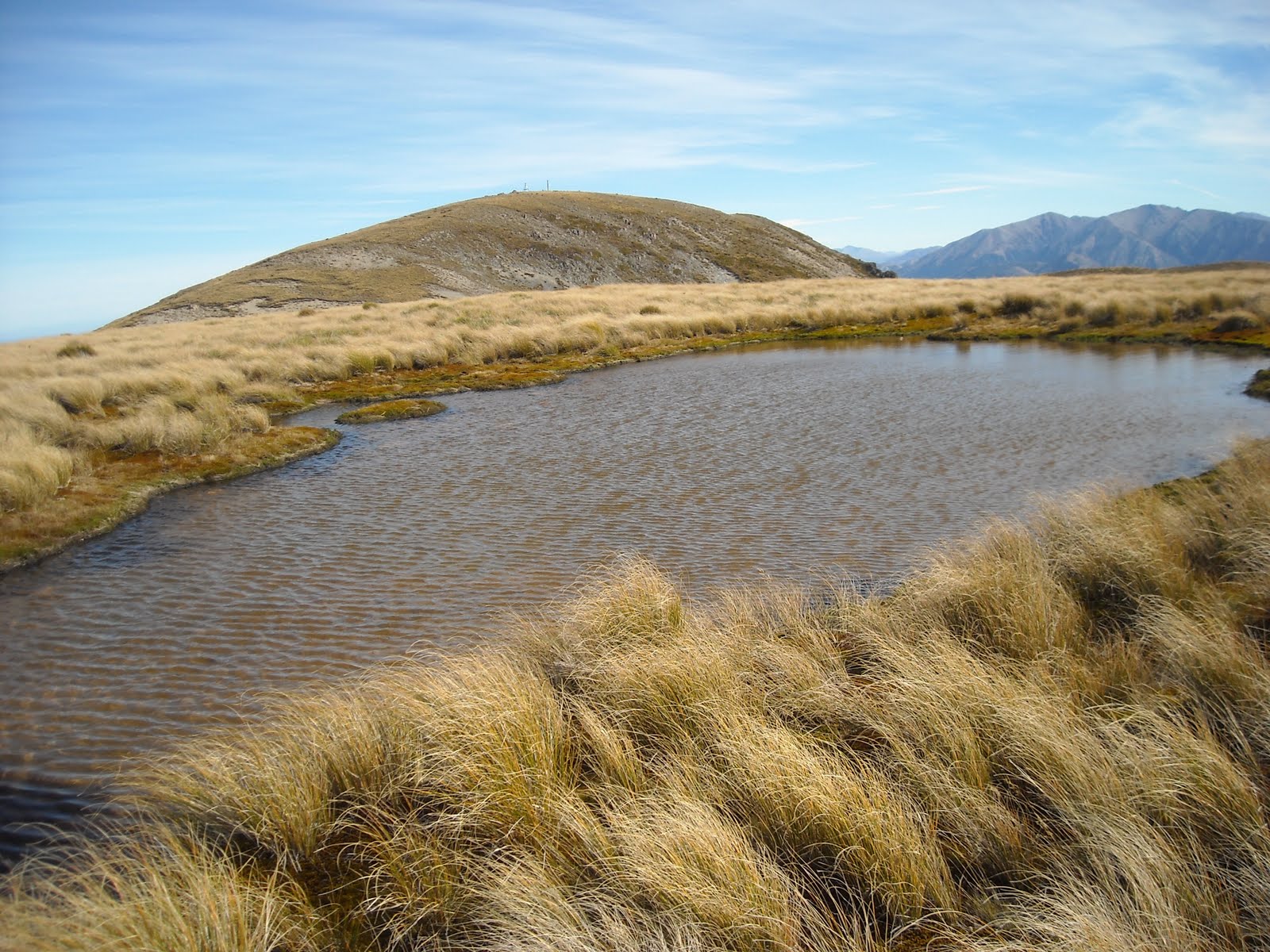
Through more windy tussockland closer to Mt Oxford summit, I passed a mossy tarn with grand Alpine views, the strong nor'wester flattening tussocks.
Below Mt Oxford summit, at a rocky wind-funnel I found a grey vegetable sheep,
Raoulia eximia, the first I'd seen in its native habitat. Three firsts for me on Mt Oxford: pig hunters, pig dogs and vegetable sheep.

2010. Mt Oxford summit cairn & trig beacon with Southern Alps backdrop

2010. Mt Oxford summit cairn view of Lees Valley

2010. Mt Oxford summit view of eastern summit ridge, Ladbrooks Hill, Bottle Hill & Canterbury Plains

2010. Mt Oxford summit view of Beg Ben, Oxford hills, Canterbury Plains, Banks Peninsula

2010. Mt Oxford summit shelter view of Canterbury Plains, Port Hills & Banks Peninsula hills

2010. Mt Oxford summit view of Waimakariri River crossing Canterbury Plains

2010. Mt Oxford summit view of beech forest, Canterbury Plains, Waimakariri River, Malvern Hills, Mt Hutt Range

2010. Mt Oxford summit closeup of beech forest, Canterbury Plains, Waimakariri River, Malvern Hills, Mt Hutt Range, Black Hill Range

2010. Mt Oxford summit view of beech forest & Waimakariri River crossing Canterbury Plains
On windy Mt Oxford summit (1364m), I again coolpixed 360 degree views by a mast, trig beacon and stone cairn. Wind-protected and seated on a tussock in the stone shelter, I scoffed a late lunch of Pams steak pie and CocaCola, while enjoying Canterbury Plains, Waimakariri River, Banks Peninsula and Alpine views. Pacific was unseen due to fog and haze.

2010. Mt Oxford summit shelter view of Malvern Hills, Mt Hutt Range & Mt Torlesse

2010. Mt Oxford summit view of Mt Torlesse, Malvern Hills, Mt Hutt, Black Hill & Craigieburn Ranges

2010. Mt Oxford summit view of Mt Torlesse & Craigieburn Range
It had taken me 7 hours solid walking from Coopers Creek to summit Mt Oxford via Big Ben Saddle and Ashley Saddle, including 3 1/2 hours track-walking, and Ashley Saddle to Mt Oxford 3 1/2 hours off-track walking.

2010. Whipcord hebes, Mt Oxford summit
4. MT OXFORD SUMMIT TO COOPERS CREEK: Mt Oxford Track. My time, 3 hours.
I wont describe Mt Oxford Track here, as I described it in another blog post: Mt Oxford Summit, Canterbury.
Briefly: It took me 1 hour to descend the rocky, pole-marked track, down the exposed spur from Mt Oxford summit to beech forest. Again the warm, dry nor'wester tried blasting me off Mt Oxford. When I dangled my heavy walking stick vertically, wind blew it about 45 degrees off vertical.

2010. Mingimingi,
Leptecophylla juniperina, Mt Oxford Track

2010. Mt Oxford eastern traverse seen from Coopers Creek

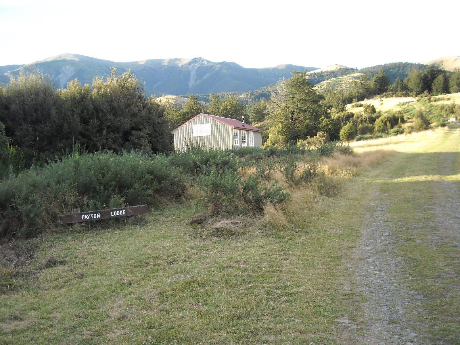
2010. Mt Oxford Summit direction sign, Payton Lodge, Coopers Creek
For the next hour or so, I descended beech forest, relieved to be out of the wind, after several hours exposure to the apocalyptic nor'wester. (A friend who lived in Oxford later opined: "Oxford is known for its strong winds, capable of blowing doors off cars and roofs off houses.") I descended fast, as beech forest was dry, and I didn't have to worry about slippery roots, rocks and wet vegetation.

2010. Payton Lodge, Coopers Creek, Mt Oxford behind
Back at Payton Lodge by sheep paddocks, I wandered the last bit of track while coolpixing late afternoon views of Mt Oxford and Big Ben Saddle. I passed the gate where I'd begun my morning route up Big Ben Saddle, and walked past sheep and beehives back to my car at Coopers Creek...
The next weekend Leah and I drove a 200 km return trip from Christchurch to Lees Valley, via Lees Valley Road turnoff between Oxford and Ashley Gorge campsite. Lees Valley Road, a metalled road, zigzagged steeply up and over Oxford hills overlooking Oxford and Canterbury Plains, then beyond a narrow saddle Lees Valley Road zigzagged down native bush to Ashley Gorge and paddocks by Ashley River Bridge.
By Ashley River Bridge we passed fishing signs and a public toilet sign. On the other side of Ashley River, driving up Ladbrooks Hill (1030m) lower beech slopes, I enjoyed bushy views of Big Ben Saddle, Ashley Saddle and Mt Oxford I'd climbed on Good Friday.
On several trees and fences, signs with camera pics warned errant hunters not to hunt on private land. Was the Good Friday pig hunter I'd met legit, or was he checking his remote cannabis patch by Ashley Saddle?
In Lees Valley, we crossed a curved Ashley River Bridge; we drove past a DOC fence sign indicating the end / start of Wharfdale Track; we crossed Whistler River bridge with more fishing signs; via Wharfdale Road, we looked at Wharfdale farm by Ashley River: NO ENTRY; we drove past another DOC fence sign indicating a farm track going to Puketeraki Hunting Block.
We picnicked at a Lees Valley view spot with open-door, long-drop loo overlooking Puketeraki Range. Grand views included Lees Valley, Puketeraki Range, Mt Thomas, Mt Richardson, Ladbrooks Hill and Mt Oxford.
We turned back at a farm fence sign indicating that cars couldn't ford Okuku River en route to Loburn: only 4x4s allowed.
Going back, I thought western Mt Storm (1254m) looked too bushy for my walking tastes. Leah enjoyed distant views of western Chest Peak (1935m). I enjoyed views of Mt Oxford east summit ridge and west summit ridge which I'd climbed.
Easter hols 2012: Post quakes, Leah & I did the walk from Coopers Creek to Big Ben Saddle. At the forestry camp a forester questioned us & Leah asked his permission to continue. No problem. He was surprised the neighbouring farmer had let us through. I'd never seen the farmer during my 3 farm crossings en route to the forestry camp & Big Ben Saddle.
Later a local told us the farmer was "unhinged" about public crossing his land & had taken the matter up to the PM in Parliament, about public access to his land below Mt Oxford. Be warned!
Content & pics Copyright Mark JS Esslemont.