
2010. Glentui Picnic Area / Carpark, Mt Richardson
I wanted to do a circular day-walk through beech forest on Richardson Track, up a western ridge to Mt Richardson summit (1048m) and descend via Blowhard Track across the summit ridge, and Bypass Track on an eastern ridge back to Glentui Picnic Area / Carpark.
Caution: Although Mt Richardson walk was mostly through beech forest, Mt Richardson summit was sunny and exposed. Water, food and weatherproof gear are needed. Hill walking fitness is required.
1. RICHARDSON TRACK. My time, 3 hours from Glentui Picnic Area / Carpark to Mt Richardson summit (1048m).

2010. DOC Sign, Mt Richardson Walks

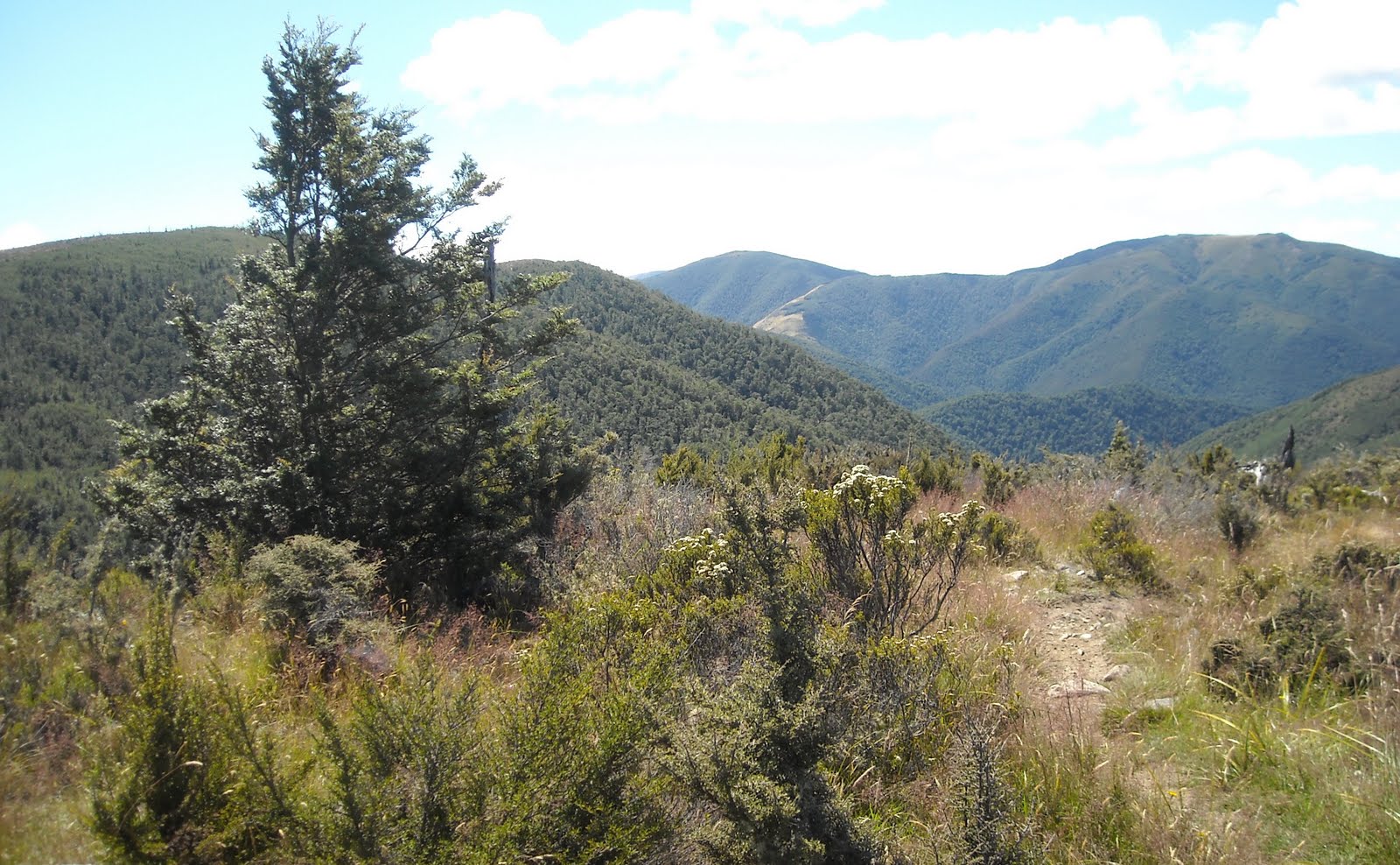
2010. Richardson Track Start, Mt Richardson
At Glentui Picnic Area / Carpark, I coolpixed the DOC map board and DOC track info board. I climbed Richardson Track up the western ridge through beech forest towards Mt Richardson summit.
As it had recently rained on Mt Richardson, Glentui River catchment streams flowed down the Mt Richardson ridge I climbed. Wet grass and trickling water on Mt Richardson Track soon soaked my shoes and socks.
I passed a DOC sign showing WATERFALL TRACK... I passed another DOC sign:
MT RICHARDSON ->
<- GLENTUI CARPARK

2010. Richardson Track view of Mt Richardson Beech Forest
I continued through the sweet smell of honeydew in Mt Richardson beech forest, past red, silver and black beeches, some with blackened trunks caused by fungi feeding off honeydew excreted by sap-sucking scale insects.
Sooty fungi blackened roots on Richardson Track and covered understorey totara saplings with ropes of blackened, fungal-covered branches and leaves. Below trackside beeches I saw blackened honeydew pools, and wasps feeding on honeydew on blackened beech trunks.

2010. Stream, Richardson Track, Mt Richardson
In ferny understorey, I passed blackberries, tree fuchsias, horopito, bush lawyer, wineberries, young rimus, lancewoods and beeches. Through dappled beech canopy I glimpsed Mt Richardson summit covered in beech forest. Below Richardson Track, in dappled beech forest I heard Glentui River flowing.

2010. Young Lancewood in Beech Forest, Richardson Track
On a gently rising track, on soft leaf-litter, I passed a DOC LOOP TRACK sign and another MT RICHARDSON -> <- GLENTUI CARPARK sign. Richardson Track was well marked with orange plastic triangles nailed to beech trunks.
I descended wooden steps to a stream by a fallen beech. After the stream, Richardson Track got steeper. I had to watch out for slippery roots, rocks, mosses, lichens and fungi. Along the way I chomped an apple, but dropped it, bouncing 20 metres down track.

2010. Tree Ferns, Richardson Track, Mt Richardson

2010. Tree Ferns in Beech Forest, Richardson Track
By another stream I passed a grove of tree ferns in beech understorey. I climbed more wooden steps and passed a lofty kahikatea white pine beside Richardson Track. I carefully crossed a mud slip, where someone had sawn toppled beeches into logs to stop more erosion.

2010. Beech Forest, Richardson Track

2010. Ferns in Beech Forest, Richardson Track

2010. Dappled Beech Forest, Richardson Track
I rock-hopped another stream and climbed stone steps, after which Richardson Track steepened with hip-high ruts in places. Walking in soggy ruts was safer than slippery sides. Through beech canopy, I glimpsed Canterbury Plains far below.

2010. Rough Richardson Track in Beech Forest

2010. Beech Glade, Richardson Track

2010. Beech Glade, Richardson Track, near Mt Richardson Summit
After 2 hours climbing Richardson Track through wet beech forest, at a sunny glade on the ridge top, surrounded by a circle of beech trees and a totara, I stopped by a log for a CocaCola, muesli bar and sarmie break. Someone had nailed two aluminium tags to a tree trunk, with two names etched on the aluminium.
Through beech canopy I had glimpses of Mt Thomas, and across Canterbury Plains I saw hazy Port Hills and beyond to hazy Mt Herbert and Mt Bradley on Banks Peninsula.

2010. Smooth Richardson Track through Beeches near Mt Richardson Summit

2010. Richardson Track Beeches near Mt Richardson Summit
Near Mt Richardson summit, the rocky track widened, and I had hazy views across Canterbury Plains to Port Hills and Banks Peninsula peaks: Mt Evans, The Monument, Mt Herbert, Mt Bradley.
On Banks Peninsula right, Lake Ellesmere was as a pale green strip, the Pacific absorbed in distant haze. On Banks Peninsula left, I saw hazy Pegasus Bay and Canterbury Plains.

2010. Richardson Track view of hazy Canterbury Plains, below Mt Richardson Summit
On Mt Richardson summit, Richardson Track opened into turpentine scrubland, Dracophyllum longifolium, between summit beeches. Through beeches I had views of Mt Oxford and further Torlesse Range in Southern Alps.
The DOC signboard, with peeling green paint and carved names, stated:
BOYS BRIGADE VIA BLOWHARD 3 hrs ->
GLENTUI VIA BYPASS 2 hrs ->
<- GLENTUI VIA RICHARDSON TRACK 2 hrs

2010. DOC Sign, Mt Richardson Summit. Mt Oxford backdrop
I'd climbed the latter in 3 hours. I disagreed with the Glentui via Bypass 2 hrs sign, as I would descend Mt Richardson along Blowhard, Bypass, bits of Loop and Richardson Tracks in 3.5 hours, tramping fit.

2010. Mt Richardson Summit view of Mt Oxford, Torlesse Range & Puketeraki Range

2010. Mt Richardson Summit view of Lees Valley, Mt Storm & Puketeraki Range
From Mt Richardson summit I had sublime views of Oxford on Canterbury Plains, and across Canterbury Plains to the Pacific. Westwards I looked over Mt Oxford to Torlesse Range and beyond to the Southern Alps vanishing into haze. Westwards too, I looked over Ashley River and farmland in Lees Valley below Puketeraki Range, Southern Alps.
Flies annoyed me, sucking my sweat on Mt Richardson summit. I would encounter more irritating flies on Blowhard Track, as someone had pony-trekked Blowhard leaving horse dung and hoof prints in the mud.

2010. Mt Richardson Summit view of Tussocks, Dracophyllum & Beeches. Lees Valley & Whistler River below, Mt Storm & Puketeraki Range behind

2010. Mt Richardson Summit view of Lees Valley & Puketeraki Range
2. BLOWHARD TRACK to BYPASS TRACK junction along Mt Richardson summit ridge. My time, 1.5 hours.

2010. Blowhard Track, Mt Richardson Summit

2010. Old Mans Beard on Beeches, Blowhard Track, Mt Richardson Summit

2010. Blowhard Track Beeches, Mt Richardson Summit

2010. Astelias, Dracophyllum & Beeches, Blowhard Track. Mt Thomas backdrop

2010. Astelias, Dracophyllum & Beeches, Blowhard Track. Mt Thomas backdrop zoom view
Blowhard Track undulated along summit ridge, overlooking beech forest in Glentui River catchment. Beech forest was down the other ridge slope too, towards unseen Blowhard Stream. Summit beeches were stunted and festooned by old man's beard. Blowhard Track was poorly marked by stone cairns and rusty fence standards.
At a track fork, I passed the old stock track descending into Lees Valley. (Walking permission needed). It was easy walking along muddy Blowhard Track towards Mt Thomas, as it was mostly downhill.

2010. Fallen Beech, Blowhard Track. Puketeraki Range backdrop

2010. Beeches, Blowhard Track. Mt Thomas backdrop

2010. Dead Beech, Blowhard Track. Mt Thomas backdrop

2010. Blowhard Track Cairn & Beeches near Mt Richardson Summit

2010. Blowhard Track Beeches festooned by Old Mans Beard, below Mt Richardson Summit

2010. Fire Damaged Beeches & Regrowth, Blowhard Track, Mt Richardson
2010. Young Beech, Blowhard Track. Mt Thomas backdrop

2010. Hebe odora, Blowhard Track, Mt Richardson

2010. Blowhard Track view of hazy Canterbury Plains & hazy Banks Peninsula
In open patches on the ridge between beech forest, I passed turpentine shrubs, matrixed by scrubby kanukas, astelias and white-flowering Hebe odora, reminding me of Cape fynbos: even smelt the same. Thinking of Pablo Neruda's words: "I will bring you happy flowers from the mountains..." I stuck a hebe sprig in my hat.
In summit beech forest again, I found a purple potato mushroom growing on Blowhard Track. I thought it was plastic rubbish, till I poked it with my walking stick.

2010. Purple Potato Mushroom, Blowhard Track, Mt Richardson
In another ridge clearing, with spectacular views of Mt Thomas ahead, fire and wind had left burnt and broken beech trunks piercing the sky, with hebes, kanukas, turpentine shrubs, bush lawyer and north-facing matagouri around dead trunks. Onwards I saw beech-forested Mt Thomas, Canterbury Plains, Pegasus Bay and the Pacific.
Across Canterbury Plains I saw tiny Christchurch buildings, reflecting sunlight below Port Hills, and beyond to Banks Peninsula, Lake Ellesmere and the Pacific. Solar panels on distant Mt Herbert summit reflected sunlight. I felt I was copter riding.

2010. Windblown Beech & Young Beeches, Blowhard Track, Mt Richardson

2010. Blowhard Track view of hazy Canterbury Plains

2010. Blowhard Track view of Mt Richardson Beech Forest & hazy Canterbury Plains
Looking back along Blowhard Track, I had views of beech forest switchback on Mt Ritchardson summit ridge. In beech forest again, I found another purple potato mushroom on Blowhard Track. In beech undergrowth someone had sprayed gorse patches, leaving dead, brown gorse by Blowhard Track.

2010. Blowhard Track view of Mt Richardson Beech Forested Summit
3. BYPASS TRACK to LOOP TRACK junction. My time, 1.5 hours.
At Blowhard Track / Bypass Track junction a DOC sign stated:
BYPASS TRACK 1 hr 30 mins ->

2010. Bypass Track off Blowhard Track, Mt Richardson
On a northern ridge, Bypass Track, like Richardson Track was well marked with orange plastic triangles nailed to trees. Bypass Track had similar beech forest and undergrowth to Richardson Track, but I saw more rimus on Bypass Track. While descending Bypass Track, I had no streams to cross, but the track was slippery from recent rains.

2010. Bypass Track view of Beech Forested Mt Richardson Summit
On Bypass Track, through beech canopy breaks on my right I glimpsed Mt Richardson summit ridge covered in beech forest. On my left I glimpsed Canterbury Plains below. On my right amongst young beech trunks, I passed a memorial board stating:
REMEMBERING
PETER
4 MAY 2006

2010. Peter Memorial, Bypass Track, Mt Richardson

2010. Lichens on Rock, Bypass Track, Mt Richardson

2010. Bypass Track through Beech Forest, Mt Richardson
Going down Bypass Track, I coolpixed dappled beech forest in late afternoon sunlight, lichens and mosses on rocks and logs, and honeydew pools in blackened soil beside blackened beech trunks.

2010. Honeydew Pool in Sooty Mould by beech tree, Bypass Track, Mt Richardson

2010. Lichen on Beech Trunk, Bypass Track, Mt Richardson

2010. Bypass Track Beeches, Mt Richardson

2010. Rimu in Beech Forest, Bypass Track, Mt Richardson

2010. Mossy Log, Bypass Track, Mt Richardson

2010. Hook Grass, Uncinia uncinata, Bypass Track, Mt Richardson
4. LOOP TRACK and RICHARDSON TRACK sections, back to Glentui Picnic Area / Carpark. My time, 30 minutes.

2010. Small Wooden Bridge, Loop Track, Mt Richardson
At the bottom of Bypass Track, I passed BYPASS TRACK and LOOP TRACK signs near a stream. Along Loop Track, I walked down wooden steps and over a wooden footbridge. Through beech forest, I walked over a spur, and in ferny undergrowth below a broadleaf tree a sign stated:
BROADLEAF
MAIHIHI
Griselinia littoralis

2010. Broadleaf, Griselinia littoralis, Ferns & Lancewood, Loop Track, Mt Richardson

2010. Wooden Bridge, Loop Track, Mt Richardson

2010. Wooden Steps, Loop Track, Mt Richardson
I crossed another wooden footbridge over another stream, climbed more wooden steps, and rejoined Richardson Track back to my car at Glentui Picnic Area / Carpark. Two campervans had joined my car, and a couple emerged from beech forest on Richardson Track after me. Otherwise I had tracks to myself all day.

2010. Loop Track view of Beech Forest, Mt Richardson
On my drive back to Christchurch via Oxford and Tram Road, I stopped to coolpix views of Mt Richardson and Mt Thomas.

2010. Tram Road view of Mt Richardson & Mt Thomas, Canterbury
Content & pics Copyright Mark JS Esslemont.
See Beech Forest (DOC)
No comments:
Post a Comment