Last week, PM Key, after his Antarctic junket, announced that money would be available to encourage builder apprentice training, to kick-start the rebuild. Key had woken up 2 years too late! During quake times, Luke did a builder carpenter tech course, did in-service builder work & rejected an apprenticeship offer, as there was no rebuild. Luke then did a tech joinery course & got a full-time job at Southern Pine Products, Halswell Junction Rd. I would be dad's taxi, twice a day for a year, driving Luke to - from work: Burnside - Hornby.
News Advertiser, 28.01.13, reported that a quake worker's camp, to house 200 workers, opening in April, would be built on Orion site, Madras St / Canon St, to house migrant workers for the rebuild. The workers' hostel, Cressy Village, would have natty workers' apartments each with a bedroom, bathroom, wardrobe / storage & kitchenette. The hostel would be security guarded & alcohol controlled. Swipe-cards would control access - egress. Sounded like migrant worker, mine hostels I knew in apartheid SA. The development would be funded by private sector, JGM group, nothing to do with slack CERA. Wishful thinking, the hostel never happened.
Drove around suburbs to see completed rebuilds & restorations done by the private sector:
Papanui Rd / Wyndham St: New shop, built on Haralds 04.09.10 Darfield Quake demolition site.

Papanui Rd: Papanui Rd, several shops restored post 04.09.10 Darfield Quake.


Further down Papanui Rd, new, 3 storey apartment block, built on a 22.02.11 Killer Quake demolition site.


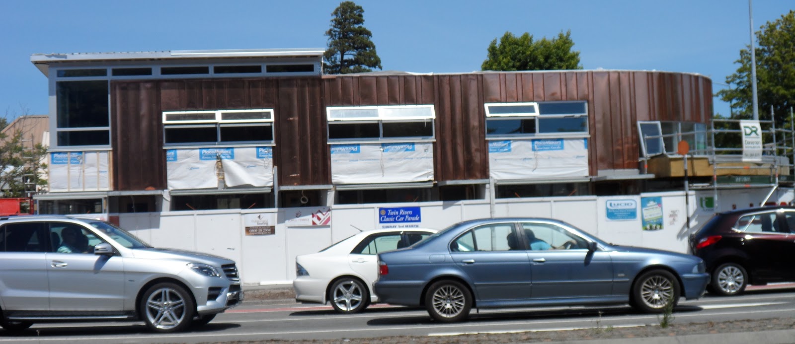
Papanui Rd / Aikmans Rd: New copper roofed shop, built on House of Travel, 22.02.11 Killer Quake demolition site.


Papanui Rd / Mansfield Ave: 2 storey, Kudos shop rebuild, on Kudos, 22.02.11 Killer Quake demolition site.


Bealey Ave / Colombo St: Concrete tilt-slab, 2 storey shops, built on Bealey Pharmacy, 22.02.11 Killer Quake demolition site.


Bealey Ave / Madras St: New dental surgery, built on Hearing Aid & Audiology Clinic, 22.02.11 Killer Quake demolition site.


Barbadoes St / Edgeware Rd: Rebuild of Restoration furniture shop, on Restoration, 04.09.10 Darfield Quake demolition site.


Opp cnr Barbadoes St / Edgeware Rd. Rebuild of shopping centre, on shopping centre, 04.09.10 Darfield Quake demolition site.


Memorial Ave / Clyde Rd: 2 storey shops rebuilt with copper wall panels on 22.02.11 Killer Quake demolition site.

Rossall St / Holmwood Rd: Rebuild of Holmwood Flowers & Holmwood shops, on Holmwood shops, 22.02.11 Killer Quake demolition site. For over a year a porta-cabin coffee shop did business on the demolition site.


Rossall St: Rangi Ruru School, new general purpose hall, built on a concrete slab, steel frame, plastic wall panels. Flimsy hall, as the nor'wester rattled plastic panels, glass doors, windows.

Stanmore Rd: Sun Ning Takeaways rebuild, on Sun Nings, 22.02.11 Killer Quake demolition site.

Stanmore Rd: Rebuild of shops, restaurant, bar, on Henry Africa's Restaurant, 22.02.11 Killer Quake demolition site.


Kerrs Reach, Avon River: Shed rebuilds of 3 rowing club houses trashed by 22.02.11 Killer Quake & demolished: Avon Rowing Club, Union Rowing Club, Christ's College Rowing.


Espalanade, Sumner: 2 storey house rebuild on 22.02.11 Killer Quake, brick house, demolition site.

There were more private rebuilds & restorations going on, the above a random sample. Architects & designers who designed those bldgs were a sorry lot. Greyness, drabness, tilt-slab boxes their metier.
The Press, Wed 30.01.13 front page blared: "Who owns our city?" Pages 10-11 showed most CBD land was owned by private landowners, a sprinkling owned by Council. Less Crown owned, so far.
NZ National govt / CERA took vast tracts of residential red zone land. CERA also took CBD land for its Blueprint Frame & anchor projects in the middle of the quake trashed, CERA demolished CBD. CCDU boss Isaacs said Frame land would later be sold, once land prices were raised in CERA's core CBD. NZ National govt / CERA thus gambled with taxpayers' money, speculating on CBD Frame land. CERA boss Sutton did minority National / coalition govt's taking. If CBD landowners didn't sell their land to CERA for its Frame, omnipotent CERA would confiscate the land with a risible offer.
CERA had already made Crown offers of half Rateable Value on red zone, vacant land! (Meanwhile owners of red zone, housed land got full RV offers). CERA bullied NG Boutique, Madras St, to sell for CERA's Blueprint, 35 000 seater, roofed stadium. Never mind NG Boutique was already post quakes restored. Using emergency powers, CERA would dish out section 38 notices to targeted businesses, like NG Boutique, hoping they would sell / demolish. CERA didn't say who would pay for the $500m roofed stadium to be built on Turners & Growers site, atop Christchurch Fault. (2021. After hassles with authorities, NG Building owners would decide to relocate their heritage building next to the Cardboard Cathedral, Madras St, at their own cost! Where were Heritage hailers? 2022. NG Bldg owners gave up the fight & demolished NG Bldg. CERA's Blueprint Stadium build pending.)
There were already green strips along Avon River banks in the CBD, Hagley Park bordering the CBD. There was also the proposed AVON / Otakaro Park, mooted by a citizens' 18 500 signature petition to parliament, for red zone residential land along Avon River banks, from city to sea. So far, AVON Park idea was ignored by NZ National govt / CERA.

27.01.13. Quake trashed house, Estuary Rd


Sun 27.01.13. Parked near the end of Estuary Rd, Southshore by Avon / Heathcote Estuary. Did a low tide, mudflats trek, snapping red zone, ghost housing lining the estuary.

27.01.13. Weedy, quake damaged house, Estuary Rd


Estuary Rd: Many houses were damaged, temporary repairs done: roofs patched; chimney gap, tarp covered; boarded walls & windows; golden foam filler in wall cracks...

27.01.13. Quake damaged house, Estuary Rd


27.01.13. Green, plastic, sewage tank, quake damaged house, Estuary Rd

27.01.13. Quake damaged house, Estuary Rd


27.01.13. Weedy house demolition site, Estuary Rd

27.01.13. Quake damaged house, Estuary Rd


Although many Estuary Rd houses were still inhabited, some were boarded ghosts, some had overgrown, weedy gardens. Passed demolition sites too. End of Estuary Rd, an Ebbtide St house facing Avon / Heathcote Estuary was fire damaged.

27.01.13. Quake damaged house, Ebbtide St

27.01.13. Quake & fire damaged, boarded house, Ebbtide St


28.01.13. NZ National govt press release, CERA minister Brownlee boasted that so far EQC / Fletcher had spent $1 billion on house repairs. The Press reported EQC / Fletcher would spend another $2 billion on house repairs by 2015. That was for EQC's under cap $100 000 house repairs. Fletcher house repair monopoly: Fletcher arranged a non litigation deal with NZ National govt, so Fletcher would not be liable for faulty repairs. What a crock!
Never mind 1 000s of homeowners waiting years for EQC to decide if their homes were overcap $100 000 before homeowners could negotiate claims with insurers. EQC would take years to decide on overcap repairs, while reinsurers replenished funds to pay $100 000 overcap repairs or rebuilds. By March 2016, many homeowners would still wait for EQC to decide on overcap $100 000 repairs, or rebuilds. Over 5 years since 22.02.11 Killer Quake, EQC had stalled overcap repairs, or rebuilds, causing strife for overcap homeowners. No protests from the rest of NZ!


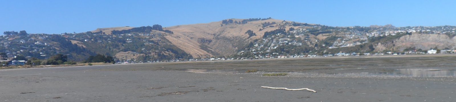
27.01.13. Southshore Spit view, Avon / Heathcote Estuary, Redcliffs, Mt Pleasant, Mt Cavendish

27.01.13. Southshore Spit view, Avon / Heathcote Estuary, Redcliffs, Mt Pleasant


27.01.13. Godwits, Avon Heathcote / Estuary, Southshore Spit

27.01.13. Pied oystercatcher, Avon / Heathcote Estuary, Southshore Spit

27.01.13. Wood propped, quake damaged house, Ebbtide St


Meanwhile, people lived in trashed houses. Despite CERA's / EQC's / Fletcher's boasting, anyone driving around E suburbs could see many houses still needed repairs: cracked walls, tarped roofs & chimneys, boarded windows & doors, wood & paper walls, brickwork peeled off, damaged roofs.


27.01.13. Southshore Spit view, gulls, pied oystercatchers, Avon / Heathcote Estuary. McCormacks Bay, Mt Pleasant, Castle Rock, The Tors beyond


27.01.13. Pied oyster catcher, pied stilts, Avon / Heathcote Estuary, Southshore Spit

27.01.13. Red zone, abandoned house, Southshore Spit


27.01.13. Black swans, Avon / Heathcote Estuary, Southshore Spit

27.01.13. Quake cracked, concrete slipway, abandoned, red zone house, Southshore Spit

27.01.13. Quake trashed, concrete, retaining wall, Avon / Heathcote Estuary, red zone, Southshore Spit


27.01.13. Red zone, abandoned house, Southshore Spit


27.01.13. Gulls, Avon / Heathcote Estuary mudflats, Southshore Spit. Clifton beyond

27.01.13. Pied stilt, pied oystercatcher, Avon / Heathcote Estuary, Southshore Spit
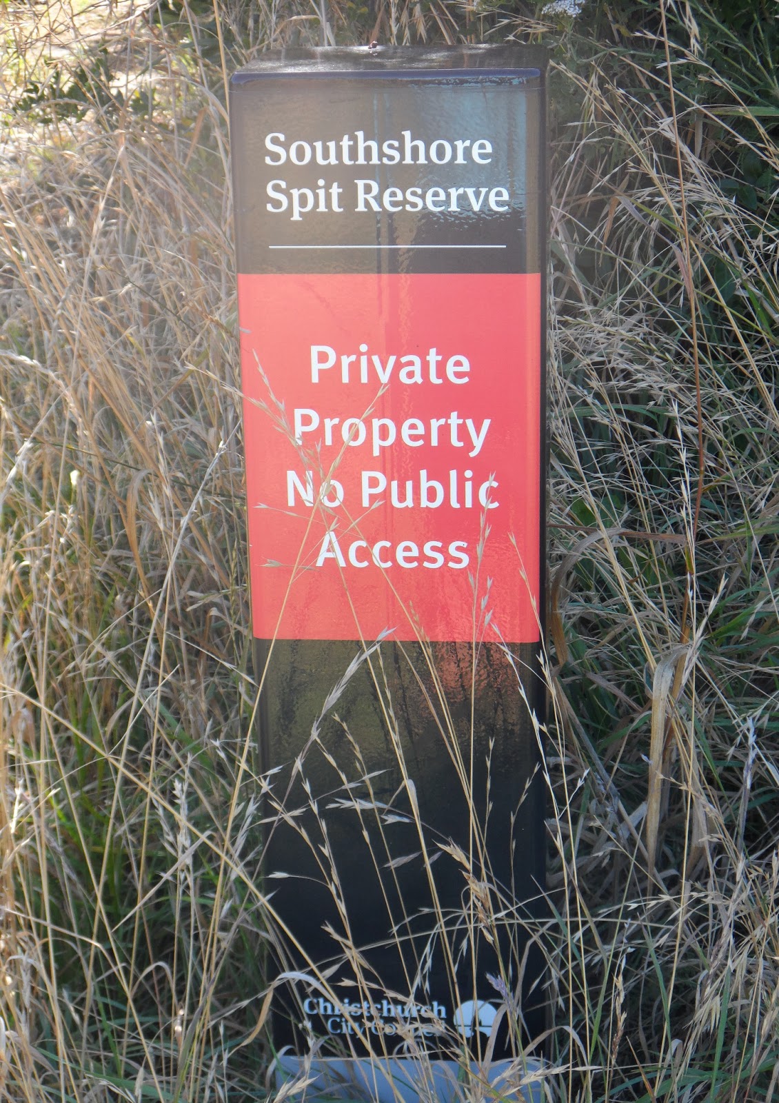
Trekked to the end of Ebbtide St, then wandered to Southshore Spit Reserve along estuary mudflats. Lots of waterfowl: godwits, pied stilts, gulls, black swans, pied oystercatchers, Canada geese... Views across the estuary: Mt Pleasant, McCormacks Bay, Redcliffs, Barnett Park, Moncks Bay, Clifton.
Weekend Press Feb 2-3 reported a planned $26m walkway / cycleway along that estuary route, from Ferrymead to Scarborough. There was already a walkway on Main Rd - Beachville Rd - Main Rd pavements, Sumner beach & Esplanade. What stopped cyclists using roads as usual?
Why stop at Ferrymead? The walkway / cycleway could go all the way round Avon / Heathcote Estuary to Southshore Spit. The walkway / cycleway could fork at Ferrymead & go beside Heathcote River, using existing paths, to Cashmere Rd. An Avon River fork from South Brighton Bridge could take walkers & cyclists along existing Avon River stopbanks, including the proposed AVON / Otakaro Park, to Christchurch CBD.

27.01.13. Red zone, weedy, abandoned house, Southshore Spit


27.01.13. Quake cracked, concrete, retaining wall, abandoned house, red zone, Southshore Spit

27.01.13. Red zone, weedy, abandoned house, Southshore Spit


27.01.13. Boat For Sale. Red zone, abandoned house, Southshore Spit

27.01.13. Red zone, weedy, abandoned house, Southshore Spit


27.01.13. Pied oystercatchers, Avon / Heathcote Estuary, Southshore Spit

27.01.13. Red zone, abandoned house, Southshore Spit


27.01.13. Quake trashed, concrete, retaining wall, abandoned house, red zone, Southshore Spit


27.01.13. Red zone, abandoned house, Southshore Spit


27.01.13. Quake trashed, concrete, retaining wall, red zone, Southshore Spit


27.01.13. Quake broken, concrete drain, Avon / Heathcote Estuary, red zone, Southshore Spit
Southshore Spit, Avon / Heathcote Estuary shore: Scores of red zone, ghost houses at the waterfront. Jetsam: boats, garden furniture, BBQ equipment, giving the impression of habitation to deter burglars. Some gardens had cut grass, many were overgrown. Damages: broken windows, houses tilted, sinking into ooze, broken pillars, cracked walls, wood braced walls, boarded walls & windows, trashed swimming pools, steps, gates, retaining walls, slipways at the waterfront. Concrete snapped, cracked, fallen everywhere.
As usual when I snapped ghost housing, despite the bright sunny day, I was spooked by the aching emptiness. CERA would demolish the lot.


27.01.13. Quake fallen, concrete / brick, retaining walls, pool, red zone, abandoned house, Avon / Heathcote Estuary, Southshore Spit


27.01.13. Quake trashed, concrete, retaining wall, Avon / Heathcote Estuary, red zone, Southshore Spit


27.01.13. Avon / Heathcote Estuary mudflats, red zone, Southshore Spit

27.01.13. Quake snapped, concrete slipway, Avon / Heathcote Estuary mudflats, red zone, Southshore Spit

27.01.13. Red zone, abandoned house, Southshore Spit


27.01.13. Cotyledons. Retaining wall rubble, red zone, Southshore Spit

27.01.13. Quake snapped, concrete slipway, red zone, Southshore Spit

27.01.13. Red zone, abandoned house, Southshore Spit


27.01.13. Quake cracked, concrete, retaining wall, Avon / Heathcote Estuary mudflats, red zone, Southshore Spit

27.01.13. Red zone, abandoned house, Southshore Spit


27.01.13. House demolition site, Avon / Heathcote Estuary mudflats, red zone, Southshore Spit
Never mind some houses in good condition. All red zoners were forced to abandon their houses, as NZ National govt / CERA had decreed trashed infrastructure too expensive to fix. That happened all over Christchurch in CERA residential red zones. Red zone Brooklands: forced abandonment, despite unbroken housing there.

27.01.13. Steel mesh fence cordon. Plastic, sewage tank. Avon / Heathcote Estuary, red zone, Southshore Spit. Mt Pleasant, Redcliffs across estuary

27.01.13. Red zone, abandoned house, Southshore Spit


27.01.13. Boat, Avon / Heathcote Estuary mudflats, red zone, Southshore Spit

27.01.13. Red zone, abandoned housing, Southshore Spit


27.01.13. Boats. Red zone, abandoned housing, Southshore Spit


27.01.13. Southshore Spit, red zone view, Avon / Heathcote Estuary mudflats, Redcliffs


That citizens were still banned from Christchurch CBD by NZDF checkpoints & steel mesh fence cordons was pathetic. Instead of using EQC as gatekeeper, Key's National govt could've let insurers get on with quicker payouts for damages, repairs, rebuilds of residential properties. More efficient than protracted dealings with bumbling EQC.


27.01.13. Red zone, abandoned house, Southshore Spit


Once CERA was gone in April 2016, after doing NZ National govt's red zoning, touting Crown offers & taking estuarine properties, future NZ Labour govt would still be dealing with red zone messes made by NZ National govt. Engineers would invent new foundations to float on estuarine ooze & enrich developers.
27.01.13. Southshore Spit view, Avon / Heathcote Estuary mudflats, Mt Pleasant

27.01.13. Southshore Spit view, Avon / Heathcote Estuary mudflats, Clifton

27.01.13. Southshore Spit view, Avon / Heathcote Estuary mudflats, Barnett Park, Mt Pleasant

27.01.13. Southshore Spit view, Avon / Heathcote Estuary mudflats, Moncks Bay, Redcliffs

27.01.13. Southshore Spit view, Avon / Heathcote Estuary mudflats, Redcliffs

27.01.13. Southshore Spit view, Avon / Heathcote Estuary mudflats, McCormacks Bay
I trekked to the end of Southshore Spit to look across the estuary mouth at ghost housing on Clifton cliff top: houses torn apart by quakes & cliff fall. One house, teetered two thirds on top of the cliff, with one third rubble scattered at the cliff bottom, on tons of cliff fall boulders by Peacocks Gallop.

27.01.13. Southshore Spit view, quake trashed houses, Clifton cliff edge. Stacked shipping container barrier below cliff, Peacocks Gallop


27.01.13. Southshore Spit view, quake collapsed, Shag Rock, quake trashed houses, Clifton cliff edge


27.01.13. Southshore Spit view, quake collapsed, Shag Rock

27.01.13. Southshore Spit view, quake cracked retaining wall, Clifton cliff top. Stacked shipping container barrier below. Lower houses would be red zone demolished, the hillside reduced to stop future rock falls
From Southshore spit, the double stack of Peacocks Gallop, shipping containers, "protecting" traffic by Clifton cliff fall looked puny. Cliff top, ghost houses opp stunted Shag Rock would be red zone demolished & the hillside on which they had stood reduced by excavators to stop future rockfalls.

27.01.13. Tsunami siren atop pole, Southshore Spit Reserve
*Trekked Papanui Rd, Bealey Ave, Barbadoes St, Memorial Ave, Rossall St, Stanmore Rd, Kerrs Reach, Sumner Esplanade, Estuary Rd, Ebbtide St, Southshore Spit. 190 images.
Mon 04.02.13, 4.44pm, M3.8 quake, 3km depth, 10km SE of Christchurch (GeoNet). Rattled by, truck like, quivering my computer chair for about 30 seconds while I edited this post.
Tues 05.02.13. The Press reported Council ineptitude regarding repairing Council housing, despite Council receiving $21m from EQC for repairs 10 months before:
"The Council - the second biggest landlord in the country - received a $21 million interim payment from the commission last April so it could begin repairing damage to its housing units. So far it has repaired only five units.
Housing new Zealand has repaired 230 of its hardest hit properties...
The closures [recent Council flat closures] bring the number of Council housing units out of action because of quake damages to about 470."
No wonder CERA minister Brownlee was annoyed with Council, hardly able to help citizens living in squalor.
Wed 06.02.13, 8.02pm, M3.6 quake, 8km depth, 10 E of Christchurch (GeoNet). Didn't feel it at Burnside, neither did Leah at Classical Sparks show in Hagley Park. Luke, closer to the epicentre at South New Brighton, said it shook his girlfriend's house.
Meanwhile SCIRT for several weeks dug up Estuary Rd again by South New Brighton School, for the third time in a year. Luke's girlfriend's family couldn't drive onto their property for days, while SCIRT buried new, concreted water pipes. No wonder Brownlee had a private meeting with Council (part of SCIRT) regarding ballooning infrastructure costs. SCIRT should've buried new sewage & water pipes simultaneously, instead of digging up Estuary Rd 3 times by South New Brighton School.
Leah was still shaken to hell at her London St school, while demolishers took their time demolishing nearby Richmond Working Mens Club. Whenever a demolition machine jolted or smashed, her school shook.
Coda:
23.03.16. The Press reported Christchurch cycleways would be completed in 2022.
03.01.22. The Press reported the 101km cycleways would only be completed in another 6 years!
Content & pics Copyright Mark JS Esslemont.
See Chch investors seize chance, take on risk (The Press / Stuff Co).
See Crown offers for flat land residential red zones (CERA).
See Big three have $1.2b price tag (The Press / Stuff Co).
See Planned coastal pathway would cost $26m (The Press / Stuff Co).
See Housing fixes my priority Johanson (The Press / Stuff Co).
See Christchurch cycleways construction to take longer than planned (The Press / Stuff Co).
Nice post Mark... it's all still so raw isn't it. Shattered lives and ongoing major issues *sigh*.
ReplyDeleteUnending Sandy. Growth & decay all at once. Hopefully someone with real vision will take take the handlebars & ride a good path. Go well.
ReplyDeleteVery nice to see all this.I live 4 blocks from the city centre and not owing a car I dont get to places like southshore etc so its hard to imagine the damage.really great seeing these pics thou.Gives one a real sense of what others have been thru.
ReplyDeleteI was looking for an update on the stanmore road rebuild and came across your site.great job.