[Post 22 February 2011 Quake, after two years of CERA's NZDF-occupation & citizen bannings from Christchurch CBD via NZDF-checkpoints, red-zone SMF-cordons became a "safety fence." CERA minister Brownlee this week berated Council for slow building consents, yet Brownlee's CERA had two years to prepare CERA & Council for consents processing].
"Once the owners have dealt with these issues, placement of the safety fence will be able to be reassessed. Owners and their engineers can access the area as required to complete the necessary works, but any reduction of the safety fence will rely on their efforts..."
CERA blamed building-owners for CERA's own occupation-cordons. If buildings were so "dangerous," why wasn't CERA using its recovery powers giving owners a deadline then demolishing the "dangerous building" after the deadline passed? Building-owners resisted CERA's offers for owners' Blueprint East Frame properties which CERA wanted to recycle into parkland & housing (latest morph).
During quake years, we experienced two military States-of-Emergencies controlled by Civil Defence. CERA began its NZDF-occupation of Christchurch CBD on 13.06.11 when an XL quake struck. CERA then demolished 100s of ruins bordered by CBD-cordons.
Before CCDU's Blueprint East Frame evolved, over a year before there was glimmerings of life where even CERA vouched for re-opening & rebuild of some pre-quakes & post-quakes buildings: EPIC Innovation Centre, between St Asaph St & Tuam St; reopening of Alice in Videoland / CI Cafe, Tuam St / High St; reopening of Mainz, High St; reopening of Les Mills Gym, Cashel St; reopening of Calendar Girls, Hereford St; (2015. Calendar Girls would relocate to Victoria St opposite Christchurch Casino); rebuild of Westende House, Manchester St / Worcester St. (By June 2015, CERA planned to demolish brand new Westende House for Manchester St widening for Blueprint East Frame bus routes)!
Ratepayers' Share an Idea for a City in a Garden was Blueprinted by CERA into taken Frame land which would become parkland to improve core-CBD land prices. Meanwhile CERA offered peanuts to Blueprint Frame landowners for their CBD-land.
Since CERA's latest Blueprint East Frame reveal, it was now possible to drive most Blueprint East Frame roads, as most roads between Manchester St & Madras St were open, except for ROAD CLOSED, SMF-cordoned Lichfield St & a bit of Bedford Row. Presently, nothing was clean & green about CERA's Blueprint East Frame, except for a grassy "meadow" (CERA's propaganda) on a demolition-site, Manchester St. The rest of the Blueprint East Frame were ruins & vast weedy & muddy demotion-sites from Oxford Tce to St Asaph St.

14.06.13. Latimer Hotel rebuild, Latimer Sq, renamed Rydges Hotel
Worcester St: I parked near Latimer Hotel rebuild, later renamed Rydges Hotel, to see CERA's latest Blueprint East Frame reveal:
*Asterisk pics revealed Blueprint East Frame & South Frame sites.
Worcester St, Blueprint East Frame: Abandoned buildings & ruins were SMF-cordoned, like The Christchurch Club & The Bicycle Thief & clinic (latter two would be demolished). I saw vast demolition-sites both sides of Worcester St stretching nothwards to Gloucester St & southwards to Hereford St. 2021. New apartments would be built both sides of Worcester St & The Christchurch Club. Some apartments were already built on Madras St / Hereford St. CERA Blueprint: I saw apartments lining east side of the East Frame / Rauora Park. Those expensive apartments were unsuitable for families with kids as there were no gardens. Did CERA's Blueprint expect apartment kids to play in Rauora Park or Margaret Mahy Family playground?
Worcester St / Manchester St: I saw cordoned Cathedral Junction & part reopened Pacific Tower / Rendezvous Hotel & associated demolition-sites along Manchester St to Gloucester St. I saw the cordoned apse of Christ Church Cathedral ruin. On the diagonally opposite coner I saw demolition-sites. Westende House's post-quake rebuild on CERA's Blueprint East Frame was a reminder of CCDU's Blueprint stupidity, as Westende House would soon be demolished for road revamping. On the diagonally opposite corner, I saw tarped & steel braced Trinity Church / Octagon Restaurant which awaited restoration. 2023. Trinity Church was still not fully restored!

*14.06.13. Steel mesh fence cordon. Yellow digger. Blueprint E Frame, demolition site, Worcester St / Manchester St. Red zone, back of ruined Christ Church Cathedral beyond

*14.06.13. Tangled, steel rebars, yellow digger. Blueprint E Frame, demolition site, Worcester St / Manchester St


14.06.13. Orange, plastic, road fencing, steel mesh fence cordon. Steel braced, tarped, boarded, Octagon Restaurant (old Trinity Church) awaited restoration, Manchester St / Worcester St
Manchester St: Worcester St crossing, southwards to Hereford St crossing: I saw demolition-sites & ruins in CERA's Blueprint East Frame, east side of Manchester St & the Blueprint core-CBD, west side of Manchester St. 2022. A Williams Corporation advert board would tout Manchester Square development, including expensive Apartments from $649,000; Terraces from $849,000; Commercial from $429,000.
Manchester St / Hereford St: In the Blueprint East Frame I saw Bradley Nuttal House's demolition-site.
Hereford St, Blueprint East Frame: I saw demolition-sites both sides of Hereford St, including Liverpool St. Abandoned Oaks Homestay Apartments loomed above. (Demolished 2015). Opposite, I saw reopened Calendar Girls & Torrens House ruin, still SMF cordoned & sporting more broken-windows since I'd last trekked past. Torrens House would be demolished.

*14.06.13. Blueprint E Frame demolition site, Manchester St / Hereford St. Abandoned bldg in core CBD right

*14.06.13. Hereford St / Liverpool St junction view, abandoned bldgs, demolition sites going across Cashel St & Lichfield St to Tuam St. Port Hills beyond. The bldgs would be demolished & replaced by Liverpool Terraces, 2019

14.06.13. Cardboard Cathedral left, Hereford St / Madras St left. *E Frame, reopened Calendar Girls, Hereford St right would be demolished for Liverpool Terrace apartments. Calendar Girls would relocate near Christchurch Casino

*14.06.13. Steel mesh fence cordon. Broken windows. Blueprint E Frame, abandoned Torrens House, awaited demolition, Hereford St

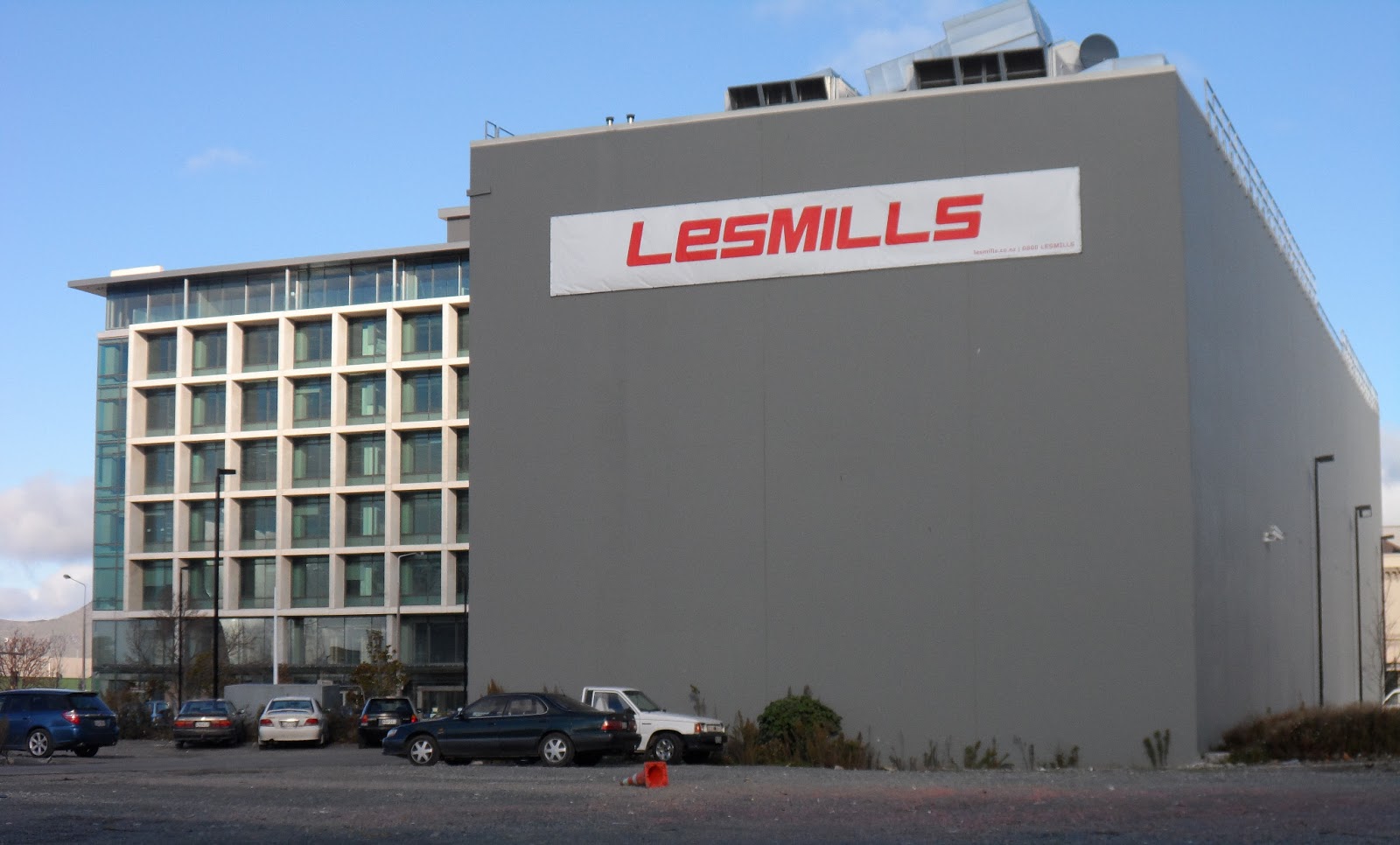
*14.06.13. Blueprint E Frame, CTV demolition site, abandoned IR bldg, Cashel St left. Reopened Les Mills Gym right. IR bldg would survive the quakes too
Hereford St, Blueprint East Frame: Looking southwards beyond Torrens House & Calendar Girls I saw a vast demolition-site including Arrow House demolition-site ending in reopened Les Mills Gym & the CTV demolition-site. Beyond loomed abandoned multi-storey IRD, Cashel St. Torrens House & Calendar Girls would be demolished, Calendar Girls relocating near Christchurch Casino. 2023. IRD would still be closed.
Hereford St / Latimer Sq, Blueprint East Frame: A demolition-site.
Hereford St / Madras St: In the non East Frame, the Anglican Cardboard Cathedral was almost completed on St Johns demolition-site, northwest of CCDU's Blueprint "stadium." I saw demolition-sites & ruins in CCDU's Blueprint stadium zone which stretched southwards down Madras St to Tuam St.

14.06.13. Arrow House demolition site view, Anglican Cardboard Cathedral on St Johns demolition site, Madras St / Hereford St

14.06.13. Latimer Sq view, Anglican Cardboard Cathedral on St Johns demolition site, Hereford St / Madras St
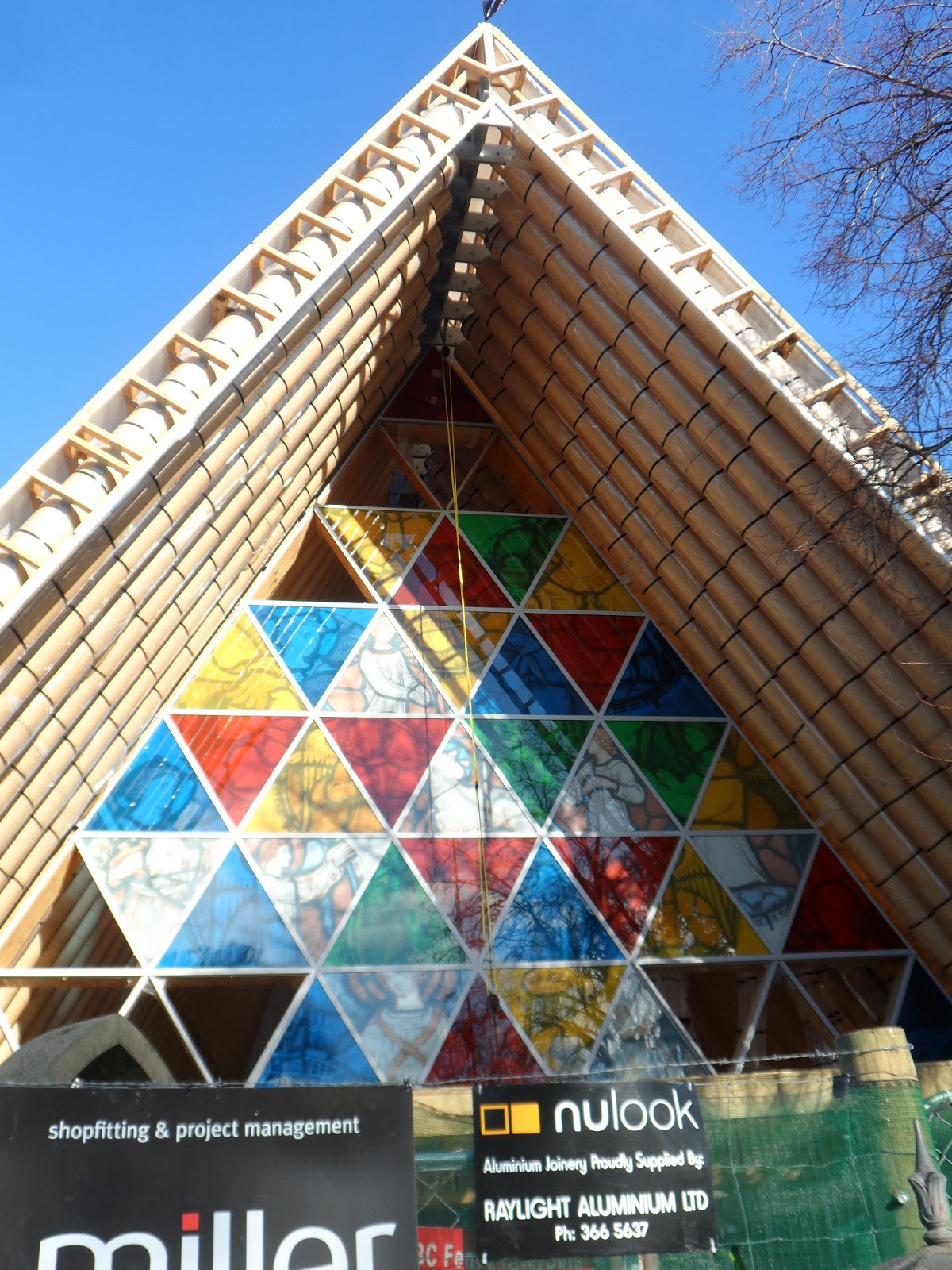

Thus CCDU not only exterminated Blueprint East Frame rebuilds with its parkland idea, CCDU also wanted to take survivor buildings east of Madras St & Blueprint East Frame for its 35 000 seater, roofed stadium. CERA didn't say who'd pay for that stadium. NZ taxpayers would pay for all CBD taken properties of course, including Blueprint Frame properties & other CCDU Blueprint anchor sites, like Convention Centre / Te Pae & the Performing Arts Precinct & the Metro Sports Facility...
CERA didn't say who'd pay for construction of Blueprint anchor projects while Brownlee bullied Council to sell Council assets for construction of the Blueprint anchor projects. People fell for Brownlee's bullshit & berated mayor Parker & councillors & town clerk Marryatt. In 2012 there were several public protests voicing incompetent Council themes.
The CERA Act usurped many Council functions & Brownlee & ECAN stooge Dame Bazley tried to embarrass the Council so CERA could take over building consents with the dubious goal of speeding up rebuild consents. Fat hope, as CERA proved to be extremely slow in land zoning with zoning delays & zoning reviews & inability to resolve EQC delays & insurer delays.
Madras St / Cashel St, Blueprint East Frame: I again saw abandoned multi-storey IRD on the south side. On the north side, I again saw the CTV demolition-site where 115 people died in the CTV collapse, 22 February 2011 Quake. I saw tributes hanging on the SMF-cordon, including a David Cohen poem.

*14.06.13. Blueprint E Frame, CTV demolition site, Madras St / Cashel St. Abandoned IR bldg left, reopened Les Mills Gym right. Both bldgs would survive the quakes

*14.06.13. Blueprint E Frame, CTV demolition site, steel mesh fence cordon tributes to 115 people killed in the CTV collapse, Madras St. Reopened Les Mills Gym behind


14.06.13. CTV demolition site view, Anglican Cardboard Cathedral on St Johns demolition site, Madras St / Hereford St
Diagonally opposite corner: I saw the 185 Empty Chairs memorial on St Pauls Trinity Pacific Presbyterian Church's demolition-site.
Blueprint East Frame on the opposite corner: The SMF-cordon was removed & abandoned IRD loomed above. I saw books strewn behind dusty windows in Book City below. I saw Council workmen resealing footpath asphalt after CERA's cordon removal. As nothing had happened near the IRD & the opposite CTV demolition-site for over a year, why did CERA reseal the footpath only after SMF-cordon removal?

*14.06.13. Steel mesh fence cordon. Blueprint E Frame, Cashel St view, CTV demolition site, Anglican Cardboard Cathedral on St Johns demolition site, Hereford St / Madras St

*14.06.13. Blueprint E Frame, abandoned IR bldg, Cashel St


*14.06.13. Blueprint E Frame, abandoned Book City in IR bldg, Cashel St. Abandoned Oaks Homestay Apartments right would be demolished (2015) for Bedford Terraces & Bedford Apartments (2018)

*14.06.13. Blueprint E Frame, abandoned Book City, quake strewn books, Cashel St


Westwards along Cashel St,in the Blueprint East Frame opposite reopened Les Mills Gym, the SMF-cordon was removed before abandoned Divine Cafe. I saw broken-glass strewn on Divine Cafe floors. Next door at abandoned Rapaki Properties, I saw piles of drink cans strewn on the floor.

*14.06.13. Blueprint E Frame, abandoned Divine Cafe, broken glass, Cashel St


*14.06.13. Blueprint E Frame, abandoned Rapaki Properties, Cashel St


*14.06.13. Blueprint E Frame, quake strewn food, Rapaki Properties, Cashel St


Cashel St / Liverpool St junction: I looked northwards past demolition-sites to Hereford St & looked southwards past ruins & demolition-sites across Lichfield St to Tuam St. I saw a vast Blueprint East Frame wasteland. I saw rows of concrete drill-holes & chipped-concrete showing rusty steel-rebars on Oaks Homestay Apartment wall. (Demolished 2015, replaced by Bedford Terraces & Bedford Apartments, 2018). So far, in CERA's Blueprint East Frame, all I saw were ruins & weedy demolition-sites!

*14.06.13. Blueprint E Frame, Cashel St view, weedy demolition sites, abandoned bldgs across Lichfield St to Tuam St. McKenzie Willis restoration beyond. Port Hills behind

*14.06.13. Blueprint E Frame, Cashel St view, abandoned, brick bldg, awaited demolition, Bedford Row


*14.06.13. Blueprint E Frame, Cashel St view along Liverpool St to abandoned Torrens House, awaiting demolition, Hereford St

*14.06.13. Blueprint E Frame, abandoned Oaks Homestay Apartments (demolished 2015, replaced by Bedford Terraces & Bedford Apartments, 2018) Cashel St / Liverpool St junction
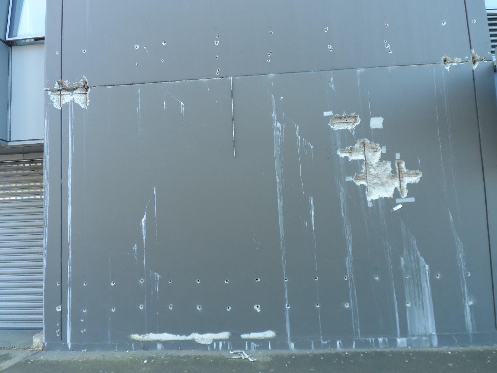

*14.06.13. Blueprint E Frame, abandoned Development House, Cashel St

*14.05.13. Blueprint E Frame, abandoned Insignis House, Cashel St
Cashel St / Manchester St, Blueprint East Frame: From one corner, I saw demolition-sites all the way to cordoned Bedford Row. I saw a workman wearing an orange Hi-Vis on a ladder while he fixed a traffic-light. On the opposite corner, Shooters ruin awaited demolition.
Across Manchester St in the core-CBD I saw abandoned buildings like WINZ, High St; All Seasons Hotel, Cashel St & rubble-piles on Holiday Inn & Hotel Grand Chancellor demolition-sites. I saw a yellow high-reach digger parked on a Manchester St demolition-site near multi-storey Te Wanaga Aotearoa, which was later refurbished as The Muse Art Hotel, sporting palm trees on its flat-roof corners.

14.06.13. Orange, plastic, road cones, orange, plastic fence, steel mesh fence cordon. Blueprint E Frame, Cashel St / Manchester view, core CBD, abandoned bldgs & yellow, high reach digger on demolition site. Abandoned Te Wanaga Aotearoa left (awaited refurbishing as The Muse Art Hotel, palm trees on flat roof cnrs). Abandoned WINZ, High St, behind digger.


14.06.13. NO ENTRY. GIVE WAY. Orange, Hi-Vis vested workman fixing traffic lights, Manchester St / Cashel St. Abandoned All Seasons Hotel, abandoned bldgs in core CBD behind

*14.06.13. White / orange, plastic bollards. Blueprint E Frame, abandoned Shooters awaited demolition, Cashel St / Manchester St

*14.06.13. Blueprint E Frame, abandoned Oaks Homestay Apartments (demolished 2015, replaced by Bedford Terraces & Bedford Apartments, 2018) Cashel St / Liverpool St. See silhouette of demolished bldg on side wall

*14.06.13. Steel mesh fence cordon. Blueprint E Frame, Cashel St demolition site view, quake trashed, brick bldg, awaited demolition, Bedford Row / Manchester St. Stacked shipping containers right stop facade falling onto Manchester St
Part cordoned Bedford Row, Blueprint East Frame: I saw demolition-sites & ruins all the way to abandoned IRD, Madras St.

*14.06.13. Steel mesh fence cordon. Blueprint E Frame, quake trashed, brick bldg, awaited demolition, Bedford Row / Manchester St. Stacked shipping containers stop facade falling on Manchester St

*14.06.13. Steel mesh fence cordon. Blueprint E Frame, Manchester St view, demolition sites, abandoned bldgs, Bedford Row. Abandoned IR mid left
Manchester St / Lichfield St, Blueprint East Frame: SMF-cordoned Majestic House ruin awaited demolition. Lichfield St was still SMF- cordon closed.
Opposite, Manchester St / High St, in the core-CBD: I saw Leighs construction-site for Stranges rebuild, one of the few construction-sites in CERA's core-CBD.

*14.06.13. Steel mesh fence cordon. Blueprint E Frame, S view, Manchester St to Tuam St crossing. Abandoned Majestic House, awaited demolition, Manchester St / Lichfield St left

*14.06.13. Steel mesh fence cordon. Blueprint E Frame, Manchester St view, closed Lichfield St. Abandoned Majestic House left awaited demolition. Lichfield St was the divide between CERA's Blueprint E Frame & S Frame

14.06.13. *Blueprint E Frame, abandoned Majestic House awaited demolition right, Manchester St / High St / Lichfield St crossing. Abandoned Te Wanaga Aotearoa, core CBD left, awaited restoration as The Muse Art Hotel, palm trees on the flat roof
South down Manchester St to Tuam St, Blueprint East Frame: I saw cordoned Lichfield St, the early divide between Blueprint East Frame & Blueprint South frame. I saw ruins & demolition-sites along Manchester St & High St & around Poplar St.
Poplar St, off High St, Blueprint South Frame: Little was left of Poplar St. Pre-quakes poplar St was a vibrant restaurant & pub & boutique shopping area. I snapped Poplar Mews demolition-site where Jake had pre-quakes flatted. Opposite, I saw two survivor buildings, the abandoned gastro-pub which would re-open as Dux Central, 2015. Behind a SMF-cordon, I saw more ruins like CF Cotter & Co, High St. I saw more ruins along Ash St to Madras St & demolition-sites. CERA still cordoned those ruins surrounded by demolition-sites.

*14.06.13. Steel mesh fence cordon. Blueprint S Frame, Poplar St demolition sites view, abandoned bldgs: CF Cotter & Co, High St left. E Frame, Majestic House awaited demolition right, Lichfield St

*14.06.13. Steel mesh fence cordon. Blueprint S Frame, Poplar St demolition sites view, reopened CI Cafe / Alice in Videoland (old PO) Tuam St left, abandoned CF Cotter & Co, High St right

*14.06.13. Steel mesh fence cordon. Blueprint Poplar St / Ash St junction view, S Frame abandoned bldgs. View of abandoned Lichfield St at end of Poplar St. Cordoned gastro pub reopened as Dux Central Sept 2015

*14.06.13. Blueprint S Frame, abandoned, gastro pub (reopened as Dux Central Sept 2015) Poplar St / Ash St

High St: One side, I saw survivors like Mainz & CI Cafe / Alice in Videoland. Across Tuam St, I saw McKenzie Willis facade, undergoing restoration. Next door, I saw a fire-razed ruin, burnt rubble was strewn across cordoned High St. Across High St, I saw survivor CPIT Fashion School.
Ash St ruins, Blueprint South Frame: I trekked past weedy, SMF-cordoned demolition-sites filled with broken brick-walls & rubble & a decapitated roof & wood & iron salvage to Madras St. One of those demolition-sites, bordered by Ash St, Poplar St & Tuam St, would become five-storey Vodafone HQ, opened 2016, beside new Vanguard Sq.

*14.06.13. Steel mesh fence cordon. Blueprint S Frame, Ash St abandoned bldgs. Front gastro pub reopened as Dux Central, Sept 2015. Behind bldg would be demolished for Lichfield St multi-storey carpark, opened Nov 2017


*14.06.13. Blueprint S Frame, Ash St, S view, Tuam St demolition sites & Tuam St / High St crossing. Reopened CPIT Fashion School left, fire razed, High St bldg middle, McKenzie Willis facade restoration right. Demo site by the orange shipping container would become Vodafone HQ, 5 storey bldg, opened 2016, beside new Vanguard Sq

*14.06.13. Blueprint S Frame, Ash St view, Tuam St demolition sites, McKenzie Willis facade restoration

*14.06.13. Blueprint S Frame, Ash St demolition sites view, Tuam St / High St bldgs: Reopened CPIT Fashion School left, fire razed, High St bldg middle, restoration of McKenzie Willis facade right

*14.06.13. Steel mesh fence cordon. Blueprint S Frame, Tuam St view, salvage by Ash St, abandoned bldgs

*14.06.13. Steel mesh fence cordon. Blueprint S Frame, Madras St view, Ash St, abandoned bldgs

*14.06.13. Steel mesh fence cordon. Blueprint S Frame, Madras St view, quake rubble, abandoned bldgs nr Ash St
Madras St: Reopened NG Gallery did fashion business, but CCDU wanted NG Gallery land for its Blueprint stadium on Turners & Growers site. NG Gallery would survive briefly next to a part-demolished ruin, Madras St / Lichfield St. That Crown-owned ruin would rot there for years, an eyesore. 2020. It was still ruined. 2021. NG owners would decide to relocate NG Building north up Madras St next to the Cardboard Cathedral. 2022 Rethink: NG Gallery owners would demolish NG Gallery, enabling building of CCDU's Blueprint stadium.

14.06.13. NG Gallery, Madras St, on CCDU's Blueprint stadium site

14.06.13. Concrete blocks, steel mesh fence cordon. Crown owned, part demolished bldg next to NG Gallery, Madras St / Lichfield St. 2020 the ruin would still be there, an eyesore. Only in 2021 would a decision be made to relocate NG Bldg, N up Madras St next to the Anglican Cardboard Cathedral, to make space for NZ National govt's / CERA's Blueprint Stadium. 2022. NG Gallery owners would change their minds & demolish NG Gallery

*14.06.13. ROAD CLOSED. Steel mesh fence cordon. Blueprint S Frame left, E Frame right. Madras St view, closed Lichfield St, abandoned bldgs

Bedford Row: Part cordoned. I trekked west, past abandoned multi-storey IRD & more ruins to snap SMF-cordoned brick-ruins near Manchester St. After two years, CERA still hadn't demolished those dangerous, unreinforced brick-buildings. Many unreinforced brick-buildings had collapsed in quakes, causing grief. A blue brick-building had upper-storey chunks stripped off by quakes, black-plastic fluttered from its Manchester St facade which was protected by three layers of shipping-containers. Another unreinforced brick-building's upper-storey walls were also stripped by quakes. It was supported by wooden-bracing. Those brick-ruins would be demolished for CERA's East Frame / Rauora Park.

*14.06.13. Steel mesh fence cordon. Blueprint E Frame, Madras St / Bedford Row, abandoned bldgs, awaiting demolitions

*14.06.13. Steel mesh fence cordon. Blueprint E Frame, abandoned amgagency, awaiting demolition, Bedford Row

*14.06.13. Steel mesh fence cordon. Blueprint E Frame, Bedford Row view, demolition sites, abandoned bldgs, closed Lichfield St. The bldgs would be demolished for Lichfield St multi-storey carpark, opened Nov 2017

Last month CERA boss Sutton & CCDU boss Isaacs went on overseas business trips at taxpayers' expense. Never mind CERA's nebulous housing- repairs & rebuilds. Meanwhile, Sutton contemplated saving some red-zone housing as monuments!
Northwards off Bedford Row, I snapped demolition-sites & ruins to Hereford St. Southwards, I snapped demolition-sites & ruins to Lichfield St & Tuam St. Those Blueprint East Frame lands would need years to become Rauora Park & expensive apartments.

*14.06.13. Steel mesh fence cordon. Blueprint E Frame, Bedford Row S view, past demolition sites & abandoned bldgs, past closed Lichfield St to open Tuam St. The abandoned bldgs would be demolished. McKenzie Willis facade restoration middle, Tuam St

*14.06.13. Steel mesh fence cordon. Blueprint E Frame, Bedford Row S view, past demolition sites & closed Lichfield St abandoned bldg to Tuam St / High St. McKenzie Willis facade restoration & abandoned CF Cotter & Co middle, reopened CI Cafe / Alice in Videoland (old PO) right
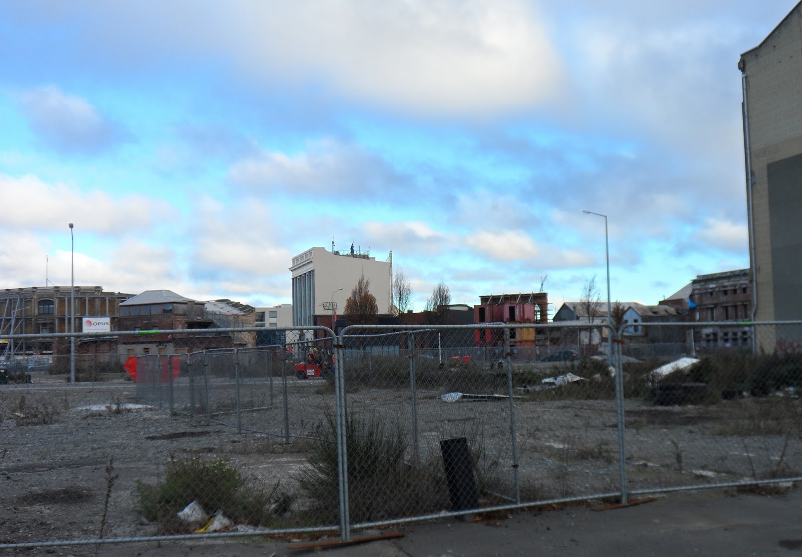

*14.06.13. NO EXIT. Steel mesh fence cordon. Blueprint E Frame, Bedford Row abandoned, brick bldgs behind abandoned Majestic House, awaited demolition


*14.06.13. Steel mesh fence cordon. Blueprint E Frame, Bedford Row N view across a demolition site to Cashel St, then along Liverpool St to Hereford St. Abandoned Oaks Homestay Apartments left (demolished 2015) abandoned Torrens House awaited demolition middle, reopened Les Mills Gym carpark on demolition site right
CBD recovery: I saw that little had happened regarding CCDU's Blueprint since it was trumpeted a year ago. I'd seen Watermark fiddling on Avon River bank by Antigua Boatsheds: a new boardwalk, a low concrete wall construction & revamped riverside paths. Public feedback was requested. Waste of money!

14.06.13. Anglican Cardboard Cathedral, built on concrete foundations & shipping container supports, Madras St / Hereford St

In June, CERA boasted about removing its strangling NZDF-cordons in the CBD. That wasn't true, as there were many buildings still SMF-cordoned in CCDU's "rebuild" zone. Some roads were useable, but potholed. Blueprint East Frame so far was CCDU dreaming, nothing concrete had evolved in its Blueprint East Frame, no rebuilds, no housing, no parklands. Like the rest of CCDU's Blueprint, we'd experienced a year of propaganda about CCDU's anchor projects, while demolitions & few rebuilds occurred in the CBD. Demolitions would continue for years in the Blueprint East Frame & Blueprint South Frame. They were zombie-zones before any rebuild occurred.
*Trekked Latimer Sq, Manchester St, Hereford St, Madras St, Cashel St, Poplar St, Ash St. 87 images.
Thursday 27.06.13. PM Key announced who would pay for what regarding CCDU's Blueprint anchor projects, including the Crown paying for the Convention Centre / Te Pae & Blueprint Frame. Public Frame land would later be transferred to Council. The Blueprint Frame was a NZ National government take, paid for by taxpayers & ratepayers. Costs for remaining Blueprint anchor projects would be shared by the Crown & Council & private sector.
CERA's 27.06.13 media release, Brownlee: "We're talking today about an investment of $4.8 billion - $2.9 billion of it coming from the Crown [Taxpayers] and $1.9 billion committed by the Christchurch City Council..." (Ratepayers).
Roads & underground-pipes infrastructure, Brownlee: "We now believe that will cost a combined $2.9 billion - $1.8 billion being the best estimate of the Crown's likely contribution and $1.1 billion being the Council's share..."
NZ National government's disaster capitalism in the CBD-cordon: NZ National government had forced its Blueprint precincts on Council, wanting Council to sell its capital assets to pay for NZ National government's Blueprint anchor projects. Never mind NZ National government's take of residential red-zone land. CERA didn't mention NZ National government's private asset takes with many transfers of privately owned, CBD land to Crown land: Blueprint Frame take, Blueprint Stadium take, Blueprint Convention Centre take, Blueprint Metro Sports Facility take, Blueprint Justice & Emergency Services take, Blueprint Health Precinct take, Blueprint Ngai Tahu Cultural Centre take, all in the former CBD, Hagley Oval take by NZ cricket, all overseen by CERA. Taxpayers paid for NZ National government takes in Christchurch CBD, while Council did nothing about it. Even Cathedral Grammar School tried taking some of Council owned Chester St West for the school's exclusive ownership, using CERA emergency powers of course.
Brownlee continued: "New time lines & designs for projects will be announced progressively over coming months giving impetus to private sector developers as the public sector's vision of the CBD becomes clearer." (My emphasis). So much for citizens' City in a Garden!
TVNZ One News 17.07.13. CCDU boss Isaacs announced that the CTV site was purchased by the Crown & was included in the Blueprint East Frame. It was where muiti-storey CTV collapsed & burned, killing 115 people in the 22 February 2011 Quake.
Content & pics Copyright Mark JS Esslemont.
See Second inner city area of rebuild zone cordon removed 14 June 2013 (CERA media release).
See Red zone homes may stay as memorials (The Press / Stuff Co).
See Anchor projects bill totals $4.8 billion (The Press / Stuff Co).
See Crown & Council agree recovery costs 27 June 2013 (CERA media release).
See Bitterness at CCDU valuations (The Press / Stuff Co).
See Westende House demolition terrible waste - Lianne Dalziel (The Press / Stuff Co).

No comments:
Post a Comment