Most of Bexley was recently red-zoned by CERA. 5 100 red-zoners in Canterbury were forced to abandon their condemned properties & find new homes, after negotiations with EQC & insurers, or duress buyout by NZ National government. That made NZ National government a land-grabber & speculator, using taxpayers' money. CERA-minister Brownlee said red-zone land could be remediated! Never mind 10 000 orange-zone & white- zone home-owners' land still to be assessed by CERA.
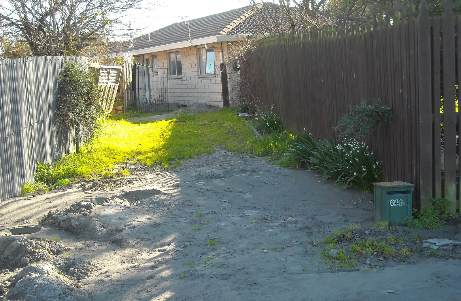
I parked at Seabreeze Cl & trekked towards Bexley Wetland. I'd seen Seabreeze Cl post 4 September 2011 Quake & post 22 February 2011 Quake, M6.3, liquefactioned by both quakes. Deja vu 13 June 2011 Quake: Seabreeze Cl, a ghost-street, grey quakemire everywhere, many ruined- houses, just one house inhabited, cars parked outside. A grey quakemired, stinking mess. Bexley ruined-houses I passed were red-zoned & would be demolished by CERA.
Bexley suffered 1 000s of tons of liquefaction MUD, MUD, MORE MUD. As in other liquefactioned-suburbs, like Avonside, Dallington, Avondale, Horseshoe Lake, Bexley's infrastructure, underground-pipes & cables, were destroyed by quakemire shoved up by quakes. During quakes, mud flooded into roads, gardens, houses & businesses, causing massive destruction.

17.07.11. Yellow portaloo. Serial quake damaged, Seabreeze Cl, Bexley, post June 13 quake. Port Hills backdrop. All Seabreeze Cl houses in the pic would be red zoned & demolished by CERA

17.07.11. Liquefactioned house, Seabreeze Cl. The house was red zoned & would be demolished by CERA


I didn't snap much of Seabreeze Cl, nor Bexley Wetland, having done so before. The post 22 February 2011 Quake stopbank between Bexley Wetland & new Bexley housing had hardened into a regular cycle-track overlooking ghost-houses, quakemire both sides of the elevated stopbank.
Bexley Rd: At stopbank-start, a road threat-sign: EARTHQUAKE DAMAGE. Ghost-houses in Seabreeze Cl & lining Bexley Wetland had shiny, blind eyes. Taking pics of ghost-houses facing Bexley Wetland, I had that creepy feeling again. Although a safe distance away, when standing before ruins, I felt I was being watched!

17.07.11. EARTHQUAKE DAMAGE road sign, start of post Feb 22 quake raised stopbank, Bexley Rd, Bexley, post June 13 quake


17.07.11. Post Feb 22 quake raised stopbank, Bexley Wetland


17.07.11. Serial quake damaged housing facing Bexley Wetland, post June 13 quake. The houses were red zoned & would be demolished by CERA


17.07.11. Post Feb 22 quake raised stopbank, Bexley Wetland. All houses in the pic were red zoned & would be demolished by CERA

As ghost-houses faced Bexley Wetland , through windows & glass-doors, I saw dried-quakemire inside houses & cracked, overgrown-gardens. 22 February 2011 Quake's liquefaction-volcanoes in Bexley Wetland already looked old, covered in low-tide brown-algae. Waterfowl still inhabited Bexley Wetland. Humans gone.

17.07.11. Serial quake damaged housing facing Bexley Wetland, post June 13 quake. The houses were red zoned & would be demolished by CERA


17.07.11. Post Feb 22 quake raised stopbank, Bexley Wetland. Port Hills backdrop, post June 13 quake
Bexley Wetland: Closer to Avon River bank, Bexley houses were inhabited. At the edge of Bexley Wetland, I passed a freshwater- spring in raupo-reeds. An Information-board described wetland ecosystems: salt marsh; salt meadow; freshwater swamp. Avon River banks had post- quake raised-stopbanks both sides of the river. On the new stopbank, I trekked past new cracks caused by lateral-spreading.

17.07.11. Bexley Wetland view, quake demolished house, post June 13 quake

17.07.11. Freshwater Spring info board, Bexley Wetland, post June 13 quake

17.07.11. Liquefaction volcano in Bexley Wetland & closed house, post June 13 quake

17.07.11. Quake cracked, raised stopbank, Avon River bank housing, Bexley Wetland beyond, post June 13 quake. The crack was due to lateral spreading
Wairoa St: I viewed post 22 February 2011 Quake's community-showers in a shipping-container. An empty wooden-hut guarded the showers, a blue-sign told people how to shower. A waste of money, the sign & guard-hut, the same $10 000 wooden-hut cops & NZDF-soldiers used at CBD-checkpoints.
A Council sign:
COMMUNITY SHOWERS
Please:
*Go to the toilet before showers.
*Use your own soap, shampoo and towell.
*Wear jandals or shower footwear.
*Put all waste in the bin - including nappies.
*Supervise children under 12 at all times.
*Keep showers to 10 minutes including change time.
*Families can have longer.
*Talk to our staff if you feel uncomfortable.
Please do not:
*Drink the water or clean teeth.
*Use if you have vomiting or diarrhoea
*Use a cellphone.
"Resilient" Cantabrians would endure new rules & officious threats from bureaucrats & jobsworths for years.

17.07.11. Wooden guard hut for post quake, shipping container, community showers, Bexley Wetland, Wairoa St, post June 13 quake


Wairoa St, parallel to Avon River, was cleared of quakemire, but was still lined with portaloos & pumps pumping sewage between sewers, one pumping waste-waste into sewage-polluted Avon River near Pages Rd Bridge.

17.07.11. Quake tilted power pole. Quake damaged Wairoa St / Brook St, Bexley, post June 13 quake. All houses in the pic were red zoned & would be demolished by CERA

17.07.11. HUMAN WASTE ONLY. Green, plastic, sewage tank, Wairoa St, Bexley, post June 13 quake. All houses in the pic were red zoned & would be demolished by CERA

17.07.11. Blue portaloo & orange, sewage pump, Wairoa St, Bexley, post June 13 quake. All houses in the pic were red zoned & would be demolished by CERA


17.07.11. Quake damaged Wairoa St, Bexley, post June 13 Quake. All houses in the pic were red zoned & would be demolished by CERA
Wairoa St: I trekked Avon River's newly raised-stopbank, past broken wooden-benches, views obscured by the raised-stopbank. Some ruined-houses were below Avon River water-level. All that stopped river-flooding was the raised-stopbank & a concrete-wall built partly along Wairoa St.

17.07.11. Wairoa St raised stopbank view, sewage polluted Avon River & Owles Tce, post June 13 quake

17.07.11. Quake junk, Wairoa St, Bexley, raised stopbank, post June 13 quake. The house was red zoned & would be demolished by CERA

17.07.11. Raised stopbank on concrete wall, Wairoa St, Bexley & upriver view, Pages Rd Bridge, post June 13 quake

17.07.11. Raised Avon River stopbank on concrete wall, Wairoa St, Bexley, post June 13 quake. All Wairoa St houses in the pic were red zoned & would be demolished by CERA

17.07.11. Raised stopbank view, down stream, sewage polluted Avon River, Wairoa St, Bexley, post June 13 quake. Wairoa St houses on the right were red zoned & would be demolished by CERA

17.07.11. Quake damaged house, Wairoa St, Bexley, post June 13 quake. The house was red zoned & would be demolished by CERA


17.07.11. Raised stopbank on concrete wall, with yellow, sewage pump, Avon River. Wairoa St level below river level, post June 13 quake. All Wairoa St houses were red zoned & would be demolished by CERA

17.07.11. Raised stopbank view, sewage polluted Avon River & Owles Tce, post June 13 quake

17.07.11. Quake useless viewing bench, Avon River raised stopbank, Wairoa St, post June 13 quake. All Wairoa St houses were red zoned & would be demolished by CERA


17.07.11. Raised stopbank view, quake damaged Pages Rd Bridge, sewage polluted Avon River & Owles Tce, post June 13 quake
Pages Rd Bridge: Cracked at road-joins & abutments. Busy traffic raised a liquefaction dust-cloud by the bridge.

17.07.11. 30 km/h speed limit sign. Quake damage, Pages Rd Bridge, Wairoa St / Page Rd, Bexley, post June 13 quake. All bldgs in the pic were red zoned & would be demolished by CERA

17.07.11. Orange, plastic, road cone cordons. Quake damage, Pages Rd / Waitaki St, Bexley, post June 13 quake. All bldgs in the pic were red zoned & would be demolished by CERA

17.07.11. Quake damage, abandoned Asian 4 Kiwis Restaurant, Pages Rd, Bexley, post June 13 quake. Foreground - bags of dry, concrete mix, ready for use during flooding. The restaurant would be demolished

17.07.11. Quake damage, abandoned shopping centre carpark & closed bar, Pages Rd, Bexley, post June 13 quake. The bldg would be demolished


Pages Rd to Anzac Dr: Potholed, shingle-patched, tar-patched. Shabby, dusty side-roads. As Bexley was mostly red-zone, few road-repairs would happen, people were leaving. Those who stayed in New Brighton & Southshore would endure quake ruined-roads & CERA ruined- roads for years.

17.07.11. Quake damaged, abandoned Video Ezy, Pages Rd, Bexley, post June 13 quake. Video Ezy would be demolished

17.07.11. Quake damaged, abandoned shop, Pages Rd, Bexley, post June 13 quake. The shop would be demolished


Pages Rd: shopping centre near Pages Rd Bridge: Ruined Robbies Bar & Bistro, ruined TAB, ruined Domino's, ruined Video Ezy & more ruined-shops had dried-quakemire in the carpark. A huge crack zig-zagged the carpark. All the shops would be demolished.
Robbies Bar was separated from the carpark by a deep water-filled crack, a foot wide. Chairs & tables were scattered in the ruined-bar. Windows were streaked with grey liquefaction-dust. Robbies Bar would be demolished.
Large, porous, white & blue plastic-bags, filled with dry concrete-mix, were stored on the carpark, in case Avon River flooded.

17.07.11. Quake damage, Pages Rd, Bexley, post June 13 quake. Bldg was red zoned & would be demolished by CERA


17.07.11. Pages Rd, Bexley, red zone, liquefactioned house was red zoned & would be demolished by CERA


Waitaki St to muddy John Hinton VC Reserve on Avon River Bank: Ruined-houses were liquefactioned, cracked & tilted. Skewed garages, skewed fences, skewed letterboxes, skewed power-poles. Some driveways were flooded, one garden was flooded with brown shitty muck by the front-door. By that time, I'd trekked through lots of Christchurch shit! Part of Waitaki St side was flooded. Mud everywhere, on the road, on footpaths, in overgrown-gardens. Few people on Waitaki St.
Waitaki St / Bexley Rd fork: Ruined-houses tilted, sunk in quakemire. All Waitaki St houses were red-zoned & would be demolished by CERA.

17.07.11. Liquefactioned Pages Rd / Waitaki St, Bexley, post June 13 quake

17.07.11. Quake damage, liquefactioned Waitaki St, Bexley, post June 13 quake. The red zone house would be demolished by CERA


17.07.11. Liquefactioned Waitaki St. All red zone houses in the pic were red zoned & would be demolished by CERA
John Hinton VC Reserve by Avon River: I stood atop the raised-stopbank. I saw that Waitaki St & parallel Bexley Rd were below high-tide Avon River. Years before, planners, surveyors, engineers, architects, builders, developers, real estate agents who'd developed Bexley on swampland were greedy.
More porous, white & blue, plastic-bags, containing dry concrete-mix, stood on the stopbank by John Hinton VC Reserve, ready for Avon River flooding. Land sank in quakes, no one was certain how deep until geotech investigation. Meanwhile citizens waited for rains to see if their properties flooded. Quaked-roads had dips on the surface, where land sank & puddles formed after rains. There were puddles on Travis Rd by Travis Wetland, where the road sank during quakes.

17.07.11. Liquefactioned John Hinton Reserve VC, Waitaki St, Avon River, Bexley, post June 13 quake

17.07.11. Raised stopbank, Avon River, John Hinton VC Reserve, Waitaki St, Bexley, post June 13 quake


17.07.11. Quake damage, Waitaki St, nr John Hinton VC Reserve, Bexley, post June 13 quake. The red zone house would be demolished by CERA


Bexley Rd was ruined like Waitaki St: ruined-houses, ruined-fences, muddy ruined-gardens, ruined-footpaths, ruined-road. A yellow-digger was parked on muddy Bexley Rd, not a workman in sight. All Bexley Rd houses were red-zoned & would be demolished by CERA.

17.07.11. Quake tilted power poles. Liquefactioned Waitaki St, Bexley, post June 13 quake. The red zone houses would be demolished by CERA

17.07.11. Liquefactioned Bexley Rd / Waitaki St, Bexley, post June 13 quake. All houses in the pic were red zoned & would be demolished by CERA


17.07.11. Quake damage, Bexley Rd, Bexley, post June 13 quake. The house was red zoned & would be demolished by CERA


17.07.11. Quake tilted power pole & sewage flooded house, Bexley Rd, Bexley, post June 13 quake. The house was red zoned & would be demolished by CERA


17.07.11. Quake damage & beige portaloo, Bexley Rd, Bexley, post June 13 quake. All houses in the pic were red zoned & would be demolished by CERA


17.07.11. Liquefactioned Bexley Rd view of Pages Rd. All houses in the pic were red zoned & would be demolished by CERA. Foreground: black, plastic, sewage tank embedded in pavement
Bexley Rd / Pages Rd: Roofless Orion utility ghosts were tilted in quakemire, steel-mesh-fence-cordoned. I saw a liquefaction water-mark just below the handle of sunken green-door.


I trekked up dusty Pages Rd, by gridlocked traffic & many orange-plastic-road-cones towards Waitaki St again, past more ruined-houses which would be red-zoned & demolished by CERA. Some Bexley residents hosed mud from cracked-driveways. Little gardening went on in Bexley. It was pointless due to residential red-zoning by CERA.

17.07.11. Orange, plastic, road cone cordons. Quake damage & repair, Pages Rd / Anzac Dr crossing, Bexley, post June 13 quake

17.07.11. Red, plastic tape, orange, plastic, road cone cordon. Quake damage, Pages Rd, Bexley, towards Pages Rd Bridge, post June 13 quake
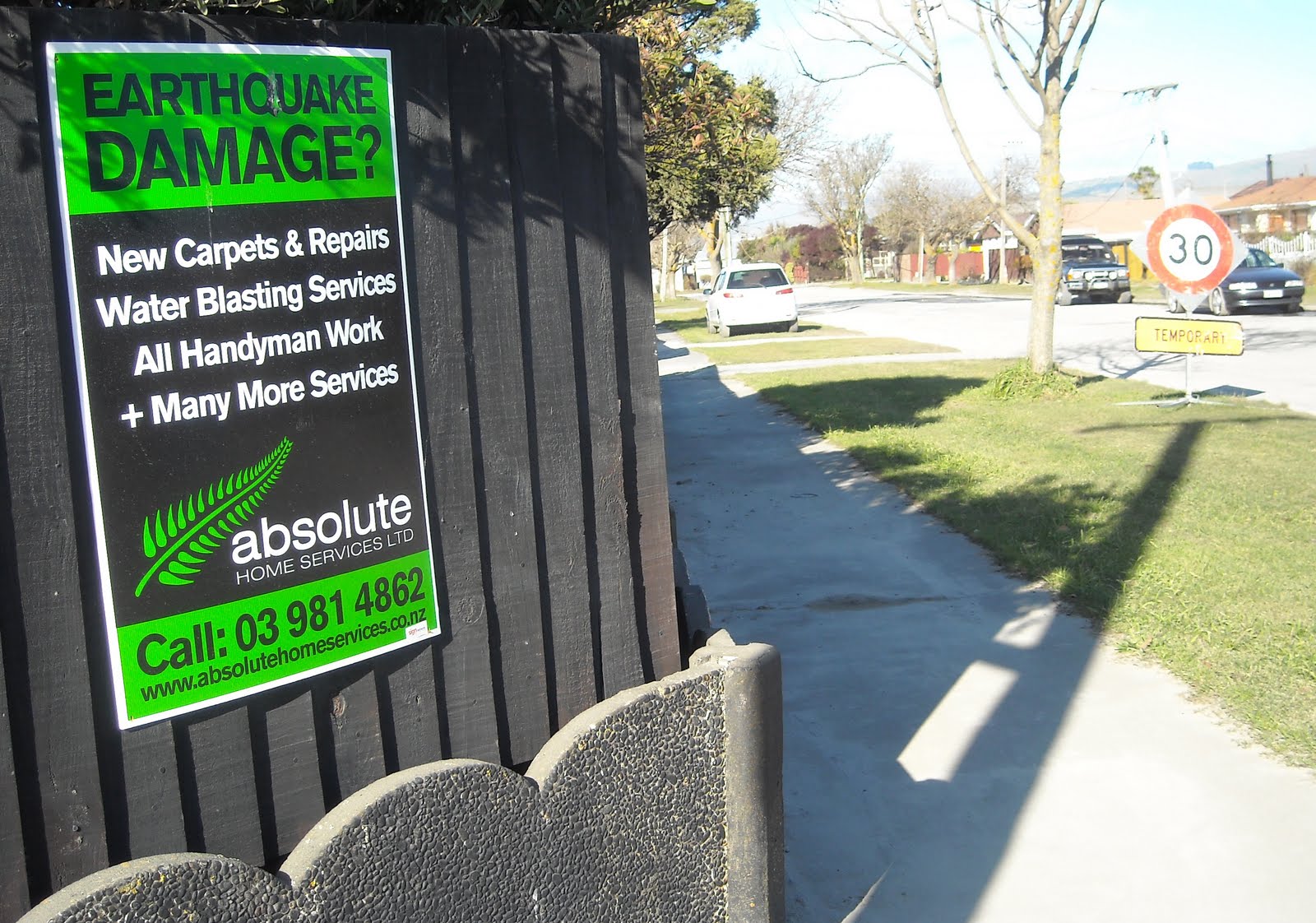
Pages Rd: a fence-sign:
EARTHQUAKE
DAMAGE?
New Carpets & Repairs
Water Blasting Services
All Handyman Work
+ Many More Services
absolute
Handyman Services
Call...
Wishful thinking as Bexley was already red-zoned.


17.07.11. Green, plastic, sewage tank, liquefactioned, red zone, Pages Rd, Bexley. Houses in the pic were red zoned & would be demolished by CERA
Across Pages Rd, I trekked Waitaki St past more ruined-houses to Harold Henry Park. AT HOME signs on some house walls & fences tried to deter thieves. All Waitaki St houses were red-zoned & would be demolished by CERA.

17.07.11. Quake damage, Waitaki St, Bexley, post June 13 quake. The red zone houses would be demolished by CERA


17.07.11. Orange, plastic, road cone cordon, blue portaloos, orange, sewage pump on liquefactioned Waitaki St. All houses in the pic were red zoned & would be demolished by CERA


Drove back to Burnside via Anzac Dr. Both sides of Anzac Dr subsidence, digital road signs: EARTHQUAKE DAMAGE.

Christchurch's post-quake housing-market, a Harcourts flyer:
"The main problem Purchasers face is trying to organise insurance. This is mainly resolved by the Purchasers insuring with the same insurance Company which currently insures the property on behalf of the Vendors. However, in many instances even though an insurance Company is going to continue with the cover they still require Engineers and / or building reports prior to granting insurance to the Purchaser.
Another main issue is how Vendors and Purchasers deal with EQC claims. If between the date of the agreement and the date of the settlement the Vendor receives a pay out from EQC then the Vendor should account to the Purchaser for the amount received. On occasions the Vendors have actually used the money to carry out repairs. If a claim has not been settled then the Vendors and Purchasers enter into a Deed of Assignment and Notice of Assignment which effectively transfers the claim to the Purchasers and from that point onwards the Purchasers will deal with EQC with regard to the settlement of the claim..."
Slow EQC again, which had 60 years' taxpayer-funded practise to get it right when the big quake came. Insurers got premiums from policy-holders, but delayed payments to property-owners post-quakes. Insurers' excuse for delays was that EQC caused delays & insurers couldn't do anything until EQC decided on undercap $100 000 repairs, or overcap $100 000 repairs, or rebuild, to be dealt with by insurers. When it was time to rebuild, home-owners & business-owners found premiums had risen astronomically, making it difficult to rebuild.
There would be problems for home-owners regarding EQC's & Fletcher's undercap $100 000, shoddy-repairs & repair / rebuild complications with damaged houses sold post-quakes, as hinted at by the above Harcourts flyer.
Christchurch Mail 20.07.11 reported about Stanmore Rd, Sun Ning takeaways owner battling to reinsure a rebuild after the shop was demolished. Post 4 September 2010 Quake, Leah had watched demolition of Sun Ning, an old brick-ruin, from her London St school.
After 10 months of quakes, there was whinging from insurers & reinsurers about Canterbury being risky. Therefore premiums for new & old buildings had to rise to refill insurers' coffers!
CERA minister Brownlee did a tour of red-zone-cordoned CBD-ruins with London Lloyd's boss Peter Levene, who whined about "syndicate markets... market forces... exposures... risks..." while Christchurch business-owners battled to access their CBD-cordoned-ruins. (The Star 20.07.11). Seven years later, June 2018, I would have an email exchange with a High St building-owner, a lawyer who still battled Lloyds for his insurance- payout.
How profitably did insurers & reinsurers invest premiums during all those good years?
Then there were lending-leeches & legal-leeches.
Tue 19.07.11. I returned to Bexley for another look at sewaged Avon River & its post-quake raised-stopbanks. By post-quake sewer-repairs on Pages Rd, I detoured along post-quake patched Rowan Ave, along patched Bexley roads to patched Porchester St, back to patched Pages Rd by Bexley Reserve.

19.07.11. Liquefaction sludge on road brushed Bexley Rd, Bexley, post June 13 quake. All houses in the pic were red zoned & would be demolished by CERA


Bexley Rd: A front-end-loader scooped mud onto roadside-piles. A tractor hauled a circular road-brush spreading quakemire along Bexley Rd & Waitaki St.

19.07.11 Quake damaged house, Waitaki St, Bexley, post June 13 quake. The red zone house would be demolished by CERA


19.07.11. Raised stopbank view, Avon River down stream level & Waitaki St level, by John Hinton VC Reserve, Bexley, post June 13 quake. White, porous, plastic bags with dry mix concrete by bldg, ready for flooding
John Hinton VC Reserve: Deja vu. I again stood on top of the raised-stopbank. Like at Wairoa St, I saw Avon River water-level was above Bexley Rd & Waitaki St levels. No wonder liquefactioned-roads flooded during quakes. White, porous, plastic- bags stood by with dry-mix concrete, ready for flooding.

19.07.11. Liquefaction flooding, Waitaki St / Mitcham Pl, Bexley, post June 13 quake. The red zone houses would be demolished by CERA


19.07.11. Liquefactioned end of Mitcham Pl, Avon River bank, Bexley, post June 13 quake. The red zone houses would be demolished by CERA


19.07.11. Liquefactioned Mitcham Reserve, Mitcham Pl, Avon River bank, Bexley, post June 13 quake


19.07.11. Post quake, raised stopbank, Avon River bank, Mitcham Pl, Bexley, post June 13 quake. Red zone houses both sides of Avon River would be demolished by CERA

Off Waitaki St: I drove along no-exit Mitcham Pl to Sopley Ln & Fordingbridge Ln, all quakemired. At the end of Mitcham Pl, I looked at Avon River raised-stopbank atop old reinforcing gabion-baskets. Riverbank-houses were too close to Avon River by the raised-stopbank. No wonder roads liquefactioned during quakes. All houses in Mitcham Pl & lanes close to Avon River would be red- zoned & demolished by CERA.

19.07.11. Post quake, raised stopbank, Avon River bank, Wairoa St, Bexley, post June 13 quake. Houses in the pic were red zoned & would be demolished by CERA


19.07.11. Quake damaged houses, Wairoa St, Bexley, below Avon River level, post June 13 quake. All houses in the pic were red zoned & would be demolished by CERA


19.07.11. Raised stopbank on concrete wall, Wairoa St, by Avon River, post June 13 quake


19.07.11. Housing on Avon River bank, by raised stopbank, near Wairoa St, Bexley, post June 13 quake. The house was red zoned & would be demolished by CERA


From Wairoa St I trekked Avon River raised-stopbank, above ruined-houses which were below river-level, towards Bexley Wetland. I viewed the backs of houses along the stopbank. I viewed Owles Tce raised-stopbank on the opposite riverbank. Waterfowl still inhabited riversides despite post-quake earthworks.

19.07.11. Quake damaged Avon River bank housing, by raised stopbank, nr Wairoa St, Bexley, post June 13 quake. The houses were red zoned & would be demolished by CERA


19.07.11. Wairoa St, raised stopbank view, Owles Tce, on opp Avon River bank, post June 13 quake


Pre-quakes, those who'd planned, built & bought houses at Bexley swampland were crazy. Geologists, seismologists, councillors, planners, surveyors, architects, engineers, builders, developers were aware of swamps on which Christchurch was built:
"Geology of the Christchurch Urban Area," LJ Brown, JH Weeber, Institute of Geological & Nuclear Sciences Ltd, 1992, gave an overview of Christchurch geology, suburbia, groundwater & quake-hazards. There was no excuse for inferior housing at Bexley, as early settlers had already described swampland on which Christchurch was built.

19.07.11. Raised stopbank & housing, Avon River, near Wairoa St, post June 13 quake. Houses in the pic were red zoned & would be demolished by CERA


19.07.11. Quake damaged house, Wairoa St, Bexley, nr Avon River bank, post June 13 quake. The house was red zoned & would be demolished by CERA

19.07.11. Orange, plastic, road cone cordon. Yellow sewage pump by Avon River stopbank, Wairoa St, Bexley, post June 13 quake. All housing in the pic was red zoned & would be demolished by CERA

19.07.11. Raised stopbank view, Pages Rd Bridge, Avon River, post June 13 quake
What saved Seabreeze Cl, Wairoa St, Bexley Rd, Waitaki St, Pages Rd & other red-zoned streets was EQC, insurers & NZ National government's red-zone buy-out scheme. Pity those without insurance, as NZ National government required red-zoned home-owners to cede their home-insurances to CERA / NZ National government when dealing with CERA offers to buy-out red-zoned homes. Thus NZ National government land-grabbed properties it expediently red-zoned & negotiated with insurers regarding the ceded-policies. Disaster Capitalism!

19.07.11. Avon River, raised stopbank view, quake damaged house, Wairoa St, Bexley, post June 13 quake. The house was red zoned & would be demolished by CERA


*Trekked Seabreeze Cl, Bexley Rd, Bexley Wetland, Wairoa St, Pages Rd, Waitaki St. 233 snaps.
Coda:
Friday 25.10.13: By October 2013, many of the red-zone houses I'd snapped in Bexley were demolished by CERA: along Wairoa St, Seabreeze Cl, Waitaki St, Bexley Rd, Pages Rd & side-streets. Some demolition sites along Waitaki St were already reverting to Avon River swampland, scummy pools & river reeds. But there were still many ruined-houses in Bexley to be demolished by CERA. The Press 25.10.13 reported that CERA had demolished only 38% of red-zone housing so far. i.e. By September CERA had demolished 3 012 houses out of a total of 7 839 red-zone houses.
Bexley demolition-sites were a mess: overgrown-gardens, household-rubbish & construction-rubbish was dumped on some sites & a fence- cordoned construction-site at John Hinton VC Reserve. A black-plastic-sewage-pipe, about 1m diameter, ran along the side of Bexley Rd from John Hinton VC Reserve to Pages Rd. Pages Rd ruined shopping-centre was fence-cordoned with green shade-cloth. That summed up CERA's "recovery" for red-zone Bexley: dusty demolition-sites, ruined-housing, a sewage-pipe fronted by a torn shade-cloth fluttering in the northwest breeze.
Bexley "recovery" was a misnomer. More than five years post 4 September 2010 Quake, the sooner Council, CERA & EQC decided what to do with Bexley's red-zone, riverside demolition-sites on Avon River swampland the better.
Pages Rd shops by Pages Rd Bridge would be demolished.
The Weekend Press 21-22 February 2015 reported that EQC horizontally injected concrete underground into two Wairoa St, red-zone demolition- properties & two Avondale red-zone demolition-properties, then tried imitating quakes with a truck trundling by, or little explosions to see if the concrete survived. That was EQC's remediation solution for red-zone land, so underground, horizontally injected concrete could support old / new house foundations on red-zone land!
Problem: EQC had to pay out for damaged, liquefactioned red-zone land, even if the house on top was unscathed by quakes. Dafter still: CERA, a NZ National government department would red-zone the land, then EQC another NZ National government agency would pay home-owners or business-owners for their liquefactioned red-zone land!
Given the strength of quakes, any concrete injected underground on liquefactioned-land would be snapped like spaghetti in future quakes! Never mind quakes snapping concrete-curbs, or cracking infrastructure like underground concrete-pipes, concrete-drains, concrete-bridge-abutments, or concrete-piers, causing billions of bucks damage, which SCIRT would spend years fixing.
Post-quakes, some repair-companies would inject concrete underground into cracks & voids to stop buildings or walls sinking further into quakemired-ground.
Content & pics Copyright Mark JS Esslemont.
See Land settlements put EQC between a rock and a hard place (The Press / Stuff Co).
See NZ Govt's Building Code Compliance, Canterbury Rebuild, Below Floor Work.
No comments:
Post a Comment