My pleasant, pre-quake walks were now horrible, post-quake treks past liquefactioned ruins, often fence-cordoned, entry forbidden. Given all the riverside, CONTAMINATED WATER threat-signs, Christchurch's river water was polluted by leaked sewage.
I trekked downriver along Avonside Dr from Swanns Rd Bridge, near Avonside Girls High ruin, to Gayhurst Rd Bridge, then returned upriver on the opposite bank along Dallington Tce & River Rd. Avonside GH was so damaged by the 22 February 2011 quake, students & staff shared Burnside High School facilities: two school shifts, near our home. Traffic congestion increased on Greers Rd, Grahams Rd & Memorial Ave during school times.
As the 4 September 2010 quake damaged riverside & swamp suburbs, I'd already seen damage by Avon River & Heathcote River. The 22 February 2011 quake made previous riverside & swamp damages worse. It confirmed wherever there was water, like rivers, streams, estuaries, swamps, underground rainwater, streams, springs, there was quake-damage.
The latest quakes weren't the first to damage Christchurch. Victorian settlers experienced quakes too. As they'd build Christchurch on a swamp, beside Avon River & Heathcote River, it was inevitable future quakes would cause damage too.
Christchurch-CBD, riverside damages I'd aleady seen: Fitzgerald Ave where the northbound road collapsed by Avon Loop; Oxford Tce, off Kilmore St, where river-banks slumped & liquefaction & shaking damaged houses in Avon Loop; Many CBD ruins & roads in National State-of-Emergency zones 1, 2, 3, 4 & in the CBD red-zone. Saturated underground water around Avon River bends, horseshoes, loops & swamps, was forced above ground by quakes with destructive quakemire.
Although many riverside ruined-houses were Council red-stickered, some desperate people still lived in their housing, two months post 22 February 2011 quake & months before CERA red-zoned their residential land.
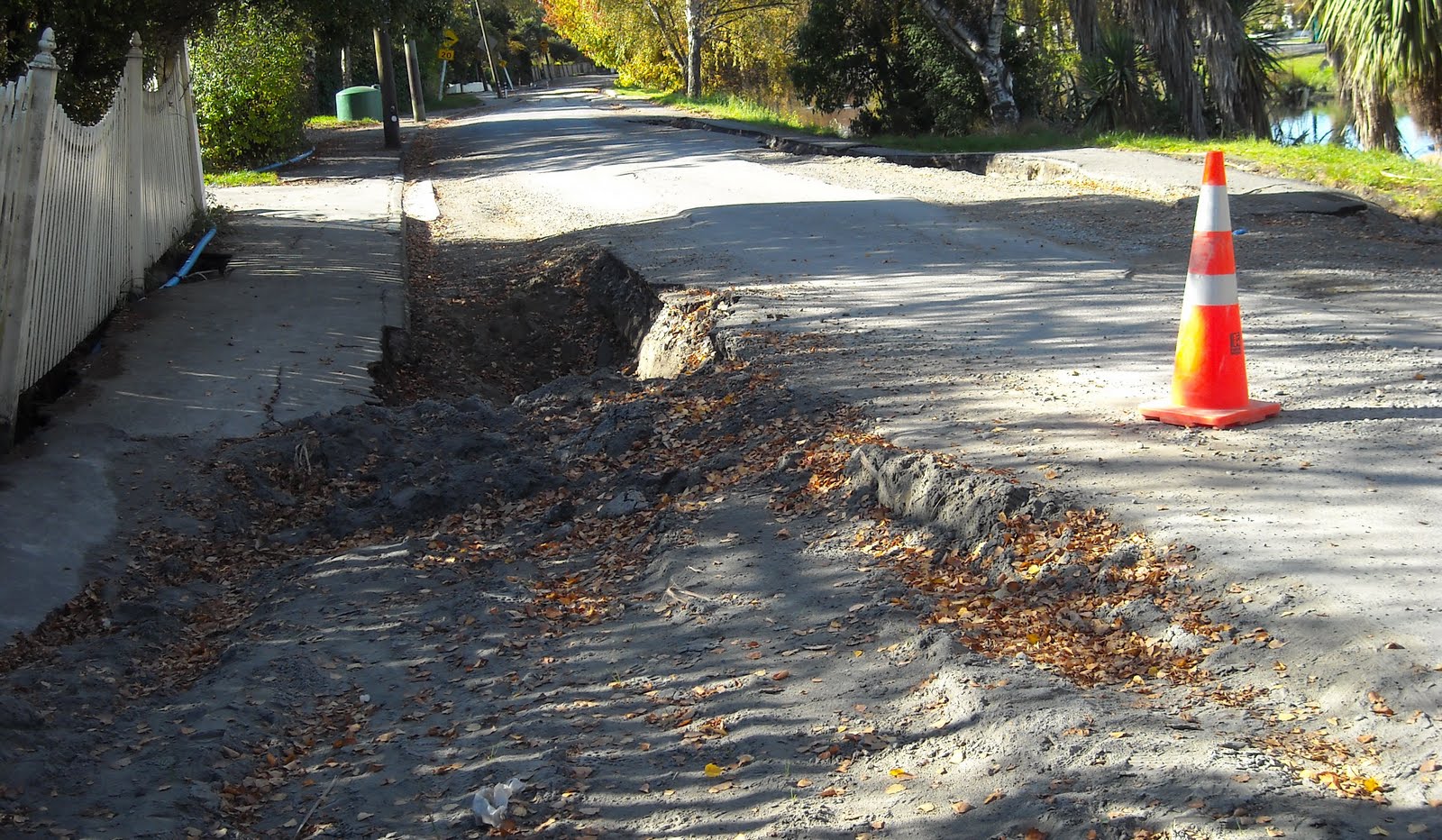
Avonside Dr / Woodham Rd / Linwood Ave crossing: Repairs in progress to the liquefactioned & burst water-pipe & drain damaged crossing. Shingle repairs, no tarseal yet.

28.04.11. Sept 4 & Feb 22 quakes, partly repaired Avonside Dr / Woodham Rd / Linwood Ave crossing, national state of emergency
Avonside Dr: Avonside Girls High School ruin: closed, brick-wall fallen on excavated footpath. Sewage stinking water leaked across Avonside Dr to Avon River. CONTAMINATED WATER threat-signs all along both Avon River banks. Cracked road.

28.04.11. Orange, plastic tape, steel / plastic mesh fence cordon. Excavation & quake felled wall, Avonside Girls High, Avonside Dr, national state of emergency

28.04.11. Feb 22 quake cracked Avonside Dr by Avonside Girls High, national state of emergency. Cracks due to lateral spreading

28.04.11. CONTAMINATED WATER. Sewage polluted Avon River, Avonside Dr, national state of emergency
River Rd on opposite bank: An Environment Canterbury car was parked, a person took a sewage polluted, water-sample from the river. An orange digger was parked on River Rd by Avon River bank.

28.04.11. Environment Canterbury person collecting sewage polluted, Avon River water samples, River Rd, opp Avonside Girls High, national state of emergency

28.04.11. CONTAMINATED WATER. Avonside Dr view, yellow digger on River Rd, national state of emergency
CONTAMINATED WATER. Red tree-feller machines: truck, chipper, log-grab & yellow-crane on River Rd bank. Fellers had morning tea on the riverbank while feeding bread to ducks.

28.04.11. CONTAMINATED WATER. Avonside Dr view, red tree feller machines & yellow crane on River Rd, national state of emergency


28.04.11. Feb 22 quake cracked roadside, Avonside Dr, nr Swanns Rd Bridge, national state of emergency. Cracks due to lateral spreading
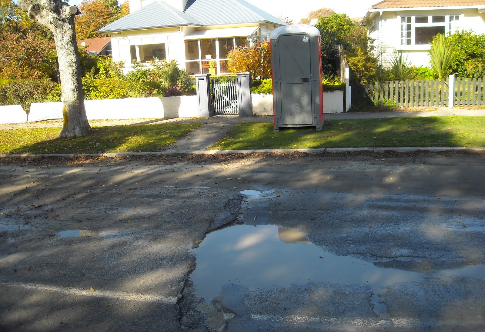
Swanns Rd Bridge / Colishaw St: Cracks at road-joins. Several ruined-houses both sides of Avon River. Example: Fallen brick side-wall, blue-tarped brick-rubble in garden. Blue-plastic water-pipe & raised concrete-manhole on footpath. Tilted concrete power-pole. Portaloos on roadsides by ruined-houses, all along both river-banks. Thousands of portaloos all over Christchurch. Sewage-system: crap. Orange-plastic-road cones drowned in Avon River near a concrete storm-water-pipe.

28.04.11. Quake damaged houses, Avonside Dr, nr Swanns Rd Bridge, national state of emergency


28.04.11. Swanns Rd Bridge view, orange, plastic, road cones in Avon River, national state of emergency
Avonside Dr / Retreat Rd fork: Blue-portaloo on footpath. Buckled, cracked road. More 22 February 2011 quake damage since the 4 September 2010 quake. Shingle road-works. Council blue & white, Residents Only threat-sign on steel-mesh-fence-cordon was there since the 4 September 2010 quake. Broken storm-water-drain, big sinkhole in road, orange-plastic-road-coned, steel-mesh-fence-cordoned. CONTAMINATED WATER threat-sign. Green-plastic-sewage-tank on opposite River Rd bank.

28.04.11. Sept 4 & Feb 22 quake damaged Avonside Dr / Retreat Rd fork, with blue portaloo & residents only sign, national state of emergency


28.04.11. Orange, plastic, road cones, steel mesh fence cordon. Feb 22 quake damaged drain & portaloo, Avonside Dr, national state of emergency

28.04.11. CONTAMINATED WATER. Avonside Dr view, sewage polluted Avon River & green, plastic, sewage tank on River Rd, national state of emergency
Avonside Dr / Monkton Pl: Blue-portaloo on footpath. Broken-manhole raised above road. Thousands of concrete-drain-manholes were raised all over Christchurch. Road-slumping all along Avonside Dr. Six inches to one foot deep slumping to Bracken St junction, slumping due to Avon River bank lateral-spreading.

28.04.11. Feb 22 quake, blue portaloo, Avonside Dr / Monkton Pl, national state of emergency

28.04.11. Feb 22 quake raised, part repaired, manhole, Avonside Dr, national state of emergency

28.04.11. Feb 22 quake cracked, slumped Avonside Dr, national state of emergency

Avonside Dr / Bracken St junction: Blue-portaloo on footpath. Quakemire. Broken-curb.

28.04.11. Feb 22 quake, blue portaloo, Avonside Dr / Bracken St, national state of emergency

22.04.11. Feb 22 quake damaged curb, Avonside Dr / Bracken St, national state of emergency
Avonside Dr: Riverbank slumping, due to lateral-spreading, one metre deep in places by Avon River bend. Ruined-houses on river-bend. Blue-portaloo in garden. Broken concrete-drain waterside.

28.04.11. CONTAMINATED WATER. Avonside Dr view, Feb 22 quake, sewage polluted Avon River & opp bank River Rd, national state of emergency

28.04.11. Orange, plastic, road cone cordon. Feb 22 quake slumped Avon River bank, Avonside Dr, national state of emergency


28.04.11. Old man, green, plastic, sewage tank, quake tilted house, Avonside Dr, national state of emergency
Avonside Dr / Morris St crossing: Blue-portaloo on footpath. Riverbank slumping, about one metre, due to lateral-spreading. Road shingle repairs. Roadside CONTAMINATED WATER threat-sign. RECOVERING AFTER THE EARTHQUAKE sign.

28.04.11. Quake damaged house, Avonside Dr, national state of emergency


28.04.11. Feb 22 quake, Avon River bank slumping due to lateral spreading, Avonside Dr, nr Morris St, national state of emergency

28.04.11. CONTAMINATED WATER. Feb 22 quake, Health Warning threat sign, Avonside Dr, national state of emergency
Avonside Dr, Avon Riverbank, Council sign, CHRISTCHURCH EARTHQUAKE RESPONSE information, headings:
CHRISTCHURCH
EARTHQUAKE RESPONSE
RECOVERY AFTER THE EARTHQUAKE
PUBLIC HEALTH...
WELFARE CENTRES...
SUPPORT AND COUNSELLING SERVICES...
EMERGENCY FINANCIAL SUPPORT...
ACCOMMODATION...
FUEL / TRANSPORT / ROADS...
WATER...
TOILETS...
RUBBISH...
YOUR PROPERTY...
SCHOOLS...
MISSING PERSON INFORMATION...
HOME REPAIRS...
ANIMALS...
LOOK AFTER YOUR HEALTH, YOUR FAMILY
FRIENDS AND NEIGHBOURS.
STAY INFORMED AS BEST YOU CAN.
ASK FOR HELP.
Council signs were erected to help citizens long before CERA's top / down interference & red-zoning Avon River banks' ruined-housing.

28.04.11. Feb 22 quake, Recovering after the Earthquake sign, Avonside Dr, national state of emergency
Avonside Dr / Robson Ave junction: Blue-portaloo on footpath. Canada Geese riverside. A recent mini-stopbank beside Avonside Dr, repaired road & riverbank slumping. The stopbank continued beside Avon River till Bowie Pl. I trekked the rough shingle on top, part of the way, as riverside footpath tarseal was deeply cracked, buckled & crumpled. Better view too. Little traffic on Avonside Dr, cordoned with orange-plastic-road-cones. More pedestrians & joggers.

28.04.11. Feb 22 quake damaged Avonside Dr / Robson Ave junction & blue portaloo, national state of emergency

28.04.11. Feb 22 quake cracked Avon River bank & a view of River Rd, opp bank, national state of emergency

28.04.11. Orange, plastic, road cone cordon. Feb 22 quake, Avon River stopbank, Avonside Dr, national state of emergency
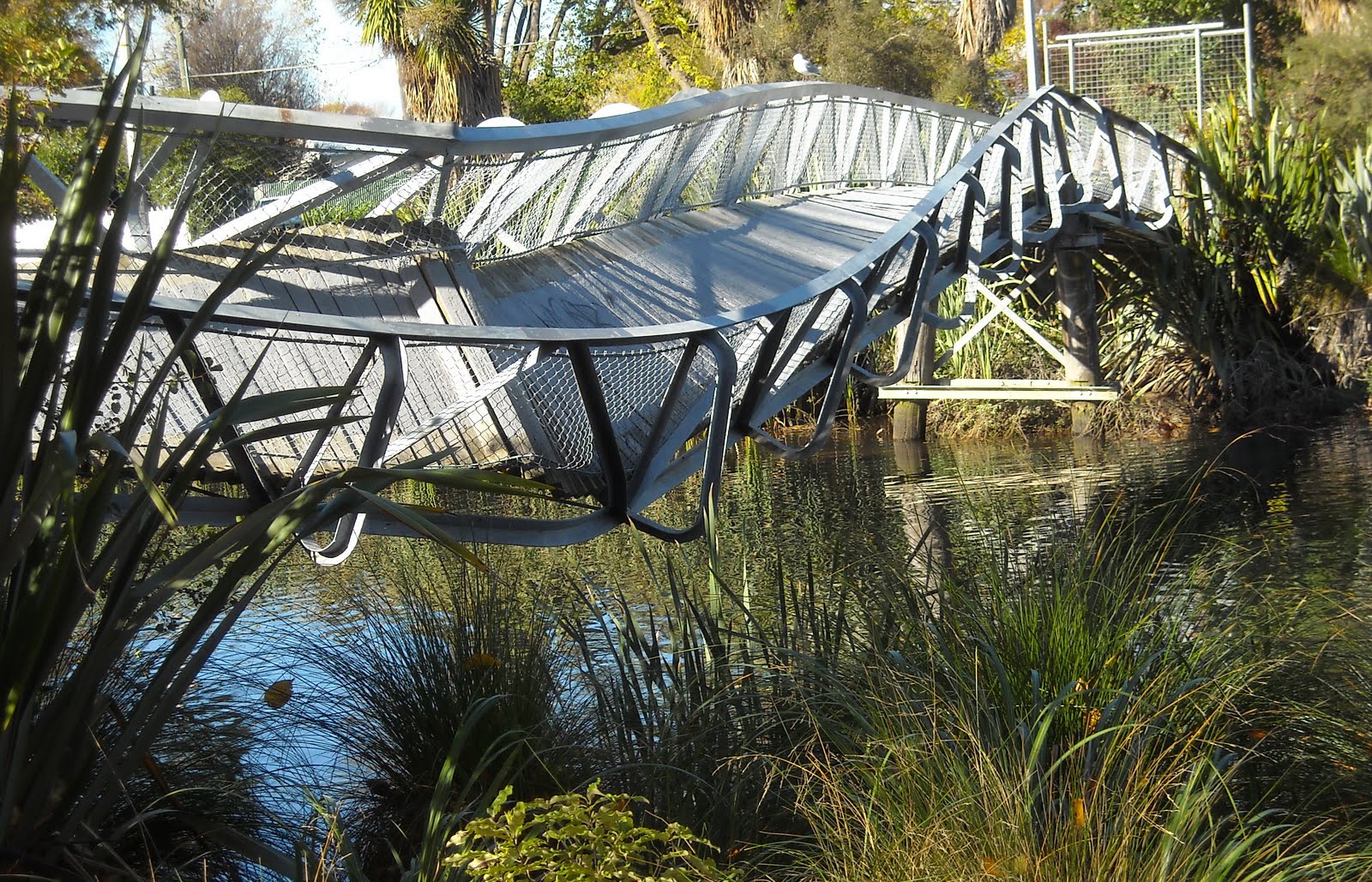
Avonside Dr: I passed twisted-steel Medway St Footbridge ruin over the Avon, 4 September 2010 quake-twisted, 22 February 2011 worsened. The twisted-steel bridge-side hung off a bridge-pier. The bridge-ruin was concrete-block-cordoned & steel-mesh-fence-cordoned on the riverbank.

28.04.11. Sept 4 & Feb 22 quake destroyed, Medway St Footbridge over Avon River, between Avonside Dr & River Rd, national state of emergency


28.04.11. Feb 22 quake damaged housing, Avonside Dr, national state of emergency


28.04.11. Orange, plastic, road cone cordon. Feb 22 quake damaged Avonside Dr & orange & red portaloos. Avon River stopbank left, national state of emergency

28.04.11. Orange, plastic, road cone cordon. Feb 22 quake damaged Avonside Dr & Avon River stopbank, national state of emergency
Avonside Dr: Cracked-road, puddled, grey-quakemire. Broken mid-white-line on road was shifted different directions by quakes. I passed more red-stickered ruined-houses: long grass in gardens, garden-walls cracked, broken fences, house-doors boarded. Orange-portaloos & red-portaloos & a green-plastic-sewage-tank on footpath.

28.04.11. Feb 22 quake damaged Avonside Dr, house & orange portaloo, national state of emergency
Avonside Dr / Galbraith Ave junction: Damaged-curb, shingle road-repairs. Fulton Hogan road-sweeper-truck passed. Coner house-ruin: fallen chimney, yellow-tarped roof, overgrown garden, green-plastic-sewage-tank on footpath.

28.04.11. Sweeper truck, Feb 22 quake damaged Avonside Dr / Galbraith Ave, national state of emergency

28.04.11. Feb 22 quake damaged house, Avonside Dr, national state of emergency


28.04.11. Feb 22 quake, green, plastic, sewage tank by quake damaged house, national state of emergency
Avonside Dr: Bend in Avon River. Opposite bank, orange-water-pump on Dallington Tce, steel-mesh-fence-cordoned, was pumping since the 4 September 2010 quake. Tilted concrete-drain on riverbank, steel-mesh-fence-cordoned.

28.04.11. Avon River stopbank view, Feb 22 quake cracked riverbank & footpath, national state of emergency. River Rd / Dallington Tce beyond

28.04.11. Orange, plastic, road cone cordon. Feb 22 quake, Avon River stopbank & quake damaged Avonside Dr, national state of emergency


28.04.11. Feb 22 quake, Avonside Dr view, Avon River bend & River Rd / Dallington Tce, national state of emergency

28.04.11. Avonside Dr view, Sept 4 & Feb 22 quake, orange pump by Avon River, Dallington Tce, national state of emergency

28.04.11. Steel mesh fence cordon. Feb 22 quake damaged manhole, Avon River bend, Avonside Dr, national state of emergency


28.04.11. Feb 22 quake tilted, 2 storey house, Avonside Dr, national state of emergency


28.04.11. Feb 22 quake cracked, Avon River footpath, Avonside Dr, national state of emergency. Cracks due to river bank lateral spreading


28.04.11. Avon River stopbank view, Feb 22 quake damaged house, Avonside Dr, national state of emergency


Avonside Dr: More red-stickered, ruined-houses by the stopbank, some tilted at odd angles. I had to look closely to see tilting, warping & bending of houses. Damage examples: Two-storey house, fallen brick porchwall, boarded front-door, window plastic-taped, white-plastic-barrier-tape cordoned. One-storey house: fallen chimney, brick-rubble on roof, boarded glass-window, yellow-stickered & red-stickered front-door! Neighbouring wooden garden-fence & brick garden-wall, red spray-painted, Response Team graffitied:
RT 10 RT 10
C 25/2 NC
25/2
Avonside Dr / Robson Ave junction: Red-portaloo by concrete-block-supported power-pole. Riverside, three inspectors wearing orange, Hi-Vis vests toted clipboards by the cracked & buckled tarseal footpath.

28.04.11. Feb 22 quake, Avon River stopbank view, red portaloo & concrete block supported power pole, Avonside Dr / Robson Ave, national state of emergency


28.04.11. Orange, Hi-Vis vested engineers, Feb 22 quake damaged footpath by Avon River, Avonside Dr, national state of emergency


28.04.11. Feb 22 quake, Avon River stopbank & steel mesh fence cordon, Avonside Dr / Robson Ave, national state of emergency
Avonside Dr: Big concrete-drain ruin, 4 September 2010 quake tilted, 22 February 2011 quake shifted about one metre above ground. The concrete-drain ruin would be demolished. Ruined-houses nearby. Orange-pump in middle of the road, orange-plastic-road-coned, steel-mesh-fence- cordoned.

28.04.11. Quake tilted, 2 storey house, quake damaged Avonside Dr, national state of emergency

28.04.11. Orange, plastic, road cones, steel mesh fence cordon. Sept 4 & Feb 22 quake, orange pump in middle of Avonside Dr, national state of emergency


28.04.11. Sept 4 quake tilted, concrete drain, Avonside Dr, national state of emergency

Avonside Dr / Morris St junction: Red-portaloo on footpath. Steel-mesh-fence-cordoned drain in middle of Avonside Dr. A red-plastic- sewage-pipe pumped sludge into a drain. It was like that since the 4 September 2010 quake. Sewage-stink by pipes. Council would take years to repair the broken sewage-system. More red-stickered house-ruins: cracked, buckled concrete-driveways, broken garden-walls, overgrown-gardens.

28.04.11. Sept 4, Feb 22 quake damaged road & house, Avonside Dr, national state of emergency


28.04.11. Sept 4, Feb 22 quakes, red portaloo, green, plastic, sewage tank, road & sewage damage, Avonside Dr / Morris St junction, national state of emergency
Avonside Dr / Bowie Pl junction: Another tilted roadside / riverside concrete-drain. Sewage-stink! Shingle-heap roadside. Shingle- repairs to road. Creamy, brown pollution trickled into Avon River by a broken storm-water-pipe, ducks swimming by. The stopbank I wlked ended beyond Bowie Pl. A pallet of filled sandbags stood on the opposite footpath. WORKS END sign on sandbags. A female jogger passed.

28.04.11. Orange, plastic, road cone cordon. Feb 22 quake damaged road, drain & stopbank, Avonside Dr, nr Bowie Pl, national state of emergency


28.04.11. Feb 22 quake, broken drain, effluent in Avon River, Avonside Dr, nr Bowie Pl, national state of emergency. Dallington Tce opp bank

28.04.11. WORKS END. Feb 22 quake damaged road, tilted house, sandbags, jogger, Avonside Dr, national state of emergency
Bowie Pl: Ruined: Yellow-stickered, eight blocks of Council's window-boarded ruined-flats, four flats per block, 32 abandoned flats. Heavily liquefactioned by the 4 September 2010 quake, silt-volcanoes everywhere. Still yellow-stickered & abandoned post 22 February 2011 quake. Footprints in grey quakemire. Fallen Royal Gala apples on a silt-volcano by flat 32. I Picked an unblemished apple for lunch. Sour!
Sixteen months post 22 February 2011 quake, at Bowie Pl, Council's ruined-flats would still be yellow-stickered, windows-boarded, closed. Only one concrete-brick zig-zag cracked wall seen. Flats looked inhabitable. A waste!

28.04.11. Sept 4 quake & Feb 22 quake liquefactioned flats, Bowie Pl, national state of emergency


28.04.11. Feb 22 quake, crooked house, Avonside Dr, nr Bowie Pl, national state of emergency


28.04.11. End of Avon River stopbank, Avonside Dr, nr Bowie Pl, national state of emergency
Avonside Dr, near Gayhurst Rd Bridge: Another Avon River bend, more ruined-houses. A group booze-up seen on the riverbank. Poplar & oak autumn leaves on the riverside, cracked footpath to Gayhurst Rd Bridge. An orange, Hi-Vis vested workman installed a new, steel-chimney on an Avonside Dr house. A waste, as CERA would soon red-zone the area.

28.04.11. Feb 22 quake, orange, Hi-Vis vested workman installing new chimney, Avonside Dr, national state of emergency

28.04.11. Feb 22 quake damaged footpath, Avon River, nr Gayhurst Rd Bridge, national state of emergency


28.04.11. CONTAMINATED WATER. Feb 22 quake, Avonside Dr, nr Gayhurst Rd Bridge, national state of emergency
Gloucester St near Gayhurst Rd Bridge: A ruined Fish n Chips shop: Second-storey, fallen exterior wall-panels. Black, spray-painted graffiti on ground-floor, boarded shop-window. Riverside tarseal-footpath was cracked. I saw road-damage near Gloucester St / Gayhurst Rd Bridge abutment-join. I crossed broken Gayhurst Rd Bridge from Avonside Dr to Dallington Tce.

28.04.11. Quake damaged, Fish n Chips shop, Gloucester St, nr Gayhurst Rd Bridge, national state of emergency
Gayhurst Rd Bridge / Dallington Tce: Broken concrete-abutment at road-join: huge concrete-chunks lay near the abutment, skewed steel- handrail on bridge, orange-plastic-road-cone-cordoned. A 30 km/h speed limit sign.

28.04.11. Gayhurst Rd Bridge upriver view, autumn trees by sewage polluted Avon River, national state of emergency

28.04.11. Orange, plastic, road cones, steel mesh fence cordon. Feb 22 quake damaged, Gayhurst Rd Bridge abutment join, Gayhurst Rd / Dallington Tce, national state of emergency


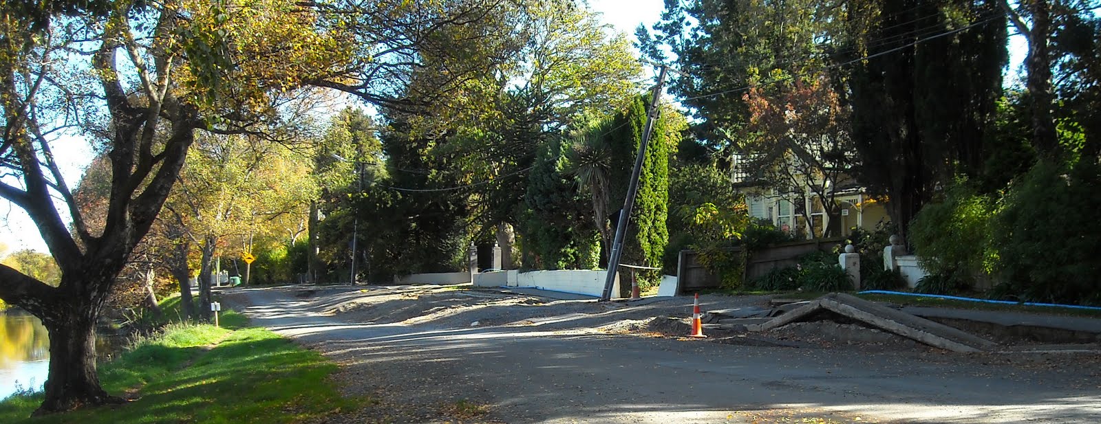
Dallington Tce: 4 September 2010 quake broken, 22 February 2011 quake ruined: Potholed-road, shingle road-repairs. Mini-stopbank at the riverbend, white-plastic-sandbags on part of the stopbank. Ruined-houses, fallen concrete garden-wall, cracked brick garden-wall, cracked tarseal-driveway. One house demolition-site, empty. Blue-portaloo on footpath. Green-plastic-sewage-tank by back-gate of 4 September 2010 ruined St Paul's School.

28.04.11. Feb 22 quake toppled garden wall, Dallington Tce, national state of emergency


28.04.11. Quake damaged driveway, Dallington Tce, national state of emergency

28.04.11. Quake damaged house & house demolition site, Dallington Tce, national state of emergency
Dallington Tce: Three orange, Hi-Vis vested workmen chatted near a yellow-digger at a roadside-excavation & shingle road-works. A blonde female engineer arrived, yellow, Hi-Vis vested. She'd followed me along Avonside Dr in her Council ute, while supervising road- workmen.

28.04.11. Feb 22 quake, green, plastic, sewage tank & blue portaloo, Dallington Tce, national state of emergency

28.04.11. Feb 22 quake, roadside excavation, Dallington Tce, national state of emergency

28.04.11. Sept 4 quake, steel mesh fence cordoned, road excavation & yellow roadside pump, Dallington Tce, national state of emergency


28.04.11. Orange, plastic, road cone cordon. Sept 4 & Feb 22 quake road repairs & blue portaloo, Dallington Tce, national state of emergency
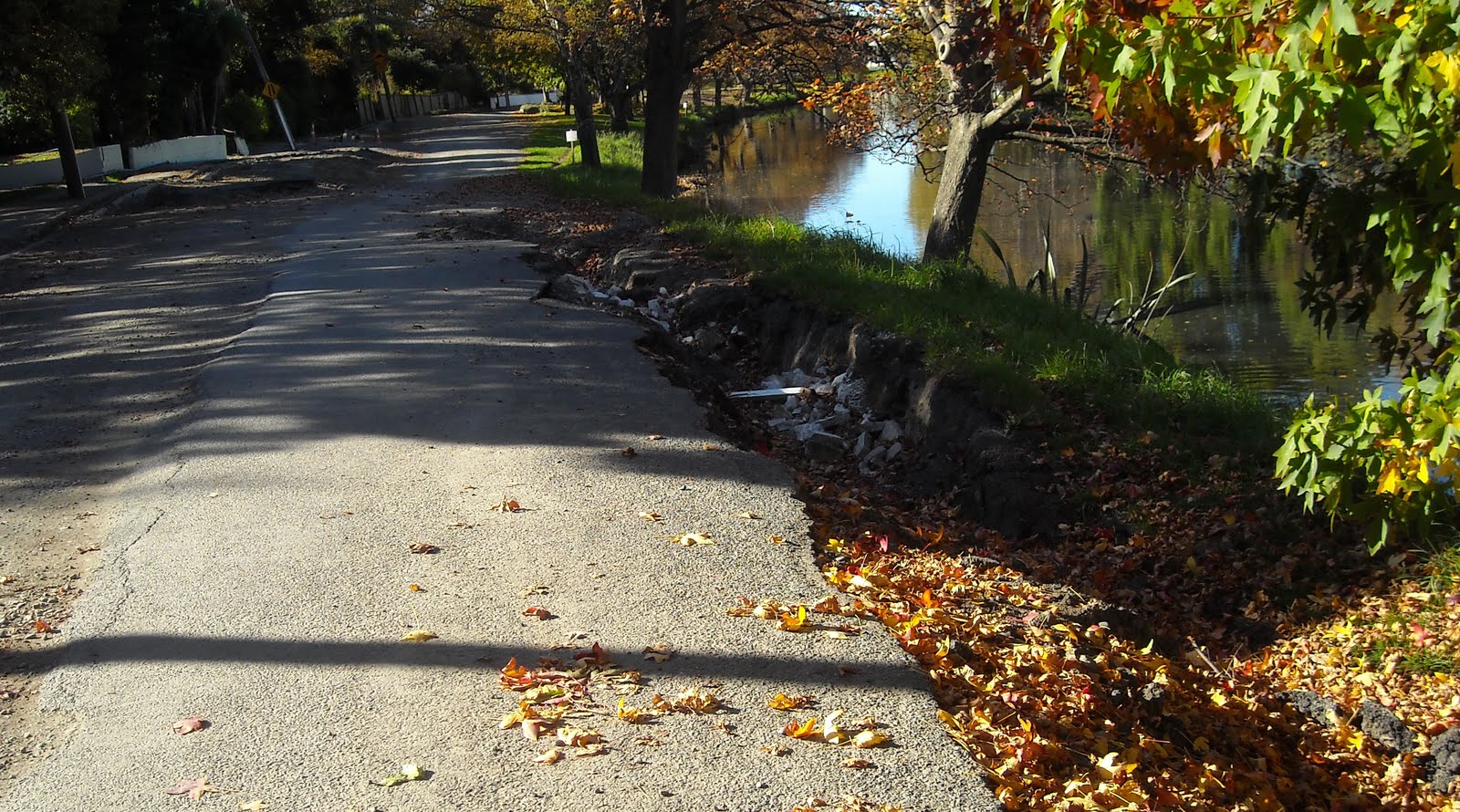
Dallington Tce: Post 4 September 2010 quake & Boxing Day quake: Yellow riverside-pump still pumped sludge into pipes, steel-mesh- fence-cordoned. Quakemired-footpath, autumn-leaves. Riverbend slumping was filled with soil, opposite 4 September 2010 quake tilted, concrete- drain-ruin on Avonside Dr riverbank. Quakemire on the riverbend was there for months since the 4 September 2010 quake. Portaloos & a green-plastic-sewage-tank stood on the footpath.
Later low-lying Dallington Tce near Gayhurst Rd Bridge would be red-zoned by CERA, but higher-ground on Dallington Tce would be green-zoned by CERA. That pattern would repeat along riverbanks: low-lying liquefactioned-land, red-zoned, higher-land, less-liquefactioned, green-zoned by CERA. Low-lying, Avon River banks slumped more in quakes, so most housing near Avon River banks would be red-zoned by CERA, from city to sea.
Thus most Avonside Dr & River Rd ruined-housing & some Dallington Tce ruined-housing would be red- zoned by CERA. There were more riverside roads, like Locksley Ave & New Brighton Rd . Their housing too would be red-zoned by CERA. Closer to the Pacific, by Avon / Heathcote Estuary, there were more roads in Bexley & Southshore due for red-zoning by CERA. I would trek them all. About 7 500 ruined-houses along riverbanks & on the Port Hills would be red-zoned by CERA, due for housing demolitions. A massive land-grab by NZ National government / CERA, taking citizens' land, then dealing with insurers for payouts after red-zoned citizens ceded their insurance policies to the Crown for government payouts.

28.04.11. Dallington Tce view, sewage polluted Avon River & Sept 4 quake damaged, concrete drain on Avonside Dr bank, national state of emergency

28.04.11. Feb 22 quake damaged house, Dallington Tce, national state of emergency

28.04.11. Feb 22 quake, Dallington Tce view, Avonside Dr stopbank & quake damaged, double storey house, national state of emergency

28.04.11. Feb 22 quake, Dallington Tce view, sewage polluted Avon River, quake crooked, concrete drain & Avonside Dr stopbank, national state of emergency
Dallington Tce / River Rd junction at a riverbend: I passed a 4 September 2010 quake, orange-roadside-pump, pumping polluted-water into Avon River. Ubiquitous CONTAMINATED WATER threat-signs were on the riverbank. Gulls stood on the footbridge & concrete storm-water-drain at the riverbend.

28.04.11. CONTAMINATED WATER. Feb 22 quake, footbridge by Avon River bend, Dallington Tce / River Rd, national state of emergency

28.04.11. Feb 22 quake, River Rd view, sewage polluted Avon River bend, national state of emergency. Dallington Tce beyond, Avonside Dr right
River Rd: Ruined-houses: broken, cracked house-walls, cracked garden-walls, cracked driveways, some overgrown-gardens. Blue-portaloos stood on the footpath. A blue-plastic-water-pipe undulated over the cracked, crumpled footpath. Like Avonside Dr, some River Rd mature trees were DANGER red-plastic-barrier-taped, ready for chopping.

28.04.11. Feb 22 quake tilted house, River Rd, national state of emergency


28.04.11. Feb 22 quake, River Rd view, autumn trees by sewage polluted Avon River, national state of emergency

28.04.11. Blue portaloo, Feb 22 quake damaged house, River Rd, national state of emergency


28.04.11. Crooked house, Feb 22 quake damaged, River Rd, national state of emergency

River Rd / Medway St junction: Back at the twisted steel-footbridge over Avon River: A SLOW DOWN! 10 NO RUBBERNECKERS threat-sign was on a corner power-pole above grey-quakemire. Homemade road-signs had sprouted all over Christchurch, citizens warning road-users of dangers, or irritations. I saw riverbank-slumping due to lateral-spreading.

28.04.11. SLOW DOWN! 10 NO RUBBERNECKERS. Feb 22 quake, River Rd / Medway St junction, national state of emergency

28.04.11. Sept 4 & Feb 22 quake destroyed, steel Medway St Footbridge over Avon River, between River Rd & Avonside Dr, national state of emergency. The bridge was later removed for storage at Ferrymead Heritage Park


River Rd / North Avon Rd junction-sign: NO THROUGH
ROUTE ACCESS
TO PROPERTIES
ONLY

28.04.11. Feb 22 quake damaged, semi detached houses, River Rd, national state of emergency


28.04.11. River Rd / North Avon Rd junction, residents only sign, national state of emergency
River Rd / Lois Pl junction: 4 September 2010 quake & 22 February 2011 quake ruined-houses were grey-quakemired. A tilted power- pole loomed. A sewage-tanker pumped sludge in a garden. A riverside, tilted concrete-drain was more damaged by the 22 February 2011 quake: new cracks. I saw a metre-wide, riverbank-crack by the drain. I smelled sewage-stink again by the drain-outlet into Avon River!

28.04.11. Sept 4 & Feb 22 quake damaged, concrete drain, River Rd / Lois Pl junction, national state of emergency

28.04.11. Feb 22 quake tilted power pole & quake damaged house, River Rd / Lois Pl junction, national state of emergency

28.04.11. Feb 22 quake damaged house, River Rd / Lois Pl junction, national state of emergency


River Rd near Swanns Rd Bridge: Huge riverside-slumping, some road-cracks two metres wide. Buckled footpath & buckled concrete-curb. Concrete-curb-arch formed by the 22 February 2011 quake. Orange-plastic-road-cone-cordoned. Several riverside, red-stickered, ruined-houses: cracked garden-walls, tilted gate-posts, tilted concrete-steps before a front-door. Blue-plastic-water-pipe along the footpath. As the quakes destroyed so much underground infrastructure, Council laid blue-plastic-water-pipes along footpaths for inhabitants to get fresh-water. That was done before CERA contaminated Council functioning & red-zoned some residential-areas.

28.04.11. Blue, plastic, water pipe to a Feb 22 quake damaged, 2 storey house, River Rd, national state of emergency

28.04.11. Post Feb 22 quake, blue, plastic, water pipe, River Rd pavement, national state of emergency
28.04.11. Buckled concrete curb, formed by Feb 22 quake, River Rd, national state of emergency


28.04.11. Red stickered, Feb 22 quake damaged house, River Rd, national state of emergency


28.04.11. Feb 22 quake damaged, 2 storey house, River Rd, national state of emergency


28.04.11. Feb 22 quake cracked River Rd & Avon River bank slumping, national state of emergency


28.04.11. Feb 22 quake damaged house, River Rd, nr Swanns Rd Bridge, national state of emergency


After trekking past so many ruined-houses, I was spooked. Pre-quakes, eight months before, riversides were humming with life. In two years time, most of the houses would be gone, red-zoned & demolished by CERA.
Avonside Dr: Workmen felled a poplar on River Rd. One feller up the tree, sawed & slinged branches; a yellow-crane hoisted chained-branches; supervisor on road; workman sawed logs; red-grabber-machine fed branches into a red-chipper; a red wood-chip-truck behind.
Over eight months, after several major quakes & 1 000s of aftershocks, the poplar didn't look dangerous to me. An old man on a sunny bench enjoyed the show too.

28.04.11. Feb 22 quake tilted, power poles & yellow, tree feller crane, River Rd, national state of emergency

28.04.11. Avonside Dr view, poplar fell, River Rd, national state of emergency


01.05.11. The National State of Emergency was lifted. CERA would do Christchurch recovery work. About time, as it was nearly 8 months post 04.09.10 quake & over 2 months post 22.02.11 quake.
*Trekked Avonside Dr, Bowie Pl, Gayhurst Rd Bridge, Dallington Tce, River Rd. 198 snaps.
Coda:
After doing CERA Landcheck searches, I would find all the little roads & housing in the two Avon River horseshoe bends I'd trekked were mostly red-zoned. Bigger roads like Avonside Dr, Retreat Rd, River Rd, Gayhurst Rd, Dallington Tce were a mix of orange-zoning, red-zoning & green-zoning, but still mainly red-zoned.
Thus a mass exodus & mass housing-demolitions in Avon River horseshoe bends would happen. Disturbing was NZ National government's land-grab by CERA's forced-offers for red-zoned riverside land: Accept our offer & go, or your water, sewage, rubbish, electricity & road-services will be cut off! (Google: The Press / Stuff Co April 07 2012: Red Zoners in dire straits - families). The vague threat by CERA boss Sutton to cut off services would later be denied by CERA.
Landcheck website neatly listed all red-zone properties: An open-invitation for looters to help themselves. Later CERA would absorb the Landcheck website into its own website, obstructing thieves. But looting, arson, vagrancy & tagging would continue for CERA-acquired red-zone housing, before final demolitions.
Content & pics Copyright Mark JS Esslemont.
No comments:
Post a Comment