
15.06.11. June 13 quake, green, plastic, sewage tank & liquefaction silt, Richmond Working Mens Club, Cumberland St

15.06.11. June 13 quake: liquefaction of Sept 4 quake demolition site, Stanmore Rd / Avalon St

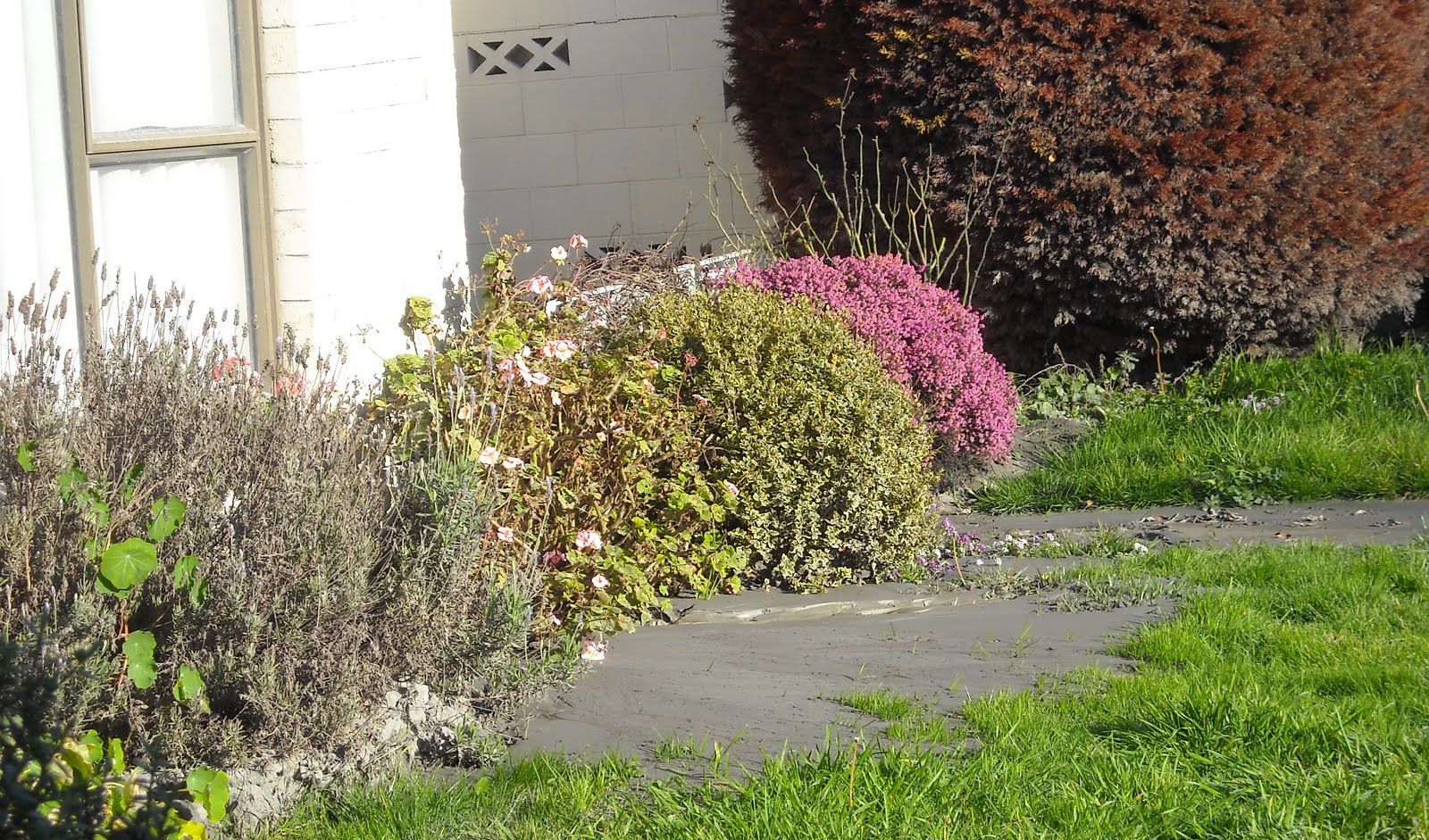
15.06.11. Post June 13 quake: Sept 4 quake damaged brick shop, Stanmore Rd
On our arrival, a team of female staff & parents were shovelling quakemire from the school carpark & playground, into silt-heaps on London St by the front-gate & Pavitt St by the back-gate. Post 22 February 2011 Quake & 13 June 2011 Quake, in four months, it was the second time the school dug itself out of quakemire. As classrooms were already tidied, I left staff & drove up silt- dusty Stanmore Rd.

15.06.11. Steel mesh fence cordon. Sept 4 quake damaged, Feb 22 quake collapsed, June 13 quake trashed Richmond Methodist Church Hall, Stanmore Rd. The church hall would be demolished


Stanmore Rd: Richmond Methodist Church Hall ruin lay collapsed behind a steel-mesh-fence-cordon. Like Richmond Methodist Church, many Christchurch churches needed demolition! e.g. Christ Church Cathedral, Cathedral Sq; St Lukes Anglican Church, Manchester St; St Johns Anglican Church, Latimer Sq; St Pauls, Madras St; Holy Trinity Avonside, Lychgate Cl; Methodist Church, Durham St Nth; St Marys, Church Ln; Chinese Methodist Church, Papanui Rd... They were all brick or stone buildings.
Weeks before the 22 February 2011 Quake, Leah & I'd wandered Christ Church Cathedral. Post 4 September 2010 Quake, inside the cathedral the nave back-wall was scaffolded, while workmen checked the nave back-wall. Workmen checked cathedral windows from outside scaffolding too. A hazardous waste of time & money considering future quakes! Never mind allowing citizens & tourists into the dangerous, greystone cathedral.

15.06.11. Steel mesh fence cordon. June 13 quake: Sept 4 quake demolition site view, Feb 22 & June 13 quake collapsed Richmond Methodist Church Hall, seen from Avalon St. The church hall would be demolished
I snapped Richmond Methodist Church Hall ruin, part-collapsed by the 22 February 2010 Quake, ruined by the 13 June 2011 Quake. That was the destruction pattern of old, brick & stone buildings in Christchurch quakes: damaged by one quake, ruined by the next.
Richmond Working Mens Club sign on a Thai Restaurant wall:
RICHMOND CLUB
& RESTAURANT
NOW OPEN
7 DAYS
Wishful thinking, as Richmond Working Mens Club would be demolished over the next two years. 2021. Richmond Club would be built on-site, 10 years post-quakes.
That warm wintry day, I did a circular-trek in the Horseshoe Lake area seeing damages & clean-ups there near Avon River. I drove along liquefactioned North Avon Rd & North Pde, where workmen laid new tarseal by Shirley Boys High School & Marian College. New quakemire-heaps lay on roadsides of all roads I drove.

15.06.11. June 13 quake, Horseshoe Lake Reserve signs, Broomfield Tce


15.06.11. June 13 quake, liquefaction boils by Horseshoe Lake Reserve, steel mesh fence cordon, Broomfield Tce

15.06.11. June 13 quake, liquefactioned footpath, Broomfield Tce

15.06.11. June 13 quake damaged house, Broomfield Tce


15.06.11. June 13 quake, liquefaction flooded, tilted power pole, Broomfield Tce
Cops, NZDF-soldiers & student-digger-gangs were absent. In past quakes, teams of volunteer student-diggers & volunteer farmer-diggers, lauded by media, shovelled quakemire from properties. Now owners of liquefactioned-homes got on with it sans digger-gangs, some clearing away silt for the third time, after four major quakes in nine months.

15.06.11. June 13 quake damaged house, red zone, Kingsford St

15.06.11. June 13 quake, liquefaction silt haulage truck, red zone, Kingsford St

15.06.11. June 13 quake, orange, sewage pump & sewage sucker tanker, red zone, Kingsford St

That night, TV news said that the Farmy Army would be operating by the end of the week & the Student Volunteer Army would arrive at the end of the next week, after completing exams. By that time citizens would've dug most of the mud themselves. Silt left too long dried like cement. And stank!
Although there was much more mud, volunteer mud-digging was not as glamorous post 22 February 2011 Quake & 13 June Quake as post 4 September 2011 Quake. Fewer photo-ops & the novelty of student labouring had worn off. Shovelling tons of mud, quake after quake, was tedious. As student mud-digging was started by a varsity student, mud-digging was formalized by Canterbury University, making mud-digging part of a university volunteer-course!

15.06.11. June 13 quake, liquefactioned red zone, Kingsford St / Goodman St

15.06.11. June 13 quake, liquefactioned driveway, red zone, Kingsford St


After driving along liquefactioned New Brighton Rd, I parked at Broomfield Tce by Horseshoe Lake Reserve. Reserve threat-signs: CONTAMINATED WATER, PARK AREA CLOSED HAZARDOUS CONDITIONS. I did a circular-trek along liquefactioned-roads in Horseshoe Lake loop: Kingsford St, Alice St, Queensbury St, New Brighton Rd...

15.06.11. June 13 quake damaged house (damaged by previous quakes too), red zone, Kingsford St


All roads I trekked in Horseshoe Lake area were deeply liquefactioned: sticky grey-mud, puddles, sinkholes, slippery-mud on footpaths, mud-boils & mud-volcanoes in gardens & on footpaths. Broken-houses, tilted-houses. Portaloos on footpaths. In two places, I passed fallen power- lines in or close to the mud. A Council sign on a fence:
WATER
ALL WATER MUST BE BOILED
After previous quakes, blue-plastic-water-pipes lined roads & footpaths all over Christchurch, including Horseshoe Lake. Those blue-plastic-water-pipes showed the extent of infrastructure damage to Christchurch roads.

15.06.11. June 13 quake, liquefactioned housing, red zone, Kingsford St


15.06.11. Yellow portaloo. June 13 quake, liquefaction flooding & sewage sucker pipe, red zone, Kingsford St / Liggins St

15.06.11. Orange, plastic, road cone cordon. June 13 quake, green, plastic, sewage tank & liquefaction flooding, red zone, Kingsford St
Kingsford St: 4 September 2010 Quake damaged houses I'd seen before the 22 February 2011 Quake were still damaged, tarped, wood- braced, boarded, some more damaged power-poles leaning. I saw only one house demolition-site near the end of Kingsford St.

15.06.11. June 13 quake, red zone, blue portaloo & liquefactioned Kingsford St / Tasman Pl


15.06.11. Orange, plastic, road cone cordon. June 13 quake, liquefactioned pavement & road flooding, red zone, Kingsford St. Brown puddle due to sewage leaks


15.06.11. June 13 quake, liquefaction mud digger, red zone, Kingsford St

Quakemire clean-ups: families, old couples, children off school until their closed-schools were deemed safe. Spade & barrow-work was done along all roads I trekked, home-owners shovelling grey-quakemire onto roadside-heaps.

15.06.11. June 13 quake damaged & liquefactioned house, red zone, Kingsford St


15.06.11. Blue, plastic, water pipe, blue portaloo, red zone, Kingsford St


Kingsford St: A red-pump pumping sewage I'd seen before the 22 February 2011 Quake still pumped sewage. A sewage-sucker-truck was parked by the pump in the middle of the road. All streets had portaloos on footpaths.

15.06.11. June 13 quake damaged, liquefactioned housing, red zone, Kingsford St


15.06.11. June 13 quake, orange, plastic, road cones cordoning a liquefaction sinkhole, red zone, Kingsford St

Quakemire needed to be to removed asap, as sewage-pipes were broken. What sewage-bugs, E coli, gastroenteritis, typhoid, cholera, were floating around? Most mud was iron-grey, some mud was brown with crappy-scum. Stinking! Blue-plastic-water-pipes snaked through crappy-mud. God knows what I splashed through that morning? Trucks hauled roadside-mud away, dumping it at Burwood dump. We all had to boil our drinking-water for a week post 13 June 2011 Quake, like previous quakes.

15.06.11. June 13 quake damaged, liquefactioned housing, red zone, Kingsford St


15.06.11. June 13 quake: Sept 4 & Feb 22 quake demolition site, red zone, Kingsford St


15.06.11. Feb 22 quake & June 13 quake tilted, liquefactioned housing, blue, plastic, water pipe in sewage, red zone, Kingsford St


15.06.11. Quake tilted power poles, droopy power line. June 13 quake damaged, liquefactioned housing, red zone, Kingsford St


15.06.11. June 13 quaked car in liquefaction shit, red zone, Kingsford St

15.06.11. DANGER KEEP OUT. Red, plastic, tape cordon. June 13 quake damaged house, red zone, Kingsford St


15.06.11. June 13 quake, green, plastic, sewage tank, liquefactioned red zone, Alice St

15.06.11. June 13 quake damaged, liquefactioned housing, red zone, Alice St


Some houses were empty, some gardens overgrown. Home-owners waited while EQC & insurers delayed payments & Council, NZ National government & CERA procrastinated, after nine months of quakes & slow geotech reports, whether home-owners would be paid out, or told to abandon their houses & rebuild elsewhere.
Some home-owners in liquid-shit had closed their homes, giving up mud-digging & sewage-digging. What was the point while Brownlee's CERA dithered? CERA was now in control of quake areas for six weeks since the 22 February 2011 Quake's National State-of-Emergency expired. The 13 June 2011 Quake then shocked CERA out of its honeymoon with Council.

15.06.11. Feb 22 quake & June 13 quaked house in liquefaction mud & shit, red zone, Alice St

15.06.11. June 13 quake damaged, liquefactioned housing, red zone, Alice St


Queensbury St: Two red front-end-loaders splashed through liquefaction, loading mud into a truck. Near New Brighton Rd a septic-tank sucker-truck splashed past. The driver gave me a friendly wave. He was making megabucks.

15.06.11. June 13 quake damaged, liquefactioned housing, red zone, Queensbury St


15.06.11. June 13 quake, red zone, liquefaction mud diggers, yellow portaloos, Queensbury St / Goodman St


15.06.11. June 13 quake, red & orange, front end loaders for liquefaction silt removal, red zone, Queensbury St


15.06.11. June 13 quake damaged, liquefactioned housing, red zone, Queensbury St

15.06.11. June 13 quake, liquefaction flooding, red zone, Queensbury St


15.06.11. June 13 quake, red zone, green portaloo & sewage pumping, liquefactioned Queensbury St & Reaby St


15.06.11. June 13 quake, liquefactioned housing, red zone, Queensbury St


15.06.11. June 13 quake, septic tank, sucker tanker, red zone, Queensbury St
Horseshoe Lake was a microcosm of thousands of liquefactioned-areas in Christchurch. That day I saw shocked faces, doomed & damned. Those faces hadn't experienced CERA's red-zoning of Horseshoe Lake yet. More shocks!
At the bottom of liquefactioned Queensbury St, a yellow emergency-sign, with emergency phone numbers & welfare centre & water website, was attached to a power-pole. Since the 4 September 2010 Quake, those yellow emergency-signs were attached to many power-poles:
EARTHQUAKE
CONTACTS
GOVT HELPLINE
...
INSTEAD OF 111:
AMBULANCE ...
FIRE SERVICE ...
HEALTH AND SAFETY AND HOUSE ISSUES
...
FOR QUERIES ABOUT MISSING PERSONS
... (... RED CROSS)
FOR INFORMATION REGARDING WELFARE CENTRES
AND WATER SEE ...

15.06.11. June 13 quake, red zone, earthquake info sign, yellow portaloo, Queensbury St / New Brighton Rd
I drove back to Burnside via New Brighton Rd, Locksley Ave, Dallington Tce , River Rd. The roads were liquefactioned, slumping riverside, due to lateral-spreading. There were new cracks on all riverside roads I drove.

15.06.11. Feb 22 quake & June 13 quake trashed, steel mesh fence cordoned shop, red zone, New Brighton Rd

15.06.11. June 13 quake, broken garden wall, New Brighton Rd, nr Kingsford St cnr

15.06.11. June 13 quake damaged, liquefactioned housing, red zone, Kingsford St, nr New Brighton Rd


Locksley Ave 1.30pm: When I passed a team of uniformed cops digging mud from a driveway near Gayhurst Rd Bridge, I did a double-take near their cop-car parked on the slumped, cracked road. Surely those cops, two days post 13 June 2011 Quake, had more important things to do than dig mud at taxpayers' expense? (Locksley Ave would soon be red-zoned by CERA, everyone would have to leave).
River Rd: Also damaged, slumped. Beyond 4 September 2010 Quake ruined, Medway St Footbridge, River Rd was closed, with orange-plastic-road-cones, so I detoured back to Stanmore Rd via Medway St.
That night CERA minister Brownlee, wearing his red CERA jacket, appeared on TV Close-up, trying to reassure irate Cantabrians that it was again OK to endure unbearable earthquakes & aftershocks, that it was again OK to dig themselves, houses & possessions from quakemire, while he & flunkeys sniffed through slow geotech reports, deciding which houses would be liveable or not, which houses would be condemned, which citizens would be told to leave & rebuild elsewhere & how much money they would be offered by NZ National government. Brownlee had more than nine months since the 4 September 2010 Quake to make a plan. Why did NZ National government take so long?
Fri 17.06.11. M4.4 aftershock woke us 6.37am. Depth 5km, 10km southeast of Christchurch (GeoNet). There were many southeast Christchurch aftershocks since the Monday 13 June 13 Quake. More M4.4 & M4.5 aftershocks rattled us that afternoon, the latter rumbling & shaking my computer while I captioned blog pics.
Weekend Press, June 18-19, reported the number of quakes & big aftershocks since Sept 4 Darfield Quake:
"Magnitude ... Numbers
M7 + .............. 1
M6.0 - M6.5 ...... 6
M5.5 - M6.0 ...... 5
M5.0 - M5.5 ...... 19
M4.5 - M5.0 ...... 56
M4.0 - M4-5 ..... 150"
So far, during nine months we'd survived 237 quakes, M4.0 - M7.1, excluding lesser magnitude quakes, totalling: "7350 quakes and counting."
18.06.11. Facebook comment to friends: "Christchurch was built on swampland, Avon River & Heathcote tidal rivers meandering to the Pacific. Quakes are reverting Christchurch-CBD & eastern suburbs to swampland. We live in a western suburb [Burnside] with minor streams, no swamps, lagoons or estuaries, hence less liquefaction damage, only shaking".
Post quakes, "new" Christchurch would develop south-westwards, inland away from riverside & coastal suburbs: 2013. There would be several housing-developments west of Christchurch-CBD in Halswell & Rolleston where the new southern freeway would evolve. 2023. Halswell would be the fastest growing suburb, with masses of new housing, a revamped New World supermarket & a new Library. Halswell would have the same two primary schools, but no new high school!
On Canterbury Plain, our Christchurch crustal-quakes were caused by shallow crustal-shearing faults on land & Pacific, close to & on Port Hills & Banks Peninsula (extinct volcanoes). The Alpine Fault between Pacific & Australian plates was about 100km inland. Most of the South Island on the Pacific plate was moving southwest past the north-moving Australian plate.
Tue 21.06.11. A wet, wintery night. M5.4 quake, 10km SW of Christchurch, 8km depth, 10.34pm (GeoNet). It roared past like an express-train, cut our Burnside power for half an hour. We scurried for torches & candles again. Electric-heaters off, it got very cold, our shabby-rental had no fireplace, nor heat-pump.
Thursday 23.06.11. After geotech reports, PM Key & Brownlee announced the division of Christchurch into red-zones, orange-zones, green-zones & white-zones, according to the state of quaked-land & a plan for NZ National government & insurance quake-payouts. Anyone could check zoning on the Landcheck website. Red-zone land would be abandoned, too damaged by quakes & too expensive to repair. Orange-zone & white- zone lands were in limbo awaiting land-reports (a CBD cop-out). Green-zone land could repair / rebuild.
Horseshoe Lake houses / land in Burwood I'd seen were declared red-zone, included in 5 000 other red-zone properties in swamp, riverside, estuary & lagoon areas in Christchurch. Avonside Dr, Locksley Ave, Glenarm Tce, Seabreeze Cl, Waitaki St, Bexley Rd, bits of New Brighton Rd which I'd walked post-quakes would be red-zoned too, abandoned.
On Christchurch Fault, Christchurch CBD streets & buildings checked out on Landcheck colour zones as white-zones, green-zones, or orange-zones! Not a cordoned red-zone street or red-zone address in Christchurch-CBD in Landcheck, yet the CBD would be NZDF-cordoned for 28 months post 22 February 2011 Quake, citizens banned, except for the favoured few! CERA-demolitions would continue in the red-zone-CBD behind steel-mesh-fence- cordons. If land-reports on which Landcheck was based were valid, giving so many CBD street addresses as orange-zone, green-zone, or white-zone, that showed how many crap buildings were still in the CBD, as so many buildings in Christchurch's CBD were ruined by the 4 September 2010, 26 December 2010, 22 February 2011 & 13 June 2011 Quake.
It was shocking that two "new" Christchurch faults were under Christchurch CBD, causing CBD damage during the Boxing Day Quake, especially to Cashel Mall. But Council would write a draft-plan to rebuild a new CBD on quake-ruined, swampy CBD-land! (Never mind CERA's later Blueprint for the CBD, based on Council's draft-plan). Council had asked citizens for their rebuild ideas & used a Danish architect to preach how to rebuild, Denmark style.
Why were there so many old, rotten, business-buildings in Christchurch-CBD before the 2010-2011 quakes?
July 2012: A year later, CERA / NZ National government still hadn't completed zoning of residential-properties on the Port Hills, 166 white zone properties still had to be rezoned red-zone, or green-zone. By that time many citizens were annoyed by CERA's land-zonings. Brownlee's public excuses, over many months, about needing time for geotech engineers & modelling studies to sort out land-zonings wore thin. (TV ONE/NEWS).
London St: Despite Leah's modern Jean Seabrook Memorial School, Richmond, being on the edge of the CBD, close to the Avon River & badly liquefactioned by the 22 February 2011 Quake & 13 June 2011 Quake, the school was green-zoned! Our Heath St, rental- house in Burnside, no liquefaction at all, was also green-zoned. How on earth did zoners green-zone buildings? (Only later would CERA concoct Technical Category, TC1, TC2, TC3 green-zoning based on the severity of land-damages).

28.06.11. June 13 quake, sandbagging by Horseshoe Lake outlet, Avon River, New Brighton Rd

28.06.11. June 13 quake, liquefactioned bus stop, Horseshoe Lake outlet by Avon River, New Brighton Rd

28.06.11. June 13 quake, orange, Hi-Vis vested, workman operating sucker truck in liquefactioned carpark, Horseshoe Lake outlet, New Brighton Rd

28.06.11. June 13 quake, workmen sucking sludge from Horseshoe Lake outlet, New Brighton Rd


28.06.11. June 13 quake, orange, Hi-Vis vested, workman by Horseshoe Lake outlet, pump house behind, New Brighton Rd
Tues 28.06.11. New Brighton Rd: I parked my car by Horseshoe Lake pump-house-outlet into Avon River by Kerrs Reach. After several quakes, New Brighton Rd was still quakemired, sunk in places, lumpy & bumpy. Opposite the pump-house, Avon River bank was built-up with white-plastic-sandbags forming a small stopbank.

28.06.11. Orange, plastic, road cone cordon. June 13 quake, orange, Hi-Vis vested, workman, liquefactioned New Brighton Rd by Horseshoe Lake outlet bridge, Avon River

Two orange, Hi-Vis vested workmen by the outlet-bridge pulled a yellow-plastic-pipe through outlet-water, sucking sludge from the water. A sewage sucker-truck stood in the liquefactioned-carpark, an orange, Hi-Vis vested workman operating truck-suction. Nearby ruined-houses along New Brighton Rd were abandoned.

28.06.11. June 13 quake damaged house, New Brighton Rd. Houses along the road were damaged in previous quakes too


*Trekked Cumberland St, Avalon St, Stanmore Rd, Broomfield Tce, Kingsford St, Alice St, Queensbury St, New Brighton Rd. 157 snaps.
Content & pics Copyright Mark JS Esslemont.
No comments:
Post a Comment