After CERA red-zoned Bexley streets in October 2011 & after the 23 December 2011 Xmas Quake Swarm, I wanted a closer look at red-zoned Waitaki St, Mitcham Pl, Bexley Rd & Pages Rd, a circular trek. After the 22 February 2011 Quake, those roads & houses were ruined by liquefaction. Subsequent quakes messed them more.
Who checked Tonkin & Taylor geotech engineers' slow work? 1 000s of homeowners & business owners were forced to accept their land decisions by CERA!
There were anomalies like coastal Brooklands red-zoned post 22 February 2011 Quake & post 13 June 2011 Quake with many liveable, unbroken houses, yet coastal Parklands closer to town was green-zoned although it had massive liquefactions post 22 February 2011 Quake & post 13 June 2011 Quake. Post 23 December 2011 Xmas Quake Swarm: red-zoned Brooklands had no mud, but green-zoned Parklands was a muddy-mess. Again!
Zoning of Bexley & New Brighton streets I saw, according to CERA's Landcheck website:
Pages Rd: some red-zone, some green-zone.
Bexley Rd: some red-zone, some green-zone.
Waitaki St close to Avon River: red-zone.
Mitcham Pl & side lanes very close to Avon River: red-zone.
Pratt St: some red-zone, some green-zone.
Huge anomaly: CERA insisted on rebuilding the red-zoned CBD, but displaced citizens from their homes in CERA's residential red-zones. Usually the closer to a river, the more red-zoning. Christchurch's CBD, close to Avon River was massively damaged & languished in a red-zone-cordon, public banned for 11 months so far. Yet CBD land still wasn't zoned properly by CERA & Tonkin & Taylor. How did Tonkin & Taylor & CERA justify rebuilding red-zone CBD on top of Christchurch Fault, on swampland, after the CBD was as badly liquefactioned as many red- zoned riverside suburbs?
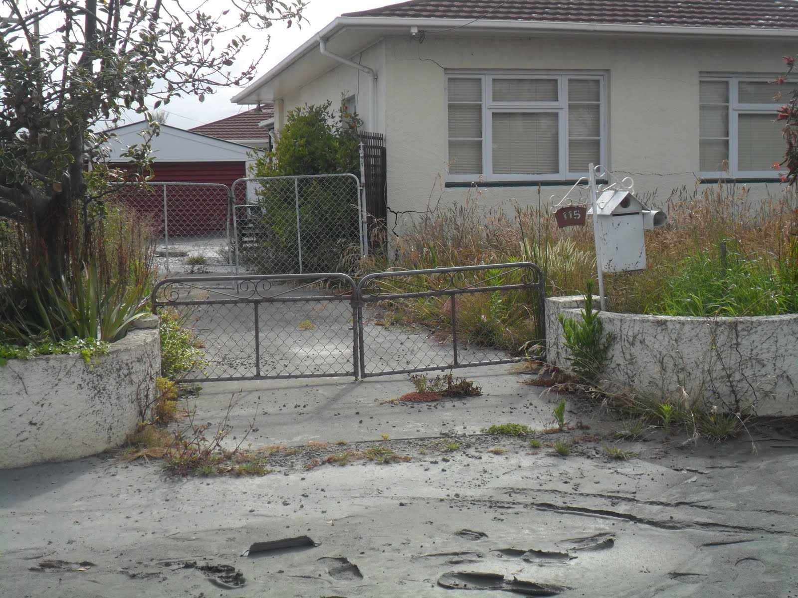
Adjacent red-zone / green-zone homes were anomalous, causing home-owner pain. Green-zone home-owners had to fix their broken properties, having lost equity due to quakes. Red-zone home-owners next door could take NZ National government and / or insurance payouts, leave & start afresh. Green-zoners in the same muddy streets as red-zoners had to stay.
Tonkin & Taylor, NZ National government's / CERA's appointed geotech engineers: White-zone & orange-zone properties still waited slow land reports after many months!
Sunday 01.01.12. New Years Day, the Xmas Quake Swarm continued in Pegasus Bay, GeoNet recording three quakes: M3.3; M3.5; M4.0.
Monday 2 January, GeoNet recorded 19 quakes: M5.1; M4.3; M3.5; M3.8; M5.5; M4.2; M4.1; M4.1; M3.9; M3.8; M4.1; M3.7; M3.7; M3.9; M3.3; M3.5; M3.6; M4.8; M3.8. Tuesday 3 January, The Press reported 21 quakes on Monday. Take your pick.
I didn't feel most of the Monday quakes, Pegasus Bay epicentres east or northeast of Christchurch, but felt some of the M4-M5s. Some I didn't feel, depending where I was. If I was trekking, or driving my car, I rarely felt M4 quakes. If I was seated at home I felt them, as a slight rumbling or trembling. Rattly, grumbling, M5s yes!
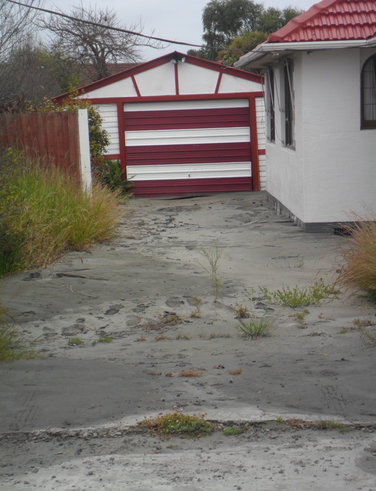
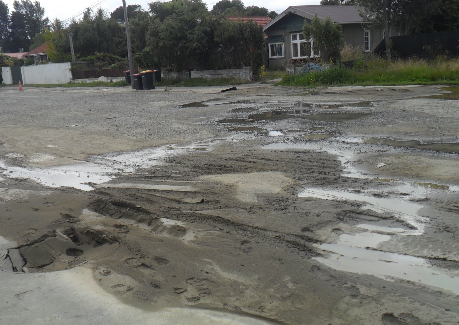
Tuesday 03.01.12. I parked my car, Pages Rd / Waitaki St. Pages Rd from Pages Rd Bridge over Avon River to Anzac Dr was disintegrating in the red-zone.

03.01.12. Serial quakes, liquefactioned Pages Rd / Waitaki St, post 23.12.11 quake swarm

03.01.12. Serial quakes, liquefactioned house, Pages Rd / Waitaki St, post 23.12.11 quake swarm

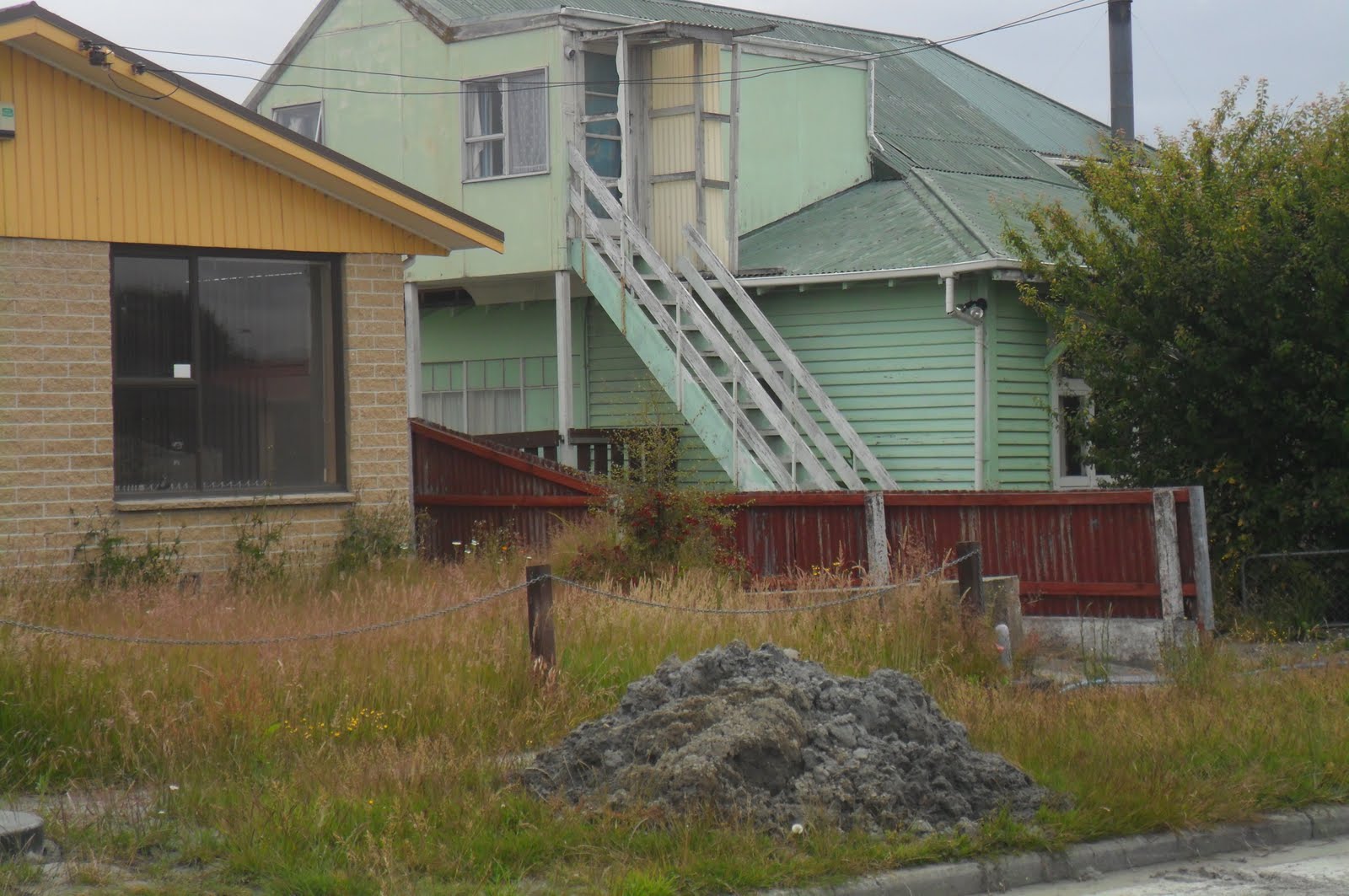
Bexley degradation was worse than what I saw post 13 June 2011 Quake. Quakemire was left lying around, little done by Council, or remaining home-owners to keep up pre-quake Garden City hype. So far CERA had condemned 6 500 Canterbury red-zone houses to demolishers!

03.01.12. Serial quakes, liquefactioned Waitaki St, post 23.12.11 quake swarm

03.01.12. Serial quakes, liquefactioned house, Waitaki St, post 23.12.11 quake swarm


03.01.12. Serial quakes, liquefaction mud, Waitaki St, post 23.12.11 quake swarm

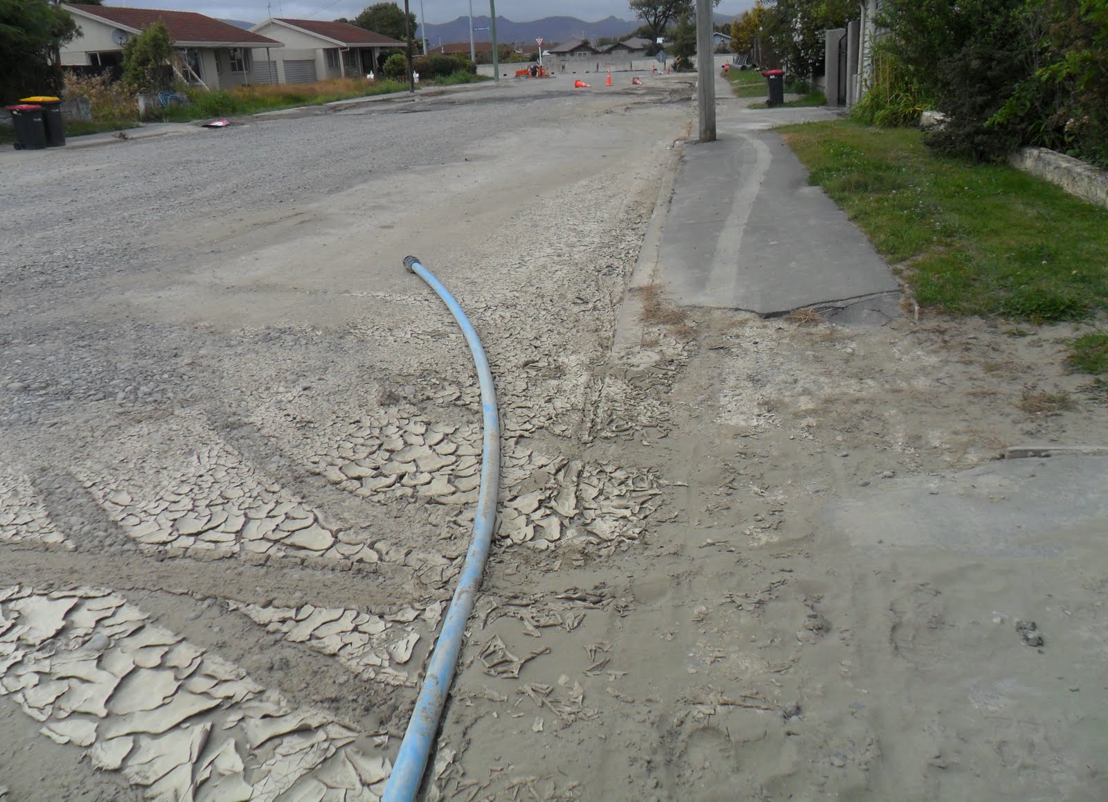
Waitaki St: Most of Bexley's broken-houses I saw that Tuesday morning were abandoned: muddy with overgrown-gardens, overgrown-footpaths & overgrown-verges. A few houses were still inhabited. A year ago, before floodings & liquefactions, the area was a bustling community.
Damage was similar to that I'd seen in other Christchurch suburbs: muddy, cracked roads & cracked driveways; blue-plastic-water-pipes along muddy-footpaths, part-buried in mud; brown-sewage in road-puddles; abandoned furniture in gardens & streets; loose roof-tarps; orange- plastic-road-cones scattered everywhere; leaning power-poles; hanging power-lines; skewed letterboxes & plastic-sewage-tanks; tilted ruined- houses &ruined-garages sinking into mud. Council black rubbish-bins were scattered everywhere, red-lids, yellow-lids, green-lids.
Meanwhile mayor Parker jabbered on TV that the 22 February 2011 Quake was the energy equivalent of 80 Hiroshima bombs... That tourists were coming to Christchurch, thrilled to experience aftershocks... Parker down-played survivor fears of the ongoing Pegasus Bay quake swarm & tsunami threat. During the 23 December 2011 Xmas Quake Swarm, while Parker was holidaying in Taupo, I was in fear of my life, four times, in Peterborough St Council library. The Press / Stuff Co's irate comments showed public-opinion was turning against Parker & his Council.
As for bombs & the 5 XL quakes we'd endured over the last 15 months, many bombs would be needed to cause the damage done by quakes in a few seconds. 2022-25. Ukraine War & Gaza War: Bomb-damage seen on TV looked similar to quake-damage we'd experienced in Christchurch.

03.01.12. Serial quake trashed house, Waitaki St, post 23.12.11 quake swarm


03.01.12. Serial quakes, liquefactioned Waitaki St, post 23.12.11 quake swarm

Devastation: Waitaki St: A junk-mailer dodged quakemire while passing ruined-houses & mailing junk in living-letterboxes.

03.01.12. Serial quake damaged housing, Waitaki St, post 23.12.11 quake swarm


Mitcham Pl: Muddy. I greeted two old ladies walking their dogs. Most of Mitcham Pl & side lanes was abandoned. At the end of Mitcham Pl, I stood on Avon River stopbank, raised after the 22 February 2011 Quake. Subsequent quakes slumped the stopbank Mitcham Pl side & Avon River side, leaving long cracks more than a metre deep. The slumping was due to lateral-spreading.

03.01.12. Serial quakes, liquefactioned Mitcham Pl, post 23.12.11 quake swarm


03.01.12. Serial quakes, liquefactioned Sopley Ln, off Mitcham Pl, post 23.12.11 quake swarm

03.01.12. Serial quake damaged, Avon River stopbank, end of Mitcham Pl, post 23.12.11 quake swarm


03.01.12. Serial quakes, liquefactioned house, Mitcham Pl, post 23.12.11 quake swarm


03.01.12. Serial quakes, liquefactioned Fordingbridge Ln, off Mitcham Pl, post 23.12.11 quake swarm

03.01.12. Serial quakes, liquefactioned Mitcham Pl, post 23.12.11 quake swarm


Waitaki St: I trekked along more muddy-mayhem to Bexley Rd junction.

03.01.12. Serial quakes, liquefactioned house, Waitaki St, post 23.12.11 quake swarm


03.01.12. Serial quake tilted, green, plastic, sewage tank, Waitaki St, post 23.12.11 quake swarm


03.01.12. Serial quakes, liquefactioned house, Waitaki St, post 23.12.11 quake swarm


Waitaki St / Bexley Rd junction: A tilted-house I'd seen post 13 June 2011 Quake was gone, demolished. The rest of the junction was a grey muddy-mess: ruined-houses; piles of grey-quakemire; flood-puddles with sewage; grey-quakemire everywhere; blue-plastic-water-pipes drowned in sewage; scattered orange-plastic-road-cones; a yellow roadside-pump.


03.01.12. Serial quakes, liquefactioned Bexley Rd view to Avon River stopbank. Seen from Bexley Rd / Waitaki St, 23.12.11 quake swarm
Bexley Rd: I trekked grey-quakemire past ruined-houses, & overgrown-gardens & overgrown-verges to John Hinton Reserve on Avon River bank. When would Council & CERA cut all that long grass & fuel-for-fire shrubbery?
Near Avon River's raised stopbank stood several big white-plastic-bags filled with dry concrete-mix, ready for Avon River bank breaching.

03.01.12. Serial quakes, liquefactioned Bexley Rd, near Avon River, 23.12.11 quake swarm


End of Bexley Rd by John Hinton Reserve: On Avon River stopbank, as usual I saw Bexley Rd was below Avon River level.

03.01.12. Avon River stopbank view, liquefactioned Bexley Rd, 23.12.11 quake swarm

03.01.12. White, plastic bags, filled with dry, concrete mix, ready for Avon River bank breaching, Bexley Rd, 23.12.11 quake swarm
I returned along Bexley Rd, trekking its grey muddy-length past Waitaki St junction, past ruined-houses & overgrown-gardens to Pages Rd.

03.01.12. Serial quakes, liquefactioned Bexley Rd, 23.12.11 quake swarm


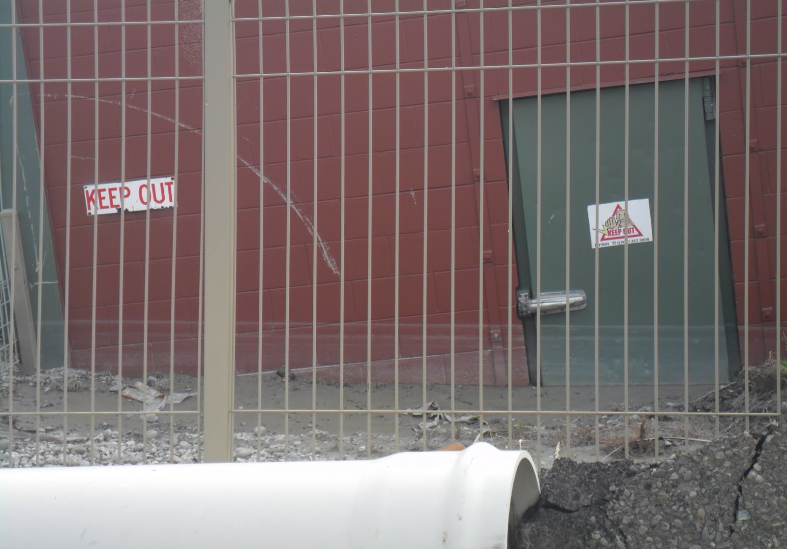
Bexley Rd / Pages Rd: Orion utility ruin was sunk into grey-quakemire more than I'd seen post 13 June 2011 Quake. I saw a liquefaction-flooding water-mark just below a door handle. The utility building would be demolished.

03.01.12. Bexley Rd / Pages Rd, view to Anzac Dr, 23.12.11 quake swarm

03.01.12. Pages Rd view, serial quakes, liquefactioned Bexley Rd, 23.12.11 quake swarm

03.01.12. Serial quakes, low hanging power lines, liquefactioned Bexley Rd, 23.12.11 quake swarm

03.01.12. Serial quakes, liquefactioned Orion substation, Bexley Rd / Pages Rd, 23.12.11 quake swarm


Pages Rd: Ruined-houses & ruined-footpaths mired in more grey-quakemire. Council wasn't bothering to dig out red-zoned houses anymore. CERA demolishers waited.

03.01.12. Serial quakes, liquefactioned Pages Rd view to Pages Rd Bridge, 23.12.11 quake swarm


03.01.12. Serial quakes, liquefaction trashed house, Pages Rd, between Bexley Rd & Waitaki St, 23.12.11 quake swarm


03.01.12. Serial quakes, liquefaction trashed house, Pages Rd / Waitaki St, 23.12.11 quake swarm

03.01.12. Abandoned furniture, serial quakes, liquefactioned house, Pages Rd / Waitaki St, 23.12.11 quake swarm
I drove across damaged Pages Rd Bridge & stopped along New Brighton Rd by Pratt St, as I wanted to snap red-zone housing there.

03.01.12. Serial quakes, liquefaction trashed, Pratt St / New Brighton Rd. Avon River stopbank beyond, 23.12.11 quake swarm


New Brighton Rd / Pratt St junction: Huge cracks & slumping on the post 22 February 2011 Quake raised stopbank on Avon River bank. Engineers & workmen had covered a Pratt St drain pipe with stopbank shingle! Result: Quake sinkhole over the drain-outlet, a broken drain-pipe & riverside-slumping. The slumping was due to lateral-spreading.

03.01.12. Serial quakes, cracked & slumped Avon River stopbank, 23.12.11 quake swarm. New Brighton Rd left. Avon River & Pages Rd Bridge right


03.01.12. Serial quakes, cracked, Avon River stopbank, 23.12.11 quakes swarm. New Brighton Rd right


03.01.12. New Brighton Rd, stopbank view, Avon River & serial quakes, raised stopbank, 23.12.11 quake swarm
Below a memorial-tree on Avon Riverbank, a black-marble memorial-plaque:
PLANTED BY THE PUPILS OF
NEW BRIGHTON DISTRICT SCHOOL
TO COMMEMORATE THE MARRIAGE OF
KING GEORGE V
TO
QUEEN MARY
1911

03.01.12. Memorial plaque, King George V marriage to Queen Mary 1911, Avon River stopbank, New Brighton Rd, 23.12.11 quake swarm

Memorial-trees & memorial-plaques in Christchurch (lots in Hagley Park & the CBD) lasted longer than quaked-housing, quaked-infrastructure, quaked-roads & river stopbanks.
Pratt St / New Brighton Rd: Ruined-houses, grey-liquefactioned overgrown-gardens.

03.01.12. Serial quakes, trashed house, Pratt St / New Brighton Rd, 23.12.11 quake swarm


Pratt St: There was a sewage-stench & messy road surface from broken, leaky sewage-pipes. There was grey-quakemire on the road, on footpaths & on gardens. The road was shingle-repaired, but in bad condition. There were blue-water-pipes on footpaths. Road workers' signs & equipment was scattered. There were tilted ruined-houses, ruined-garages & overgrown gardens. Some houses were still inhabited.

03.01.12. Liquefactioned pavement, Pratt St, 23.12.11 quake swarm

03.01.12. Sewage leak across liquefaction trashed, Pratt St, 23.12.11 quake swarm


03.01.12. Serial quakes, liquefaction damaged house, Pratt St, 23.12.11 quake swarm


03.01.12. Blue, plastic, water pipe, liquefaction damaged Pratt St, 23.12.11 quake swarm

Pratt St / Keyes Rd: ANNABELS EDUCARE building was about 100 metres from sewage leaking across Pratt St!

03.01.12. Signs, Pratt St / Keyes Rd, 23.12.11 quake swarm

Pratt St end: My camera-battery expired. I would snap Baker St & Sinclair St another day.
*Trekked Pages Rd, Waitaki St, Mitcham Pl, Bexley Rd, New Brighton Rd, Pratt St. 219 snaps.
Coda:
November 2013. Two years later, many of the liquefactioned red-zone houses I'd seen had been demolished by CERA.
Content & pics Copyright Mark JS Esslemont.
See Tonkin and Taylor.
Responded to an email inquiring about Bexley homeowners.
ReplyDelete