Port Hills white-zoners waited for months to be red-zoned or green-zoned. Some were, some weren't. There were more delays for Port Hills white- zoners still awaiting slow CERA re-zonings.
CERA minister Brownlee went into "degree of rigour" required routine, but we'd heard those delay excuses since riverside properties were red- zoned over a year before. CERA was scaring Port Hills homeowners about rockfall, hill-slide & cliff-fall risks.
During nearly two years of quakes, some red-zoned Port Hills properties never had rockfalls on them, yet Brownlee & CERA scaremongers red- zoned perfectly good Port Hills properties, then made risible NZ National government offers based on 2007 Rateable Value to land-grab perfectly good properties.
Examples: An engineer built his own rock-catcher fence to protect his three year old Lyttelton home which was red-zoned. Like he was being punished by CERA scaremongers for speaking out in The Press months before, together with neighbour columnist Joe Bennett who received one tiny rock from the Port Hills over two quake years. A Sumner civil engineer / builder refused to leave his red-zoned home as he'd concrete-protected it against rockfall.
The Lyttelton engineer & Joe Bennett objected to their safe houses being Council red-stickered unlivable, to be abandoned. The Lyttelton engineer said on TV One News that CERA had no transparency in its zoning decisions. The Sumner engineer said he'd have to be taken out of his home in handcuffs. (The Press 23.08.12).
CERA boss Sutton rogered Port Hills white-zoners for months with his scaremongering, threatening Milan University modelling of bouncing-rocks. Yet CERA couldn't sort out its computer cock-ups regarding timeously informing Port Hills white-zoners by emails that their properties were red zoned!
Why emails?
Latest CERA cock-up: some Port Hills property-owners only found out about their red-zoning through the media. How effective were slow geotech engineers & their ground-truthing & computer modelling?
TV One News: Latest from scaremonger Sutton: CERA had inquired about rock-catcher fencing. But nowhere in the world were rock-catcher fences used for seismic rockfalls. Sutton: "We haven't found remediation which fits our criteria."
In my Europe travels I'd driven / bussed / trained under many rock-catcher / avalanche protection, concrete-structures. I'd passed many rock-catcher embankments. Not high tech, but effective. Concreting & steel-reinforcing, like on road-cuttings, would stop rockfalls. Never mind mining, steel, roof-bolt pinning of rocks. And what about CERA's / Council's shipping-container barriers below Clifton & Sumner cliffs?
1995. One of my first labouring jobs was at a forestry nursery in Avoca Valley. Most Avoca Valley properties had zoning completion. Did Avoca Valley residents' recent protest on Ports Hills Rd cause CERA to speed up its zoning there?
The Press 21.08.12. CERA efficiency: An Avoca Valley property was green-zoned green but had a heap of fallen rocks, whereas neighbouring properties were red-zoned having no fallen rocks. So much for CERA's Port Hill's rezoning delays & transparency regarding Sutton's vaunted computer-modelling. CERA's land-reports could only be obtained in October when zoning of all properties was completed.
Saturday 18.08.12. I wanted to see warm, north-facing Horotane Valley & Heathcote Valley & Morgans Valley, so I drove to Horotane Valley Rd, snapping ruined-housing & daffodils in an early-blooming, fruit orchard.

18.08.12. Horotane Valley view, quake collapsed Castle Rock, left & The Tors

18.08.12. Quake damaged house, Horotane Valley

18.08.12. Greenhouse, Horotane Valley. Quake collapsed Castle Rock backdrop

18.08.12. Daffodils, Horotane Valley


18.08.12. Fruiterers store, Horotane Valley

18.08.12. Horotane Valley view, quake collapsed Castle Rock
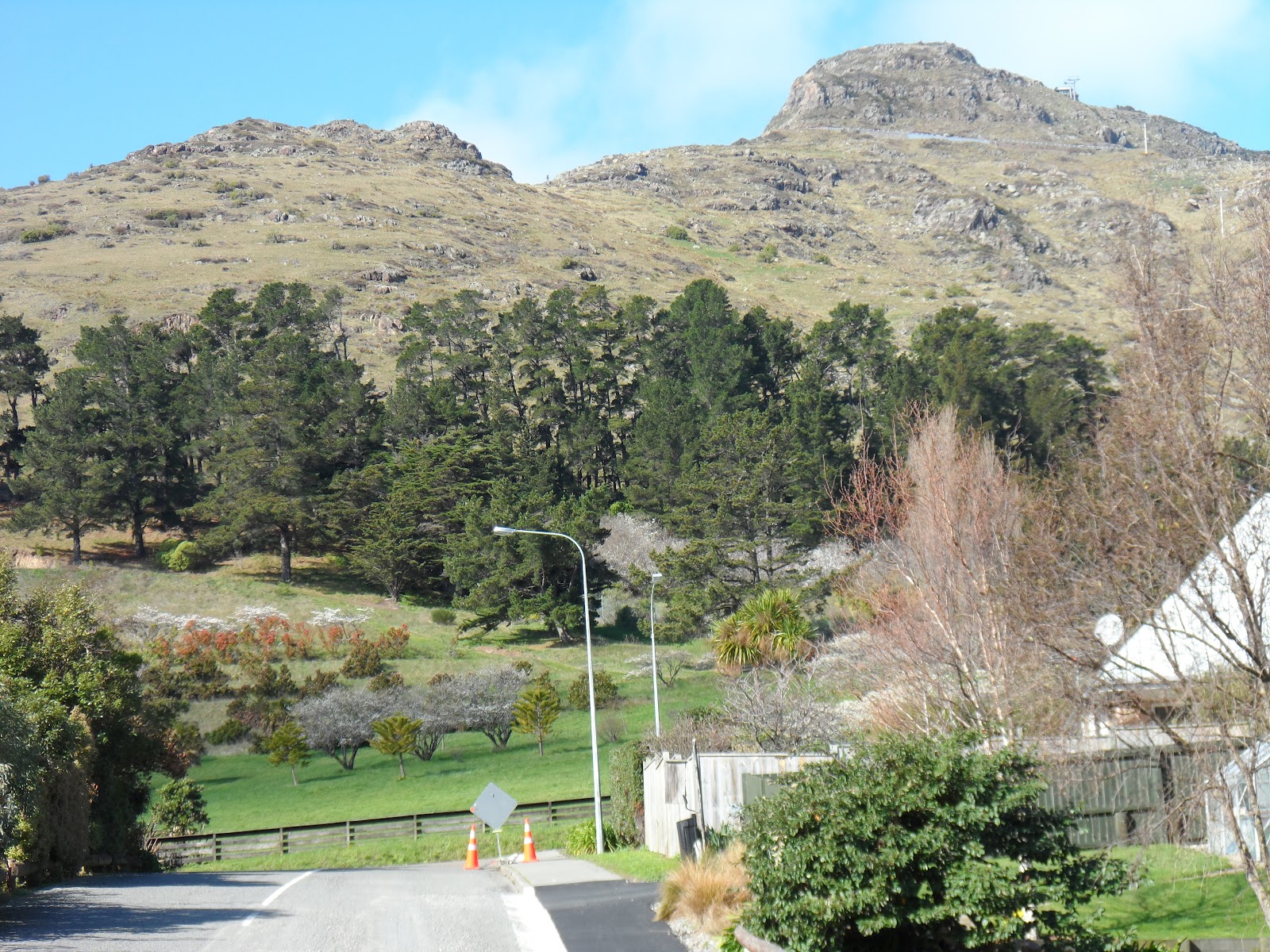
Heathcote Valley, epicentre of the 22 February 2011 Quake: I drove to Heathcote Valley, doing a circuit of roads, including Port Hills Rd & stopping for quake pics. Heathcote valley was dominated by rocky bluffs on Mt Pleasant, left; Mt Cavendish & 4 September 2010 Quake collapsed Castle Rock middle & Horotane Valley wall, right. Above Flinders Rd the motorway went to Lyttelton Road Tunnel. Between Port Hills Rd & Bridle Path Rd, the railway went up Heathcote Valley to Lyttelton Railway Tunnel.
Flinders Rd: Some ruined-houses: Broken-walls, some boarded. Broken-roofs, some blue-tarped. Other houses OK, inhabited. I saw mud-slides by the road-cutting, after recent heavy rains. I saw a ruined-house at the top, near the stream.

18.08.12. Heathcote Valley, Martindales Rd view, quake damaged roof, Flinders Rd. Quake collapsed, Castle Rock backdrop

18.08.12. Quake damaged house, Flinders Rd, Heathcote Valley. Mt Pleasant backdrop


18.08.12. Flinders Rd view, post quake, Maltworks silos, demolition site, Heathcote Valley

18.08.12. Flinders Rd, Heathcote Valley view, quake collapsed, Castle Rock


18.08.12. Flinders Rd, Heathcote Valley view, Mt Cavendish

18.08.12. Quake damaged house, Flinders Rd / Bridle Path Rd, Heathcote Valley
Bridle Path Rd: Ghost house at the top, near the Gondola Station. House walls boarded.

18.08.12. Quake damaged house, Bridle Path Rd, Heathcote Valley
Port Hills Rd: Ruined-houses. Some houses were OK, inhabited. I saw a soccer crowd on Heathcote Domain club field. Kids played on the domain's playing area by the Bowls Club. A man chucked a ball across the soccer field for his huntaway to fetch.

18.08.12. Port Hills Rd view, quake collapsed, Castle Rock

18.08.12. Quake damaged house, Port Hills Rd, Heathcote Valley


18.08.12. Heathcote Valley, Port Hills Rd, quake damaged housing. Quake collapsed, Castle Rock above, The Tors behind


18.08.12. Heathcote Domain playground, Port Hills Rd. Lyttelton Tunnel motorway cutting above green embankment

18.08.12. Heathcote Domain, sports field, clubhouse. Mt Cavendish, Morgans Valley backdrop
At the old Maltworks, over past months we saw demolition of the surviving concrete-silos. Today, a digger picked over concrete-rubble near the railway going to Lyttelton Tunnel. New Maltworks Villas would be built on the old Maltworks site.

18.08.12. Post quake, Maltworks Villas development, Maltworks silos demolition site, Port Hills Rd, Heathcote Valley. Lyttelton Tunnel railway behind demolition site

18.08.12. Post quake, Maltworks Villas development, Maltworks silos, demolition site, Port Hills Rd, Heathcote Valley. Mt Cavendish right
So close to the Port Hills Fault which had raised the Port Hills one metre in the 22 February 2011 Quake, Maltworks Villas development was touted by a board on bare development ground & another board by the railway which extolled future Maltworks Villas' safety:
"Soon to be established on this site will be a Lifestyle Village designed thoughtfully to enhance the quality of living for those looking for a safe environment and secure investment."

18.08.12. Orange, digger, yellow crane. Post quake, Maltworks silos demolition site, Port Hills Rd, Heathcote Valley


18.08.12. Port Hills Rd view, quake collapsed, Castle Rock. The Tors behind

18.08.12. Martindales Rd, traffic circle view, Port Hills Rd, Heathcote Valley. Mt Cavendish beyond
Martindales Rd: Dairy by the traffic circle, gone, demolished. I saw several ruined-houses: Broken-roofs. Broken-walls, some boarded, some blue-tarped. Heathcote Valley Community Library ruin was steel-mesh-fence-cordoned: broken-gables, broken, boarded, wood-propped walls. The library would be demolished in 2013.

18.08.12. Martindales Rd view, quake damaged house, Flinders Rd, Heathcote Valley

18.08.12. Quake damaged house, Martindales Rd, Heathcote Valley


Sham Recovery: 18 months post 22 February 2011 Quake, as I saw so many Heathcote Valley ruins, it was an indictment of CERA & EQC & insurers. The latter two were delayers, as CERA didn't enable speedy claims settlements by EQC & insurers. As CERA didn't use it's National government decreed powers to sort out EQC's & insurers' delays, what was the point of CERA as a RECOVERY agency?

18.08.12. Quake damaged house, Martindales Rd. Quake collapsed, Castle Rock backdrop


18.08.12. Quake damaged house, Martindales Rd. Mt Cavendish backdrop


18.08.12. Quake damaged house, Martindales Rd. Mt Pleasant behind


18.08.12. Quake trashed, steel mesh fence cordoned, Heathcote Valley Community Library, Martindales Rd. The library would be demolished, 2013


Martindales Rd / Bridle Path Rd: On the WW1 / WW2 black-granite obelisk, someone had stuck details-of-the-dead captions next to dead soldiers' names. Beyond, below blue-sky, Mt Pleasant & Mt Cavendish loomed. Given CERA's land-grabbing as opposed to freedoms those soldiers had fought for, they'd be spinning in their graves! Like other WW colonials, Kiwi soldiers fought for land rights, yet the present National government land-grabbed NZ citizens' land.

18.08.12. WW1 / WW2 monument, Martindales Rd / Bridle Path Rd, Heathcote Valley. Mt Pleasant left, Mt Cavendish right
Morgans Valley: New houses at the valley-mouth looked OK. I saw ruined-houses at the top development. Above that housing-development & concrete retaining-walls, a line of pine trees grew. Mt Pleasant & Mt Cavendish bluffs loomed above. I saw a Council-vetted rockfall-fence which had proved useless against rockfall.

18.08.12. Morgans Valley view, Mt Pleasant bluffs, Port Hills


18.08.12. Morgans Valley view, Mt Cavendish, Port Hills


18.08.12. Morgans Valley skateboarders below Mt Cavendish, Port Hills
Youngsters skateboarded down steep Morgans Valley. I gave a lift to two skateboarders to the top traffic-circle. A spaniel greeted me there, another dog barked from the only inhabited garden. Top end of the road, another ruined-house.

18.08.12. Morgans Valley, quake damaged house below Mt Pleasant bluffs

18.08.12. Morgans Valley, quake neglected, letter boxes, Port Hills

18.08.12. Quake abandoned house, Morgans Valley
Top raffic-circle: two stands of 10 letter boxes each, lot-numbers up to 86 in the ruined-development. Junk-mail poked from letter-boxes. Atop the letter-boxes, I saw new telephone-directories wrapped in yellow-plastic-packets. Would anyone collect that junk-mail & telephone directories?

18.08.12. Quake damaged roadside, Morgans Valley, Christchurch


18.08.12. Morgans Valley view, Heathcote Valley, Heathcote River, Christchurch

18.08.12. Morgans Valley letter boxes, concrete retaining wall, rock-catcher trees

After Council development cock-ups, quakes & CERA zonings, all that the steep road up Morgans Valley was good for was skateboarding!

18.08.12. Concrete retaining wall, quake abandoned house, Morgans Valley


18.08.12. Morgans Valley view, soggy Heathcote Valley, Heathcote River, Christchurch
*Trekked Horotane Valley Rd, Flinders Rd, Bridle Path Rd, Port Hills Rd, Martindales Rd, Morgans Valley. 79 images.
Once CERA completed red-zonings for NZ National government, who owned Christchurch's red-zoned land? Like bits of red-zoned riverside suburbs: Avonside, Dallington, Burwood, Avondale, Bexley, Southshore, Brooklands. Like red-zoned Port Hills lands. Like red-zoned CBD's East Frame & the CBD's South Frame. CBD land was also needed for CERA's Blueprint stadium & Blueprint Convention Centre / Te Pae.
With its CERA two offers for residential-red-zoners, NZ National government used home-owners' insurances from slow insurers to compensate homeowners, based on 2007 Rates Valuations. Worse still, ratepayers had to cough up a payout proportion for each Port Hills red-zoned property, as Council was responsible for rockfall, hill-slide & cliff-fall hazards protection.
As CERA had also Blueprinted CBD's East Frame land & South Frame land with market value payouts, it was a National government land-grab of Christchurch CBD areas & also land-grabbing of vast suburban residential areas.
In Christchurch, I saw CBD occupation by cops & NZDF-soldiers & Ryan Security at checkpoints. In inhabited suburbs & demolished suburbs, I saw cop-patrols, even some cop / NZDF military-exercises, the excuse, public-safety. During quake-times I became tired of shrieking cop sirens!
Imagine your residential-land or CBD commercial-land red-zoned & confiscated by NZ National government without adequate reasons! That happened in Christchurch. NZ National government's two offers for residential-land at 2007 RV happened, but NZ National government's land-reports giving reasons for the red-zoning only happened long after the red-zoning.
Example of CERA boss Sutton's supreme indifference regarding NZ National government's offers on CBD Frame land: "This is the offer, have a nice day." (The Press 30.08.12). As Sutton's CERA confiscated CBD land & demolished red-zone, NZDF-cordoned CBD, it was time Brownlee & Sutton ordered a 100 day Blueprint for Christchurch's neglected eastern suburbs still wallowing in liquefactioned, red-zone & green-blue zone, TC3 squalor. Separation of CERA's Blueprint for CBD rebuild & CERA's neglect of ruined eastern suburbs was supreme apartheid!
CERA land-reports would only be released after all Port Hills land was zoned, perhaps during October. CERA took its time completing land-zonings in the Port Hills with expedient apologies from Brownlee. That was only after 1 000s of residential red-zoners had already accepted NZ National government's offer, accepted before the NZ National government deadline!
Rebuild companies wanted to recruit overseas migrant, cheap labour, like Filipinos & Irish & stuff workers into single-sex men's hostels by buying Christchurch blocks of flats for migrant-workers, or making migrant-workers' camps, within the four Avenues of the old CBD to rebuild the post-quake CBD. (Rebuild accommodation was discussed, but fizzled, as rebuild workers just flooded Christchurch's rental-market, causing inflation & rental hardship for Christchurch citizens).
More apartheid: Millions of dollars were pumped in Christchurch's rebuild CBD, but Christchurch's eastern suburbs were neglected!
Friday 24.08.12. To sort out CERA's zoning cock-ups, Sutton announced that of the 1 300 flat-land residential-properties under zone review, only "three properties change from red to green zone and 101 properties will change from green to red." The rest no change. After review, CERA only rezoned 104 properties out of 1 300 flat-land properties under review. The rezonings included properties where owners hadn't even asked for a review, but their rezonings were decreed by CERA regarding infrastructure availability & isolation.
"The remaining properties that didn't change are mostly in Technical category (TC3) areas..." That still left TC3 flat-land properties in a muddle dictated by CERA, 28 000 TC3 property values degraded by CERA, as EQC dithered about drilling land so TC3 foundations could be fixed, according to Dept of Building & Health criteria & EQC was dithering about apportionment of costs for different quakes, which let slow insurers off the payment hook, as they just blamed EQC for delays.
Properties were red-zoned if they were too expensive to fix on land too expensive to remediate. Properties were green-zoned if they were less expensive to fix on land not too expensive to remediate, like CERA concocted, green-blue, TC3 land. That was bullshit, as rebuild-costs were based on post-quakes, mythical land values. Who knew the value of Canterbury or Christchurch land after 11 000 quakes over the last two years?
Saturday afternoon 25.08.12. Leah & I bought pies at French Bakery, Chapmans Rd, chomping them at Heathcote Domain. We watched kids gliding down the Flying Fox & a blue paraglider soaring & swooping from Mt Cavendish over Heathcote Valley. The paraglider stooped & landed safely on Heathcote Domain's sports-field. The kids & paraglider took risks, giving the lie to CERA's computer-modelling, gobbledegook about future quake-hazards in Heathcote Valley.
13.09.12. CERA announced that 37 Port Hills properties were red-zoned in Horotane Valley & Bridle Path Rd, Heathcote Valley, 443 red zone Port Hills properties so far. Lucas Ln, Hillsborough properties were still white-zoned, in limbo awaiting re-zoning.
Content & pics Copyright Mark JS Esslemont.
See Family struggles for answers after land zoning (The Press / Stuff Co).
See Left with a house that's unsellable (The Press / Stuff Co).
See Resident defiant despite red sticker (The Press / Stuff Co).
See Review of land zoning completed 24 August 2012 (CERA).
See Housing squeeze hits rebuild (The Press / Stuff Co).
See Unwilling landowners to get ultimatum (The Press / Stuff Co).
See Big camps planned for rebuild workers (The Press / Stuff Co).
See The red zone in the hills (The Press / Stuff Co).
See Mayor challenges Port Hills zoning process (The Press / Stuff Co).
Replied to an email: A High St jeweller needed permission to use one of my Sept 4 quake pics in her soon to be published book, proceeds to go to people injured in the 22.02.11 quake.
ReplyDeleteJune 2021 comment on my Heathcote Valley post (Woza Mark blog) received from Julia whose house was red zoned in the Heathcote Valley, Bridle Path Rd:
ReplyDeleteThank you immensely for the photos of the walk [Heathcote Valley Park] and the surrounding hills. The first house you passed on your right coming up the track was my home. I had to leave as my house did not survive the earthquake [22.02.11] and I never saw a single bit of footage of the Heathcote Valley in the weeks that followed. I never understood why the suburb directly over the epicentre never got any coverage.
I was home on the day. Rocks the size of cars came flying down. They bounced off the trees like pin balls and sent them through my neighbour's house. My 5 year old daughter was at Heathcote Primary School. I could hear the screams of 250+ kids from my house. The whole school was assembled (if you can call it that) in the playground. The next aftershock knocked us off our feet!
I used to love walking (coronary inducing) up to the quarry behind the house as the view was amazing... so thank you so very much for capturing what I didn't do all the years I lived there... probably thinking I had all the time in the world.